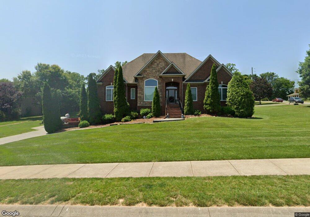
7202 Polston Ct Fairview, TN 37062
Estimated Value: $565,611 - $804,000
--
Bed
4
Baths
2,221
Sq Ft
$298/Sq Ft
Est. Value
About This Home
This home is located at 7202 Polston Ct, Fairview, TN 37062 and is currently estimated at $662,903, approximately $298 per square foot. 7202 Polston Ct is a home located in Williamson County with nearby schools including Westwood Elementary School, Fairview Middle School, and Fairview High School.
Ownership History
Date
Name
Owned For
Owner Type
Purchase Details
Closed on
Oct 27, 2006
Sold by
Royal Oak Investment Inc
Bought by
Russell Fred L
Current Estimated Value
Home Financials for this Owner
Home Financials are based on the most recent Mortgage that was taken out on this home.
Original Mortgage
$287,900
Outstanding Balance
$171,251
Interest Rate
6.31%
Mortgage Type
Purchase Money Mortgage
Estimated Equity
$491,652
Purchase Details
Closed on
Sep 21, 2005
Sold by
The Cunningham Partnership
Bought by
Royal Oak Investments Inc
Create a Home Valuation Report for This Property
The Home Valuation Report is an in-depth analysis detailing your home's value as well as a comparison with similar homes in the area
Home Values in the Area
Average Home Value in this Area
Purchase History
| Date | Buyer | Sale Price | Title Company |
|---|---|---|---|
| Russell Fred L | $359,900 | Prestige Title Llc | |
| Royal Oak Investments Inc | $154,000 | -- |
Source: Public Records
Mortgage History
| Date | Status | Borrower | Loan Amount |
|---|---|---|---|
| Open | Russell Fred L | $287,900 |
Source: Public Records
Tax History Compared to Growth
Tax History
| Year | Tax Paid | Tax Assessment Tax Assessment Total Assessment is a certain percentage of the fair market value that is determined by local assessors to be the total taxable value of land and additions on the property. | Land | Improvement |
|---|---|---|---|---|
| 2024 | $2,755 | $99,925 | $18,750 | $81,175 |
| 2023 | $2,755 | $99,925 | $18,750 | $81,175 |
| 2022 | $2,755 | $99,925 | $18,750 | $81,175 |
| 2021 | $1,879 | $99,925 | $18,750 | $81,175 |
| 2020 | $1,739 | $78,350 | $10,000 | $68,350 |
| 2019 | $1,739 | $78,350 | $10,000 | $68,350 |
| 2018 | $1,685 | $78,350 | $10,000 | $68,350 |
| 2017 | $1,669 | $78,350 | $10,000 | $68,350 |
| 2016 | $1,645 | $78,350 | $10,000 | $68,350 |
| 2015 | -- | $79,025 | $10,000 | $69,025 |
| 2014 | -- | $79,025 | $10,000 | $69,025 |
Source: Public Records
Map
Nearby Homes
- 7511 Cox Pike
- Kingston Plan at Wynwood Park
- Primrose Plan at Wynwood Park
- Mayflower Plan at Wynwood Park
- 7456 Cox Pike
- 7111 Frances St
- 7131 Frances St
- 7133 Frances St Unit Lot 26
- 7137 Frances St
- 7271 Belvoir Dr
- 7212 Hanworth St
- 7214 Hanworth St
- 7455 Cox Pike
- 7201 Cold Harbor Ct
- 7218 Hanworth St
- 7514 Shoal Mill Point
- 7509 Shoal Mill Point
- 7532 Shoal Mill Point
- 7505 Shoal Mill Point
- 7332 Dutch River Cir
- 7104 Donald Wilson Dr
- 7204 Polston Ct
- 7201 Polston Ct
- 7102 Donald Wilson Dr
- 7205 Polston Ct
- 7103 Donald Wilson Dr
- 7105 Donald Wilson Dr
- 7203 Polston Ct
- 7110 Donald Wilson Dr
- 7206 Polston Ct
- 7107 Donald Wilson Dr
- 7466 Cox Pike
- 7101 Donald Wilson Dr
- 7208 Polston Ct
- 7207 Polston Ct
- 7509 Cox Pike
- 7109 Donald Wilson Dr
- 7112 Donald Wilson Dr
- 4 Frances St
- 7111 Donald Wilson Dr