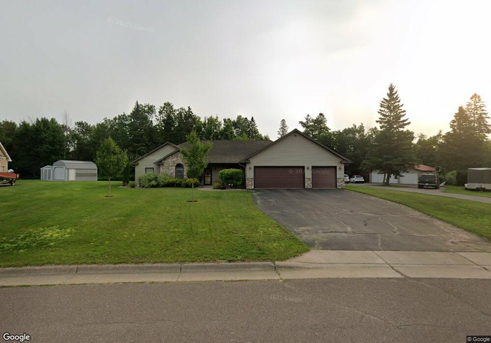
721 Creekside Cir Duluth, MN 55811
Kenwood NeighborhoodEstimated Value: $456,000 - $683,000
2
Beds
2
Baths
2,440
Sq Ft
$229/Sq Ft
Est. Value
About This Home
This home is located at 721 Creekside Cir, Duluth, MN 55811 and is currently estimated at $557,546, approximately $228 per square foot. 721 Creekside Cir is a home located in St. Louis County with nearby schools including Lowell Elementary School, Lincoln Park Middle School, and Denfeld High School.
Ownership History
Date
Name
Owned For
Owner Type
Purchase Details
Closed on
Feb 10, 2023
Sold by
Beyer John Warren and Beyer Christine Ann
Bought by
Trust Agreement Of John Warren Beyer And Chri
Current Estimated Value
Purchase Details
Closed on
Jan 10, 2017
Sold by
Beyer John W and Beyer Christyine A
Bought by
Beyer John W and Beyer Christyine A
Home Financials for this Owner
Home Financials are based on the most recent Mortgage that was taken out on this home.
Original Mortgage
$225,000
Interest Rate
4.13%
Mortgage Type
New Conventional
Purchase Details
Closed on
May 21, 2002
Sold by
Stocke Theodore J
Bought by
Beyer John W
Create a Home Valuation Report for This Property
The Home Valuation Report is an in-depth analysis detailing your home's value as well as a comparison with similar homes in the area
Home Values in the Area
Average Home Value in this Area
Purchase History
| Date | Buyer | Sale Price | Title Company |
|---|---|---|---|
| Trust Agreement Of John Warren Beyer And Chri | $3,000 | -- | |
| Beyer John W | -- | Stewart Title Company | |
| Beyer John W | $39,000 | Scenic Title |
Source: Public Records
Mortgage History
| Date | Status | Borrower | Loan Amount |
|---|---|---|---|
| Previous Owner | Beyer John W | $225,000 |
Source: Public Records
Tax History
| Year | Tax Paid | Tax Assessment Tax Assessment Total Assessment is a certain percentage of the fair market value that is determined by local assessors to be the total taxable value of land and additions on the property. | Land | Improvement |
|---|---|---|---|---|
| 2024 | $7,720 | $552,000 | $88,300 | $463,700 |
| 2023 | $7,720 | $490,000 | $88,300 | $401,700 |
| 2022 | $6,982 | $490,000 | $88,300 | $401,700 |
| 2021 | $6,838 | $423,800 | $76,000 | $347,800 |
| 2020 | $7,052 | $423,800 | $76,000 | $347,800 |
| 2019 | $6,338 | $424,800 | $76,100 | $348,700 |
| 2018 | $5,926 | $386,600 | $69,000 | $317,600 |
| 2017 | $6,480 | $386,600 | $69,000 | $317,600 |
| 2016 | $6,318 | $178,100 | $34,100 | $144,000 |
| 2015 | $5,108 | $331,900 | $61,600 | $270,300 |
| 2014 | $5,108 | $331,900 | $61,600 | $270,300 |
Source: Public Records
Map
Nearby Homes
- 1524 W Arrowhead Rd
- 1944 Chinook Dr
- 1802 Rice Lake Rd
- 1804 Rice Lake Rd
- 2718 Northridge Dr
- 116 E Niagara St
- 126 E Niagara St
- 1205 W Arrowhead Rd
- 1145 Como Ave Unit 1
- 1950 Middle Ln
- 1722 North Rd
- 1030 Missouri Ave
- 1011 W Arrowhead Rd
- 205 Bluff's Ridge Ct
- 20xx Stanford Ave
- 29 W Ideal St
- 35 W Ideal St
- 908 E Skyline Pkwy
- 1011 N 12th Ave E
- 1125 N 7th Ave E
- 717 Creekside Cir
- 725 Creekside Cir
- LOT 12 Creekside Cir
- LOT 9 Creekside Cir
- LOT 14 Creekside Cir
- LOT 10 Creekside Cir
- LOT 7 Creekside Cir
- LOT 3 Creekside Cir
- LOT 8 Creekside Cir
- LOT 2 Creekside Cir
- LOT 5 Creekside Cir
- LOT 6 Creekside Cir
- LOT 4 Creekside Cir
- lot 1 Creekside Cir
- LOT 16 Creekside Cir
- LOT 15 Creekside Cir
- 2368 Apple Ridge Dr
- 711 Creekside Cir
- 729 Creekside Cir
- 724 Creekside Cir
Your Personal Tour Guide
Ask me questions while you tour the home.