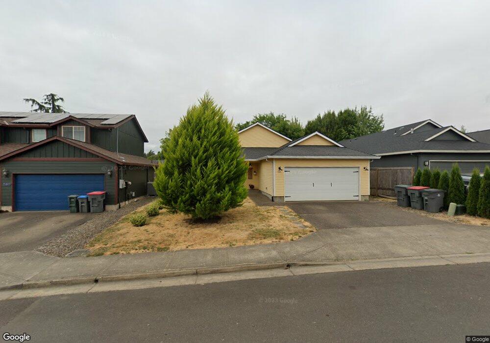
721 Grant St Lafayette, OR 97127
Lafayette NeighborhoodEstimated Value: $432,000 - $462,000
3
Beds
2
Baths
1,502
Sq Ft
$297/Sq Ft
Est. Value
About This Home
This home is located at 721 Grant St, Lafayette, OR 97127 and is currently estimated at $445,848, approximately $296 per square foot. 721 Grant St is a home located in Yamhill County with nearby schools including Wascher Elementary School, Patton Middle School, and McMinnville High School.
Ownership History
Date
Name
Owned For
Owner Type
Purchase Details
Closed on
Aug 11, 2016
Sold by
Flynn Michael S
Bought by
Snider Craig L and Snider Valorie A
Current Estimated Value
Home Financials for this Owner
Home Financials are based on the most recent Mortgage that was taken out on this home.
Original Mortgage
$216,000
Outstanding Balance
$170,464
Interest Rate
3.48%
Mortgage Type
New Conventional
Estimated Equity
$275,384
Purchase Details
Closed on
Oct 25, 2011
Sold by
Holland Gregory F and Holland Muriel Margot
Bought by
The Bank Of New York Mellon and The Bank Of New York
Purchase Details
Closed on
Feb 1, 2007
Sold by
Green Castle Llc
Bought by
Holland Gregory F and Holland Muriel Margot
Home Financials for this Owner
Home Financials are based on the most recent Mortgage that was taken out on this home.
Original Mortgage
$179,200
Interest Rate
6.11%
Mortgage Type
Purchase Money Mortgage
Create a Home Valuation Report for This Property
The Home Valuation Report is an in-depth analysis detailing your home's value as well as a comparison with similar homes in the area
Home Values in the Area
Average Home Value in this Area
Purchase History
| Date | Buyer | Sale Price | Title Company |
|---|---|---|---|
| Snider Craig L | $240,000 | Fidelity Natl Title Co Of Or | |
| The Bank Of New York Mellon | $126,000 | None Available | |
| Holland Gregory F | $224,900 | Ticor Title Insurance Co |
Source: Public Records
Mortgage History
| Date | Status | Borrower | Loan Amount |
|---|---|---|---|
| Open | Snider Craig L | $216,000 | |
| Previous Owner | Holland Gregory F | $179,200 |
Source: Public Records
Tax History
| Year | Tax Paid | Tax Assessment Tax Assessment Total Assessment is a certain percentage of the fair market value that is determined by local assessors to be the total taxable value of land and additions on the property. | Land | Improvement |
|---|---|---|---|---|
| 2025 | $2,830 | $193,131 | -- | -- |
| 2024 | $2,756 | $187,506 | -- | -- |
| 2023 | $2,683 | $182,045 | $0 | $0 |
| 2022 | $2,630 | $176,743 | $0 | $0 |
| 2021 | $2,547 | $171,595 | $0 | $0 |
| 2020 | $2,483 | $166,597 | $0 | $0 |
| 2019 | $2,427 | $161,745 | $0 | $0 |
| 2018 | $2,224 | $157,034 | $0 | $0 |
| 2017 | $2,161 | $152,460 | $0 | $0 |
| 2016 | $2,118 | $148,019 | $0 | $0 |
| 2015 | $2,057 | $143,710 | $0 | $0 |
| 2014 | $2,004 | $139,527 | $0 | $0 |
Source: Public Records
Map
Nearby Homes
- 1001 E 9th St
- 847 NE Duniway Rd
- 731 N Lincoln St
- 843 10th Ct
- 1282 3rd St Unit 59
- 1282 3rd St
- 1282 3rd St Unit 37
- 1282 3rd St Unit 60
- 1282 3rd St Unit 83
- 850 5th St
- 1026 E 15th St
- 967 E 16th St
- 1002 Market St
- 1028 E 16th St
- 720 Market St
- 0 5th St
- 0 N Jefferson St
- 1720 N Chinook Ln
- 234 W 18th St
- 1713 N Kalapuya Place
Your Personal Tour Guide
Ask me questions while you tour the home.