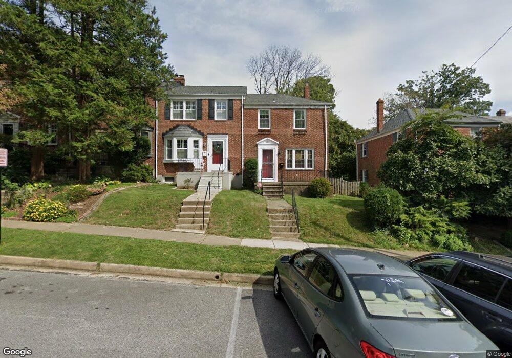
7211 Lanark Rd Baltimore, MD 21212
Estimated Value: $352,000 - $435,000
Studio
2
Baths
1,280
Sq Ft
$312/Sq Ft
Est. Value
About This Home
This home is located at 7211 Lanark Rd, Baltimore, MD 21212 and is currently estimated at $399,934, approximately $312 per square foot. 7211 Lanark Rd is a home located in Baltimore County with nearby schools including Rodgers Forge Elementary School, Dumbarton Middle School, and Towson High Law & Public Policy.
Ownership History
Date
Name
Owned For
Owner Type
Purchase Details
Closed on
Oct 14, 2021
Sold by
Mendel Olga and Mendel Richard A
Bought by
Mendel Richard A
Current Estimated Value
Purchase Details
Closed on
Nov 9, 2004
Sold by
Hey Jamie C
Bought by
Mendel Richard A and Mendel Olga
Purchase Details
Closed on
Oct 22, 2004
Sold by
Hey Jamie C
Bought by
Mendel Richard A and Mendel Olga
Purchase Details
Closed on
Jul 20, 2000
Sold by
Marsh Stephen J
Bought by
Hey Jamie C and Harrison Kristine S
Purchase Details
Closed on
Apr 1, 1993
Sold by
Cloyd Kathleen C
Bought by
Marsh Stephen J
Create a Home Valuation Report for This Property
The Home Valuation Report is an in-depth analysis detailing your home's value as well as a comparison with similar homes in the area
Home Values in the Area
Average Home Value in this Area
Purchase History
| Date | Buyer | Sale Price | Title Company |
|---|---|---|---|
| Mendel Richard A | -- | None Available | |
| Mendel Richard A | $288,000 | -- | |
| Mendel Richard A | $288,000 | -- | |
| Hey Jamie C | $167,000 | -- | |
| Marsh Stephen J | $116,000 | -- |
Source: Public Records
Tax History
| Year | Tax Paid | Tax Assessment Tax Assessment Total Assessment is a certain percentage of the fair market value that is determined by local assessors to be the total taxable value of land and additions on the property. | Land | Improvement |
|---|---|---|---|---|
| 2025 | $4,358 | $338,900 | $100,000 | $238,900 |
| 2024 | $4,358 | $324,800 | $0 | $0 |
| 2023 | $2,102 | $310,700 | $0 | $0 |
| 2022 | $4,007 | $296,600 | $100,000 | $196,600 |
| 2021 | $4,109 | $296,267 | $0 | $0 |
| 2020 | $4,109 | $295,933 | $0 | $0 |
| 2019 | $4,009 | $295,600 | $100,000 | $195,600 |
| 2018 | $3,701 | $279,300 | $0 | $0 |
| 2017 | $3,573 | $263,000 | $0 | $0 |
| 2016 | $3,041 | $246,700 | $0 | $0 |
| 2015 | $3,041 | $246,700 | $0 | $0 |
| 2014 | $3,041 | $246,700 | $0 | $0 |
Source: Public Records
Map
Nearby Homes
- 146 Dumbarton Rd
- 183 Stanmore Rd
- 335 Old Trail Rd
- 214 Murdock Rd
- 6509 Abbey View Way
- 67 Dunkirk Rd
- 111 Dunkirk Rd
- 150 Hopkins Rd
- 146 Villabrook Way
- 318 Hopkins Rd
- 100 Villabrook Way
- 102 Villabrook Way
- 106 Villabrook Way
- 501 Stoneleigh Rd
- 6306 Canter Way
- 415 Schwartz Ave
- 529 Overbrook Rd
- 3 Aintree Rd
- 517 Worcester Rd
- 613 Anneslie Rd
Your Personal Tour Guide
Ask me questions while you tour the home.