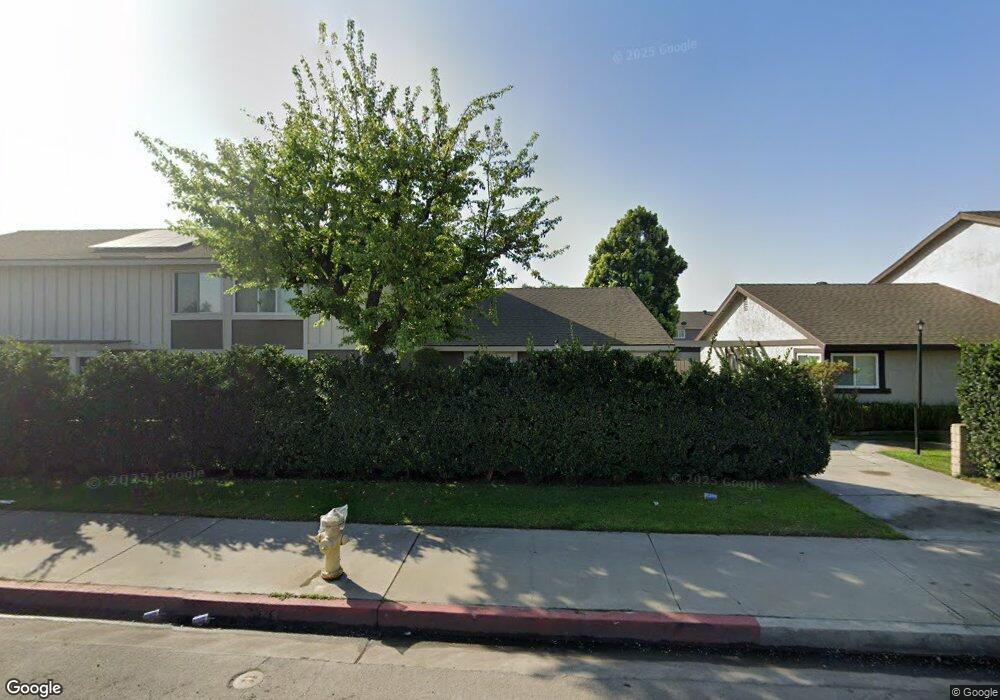
7215 Newton Way Stanton, CA 90680
Estimated Value: $585,385 - $645,000
2
Beds
1
Bath
850
Sq Ft
$735/Sq Ft
Est. Value
About This Home
This home is located at 7215 Newton Way, Stanton, CA 90680 and is currently estimated at $625,096, approximately $735 per square foot. 7215 Newton Way is a home located in Orange County with nearby schools including Bryant Elementary School, Hilton D. Bell Intermediate School, and Pacifica High School.
Ownership History
Date
Name
Owned For
Owner Type
Purchase Details
Closed on
Sep 5, 2013
Sold by
Biernat Raymond S
Bought by
Biernat Raymond S and Raymond S Biernat Trust
Current Estimated Value
Purchase Details
Closed on
Jul 1, 1994
Sold by
Biernat Raymond S and Messano Biernat Joanne
Bought by
Biernat Raymond S and Messano Biernat Joanne
Purchase Details
Closed on
Apr 28, 1994
Sold by
Messano Biernat Joanne
Bought by
Biernat Raymond S and Messano Biernat Joanne
Purchase Details
Closed on
Feb 3, 1994
Sold by
Biernat Raymond S
Bought by
Messano Biernat Joanne
Home Financials for this Owner
Home Financials are based on the most recent Mortgage that was taken out on this home.
Original Mortgage
$64,800
Interest Rate
7.1%
Create a Home Valuation Report for This Property
The Home Valuation Report is an in-depth analysis detailing your home's value as well as a comparison with similar homes in the area
Home Values in the Area
Average Home Value in this Area
Purchase History
| Date | Buyer | Sale Price | Title Company |
|---|---|---|---|
| Biernat Raymond S | -- | None Available | |
| Biernat Raymond S | -- | None Available | |
| Biernat Raymond S | -- | -- | |
| Biernat Raymond S | -- | -- | |
| Messano Biernat Joanne | -- | Old Republic Title Company | |
| Messano Biernat Joanne | -- | Old Republic Title Company |
Source: Public Records
Mortgage History
| Date | Status | Borrower | Loan Amount |
|---|---|---|---|
| Previous Owner | Messano Biernat Joanne | $64,800 |
Source: Public Records
Tax History
| Year | Tax Paid | Tax Assessment Tax Assessment Total Assessment is a certain percentage of the fair market value that is determined by local assessors to be the total taxable value of land and additions on the property. | Land | Improvement |
|---|---|---|---|---|
| 2025 | $2,150 | $161,748 | $84,554 | $77,194 |
| 2024 | $2,150 | $158,577 | $82,896 | $75,681 |
| 2023 | $2,106 | $155,468 | $81,270 | $74,198 |
| 2022 | $2,072 | $152,420 | $79,676 | $72,744 |
| 2021 | $2,051 | $149,432 | $78,114 | $71,318 |
| 2020 | $2,026 | $147,900 | $77,313 | $70,587 |
| 2019 | $1,980 | $145,000 | $75,797 | $69,203 |
| 2018 | $1,947 | $142,157 | $74,310 | $67,847 |
| 2017 | $1,918 | $139,370 | $72,853 | $66,517 |
| 2016 | $1,845 | $136,638 | $71,425 | $65,213 |
| 2015 | $1,821 | $134,586 | $70,352 | $64,234 |
| 2014 | $1,764 | $131,950 | $68,974 | $62,976 |
Source: Public Records
Map
Nearby Homes
- 7085 Fulton Way
- 7081 Fulton Way
- 7271 Katella Ave Unit 101
- 7271 Katella Ave Unit 99
- 7336 Ewell Way
- 11219 Hood Way
- 10748 Knott Ave
- 10756 Knott Ave
- 10720 Knott Ave
- 10700 Knott Ave
- 10684 Bell St
- 6842 Amelia Way
- 6844 Southampton Dr
- 7100 Cerritos Ave Unit 86
- 7100 Cerritos Ave Unit 85
- 11371 Harkers Ct
- 15 Redwood Ct Unit 15
- 18 Redwood Ct Unit 18
- 11271 Lowell Ct
- 7129 Cerritos Ave Unit 7
- 7219 Newton Way
- 7207 Newton Way
- 7223 Newton Way
- 7227 Newton Way
- 7203 Newton Way
- 7199 Newton Way
- 7195 Newton Way
- 7216 Newton Way
- 7220 Newton Way
- 7212 Newton Way
- 7224 Newton Way
- 7204 Newton Way
- 7191 Newton Way
- 7228 Newton Way
- 11010 Carlton Way
- 11014 Carlton Way
- 7187 Newton Way
- 7196 Newton Way
- 11018 Carlton Way
- 11006 Carlton Way
Your Personal Tour Guide
Ask me questions while you tour the home.