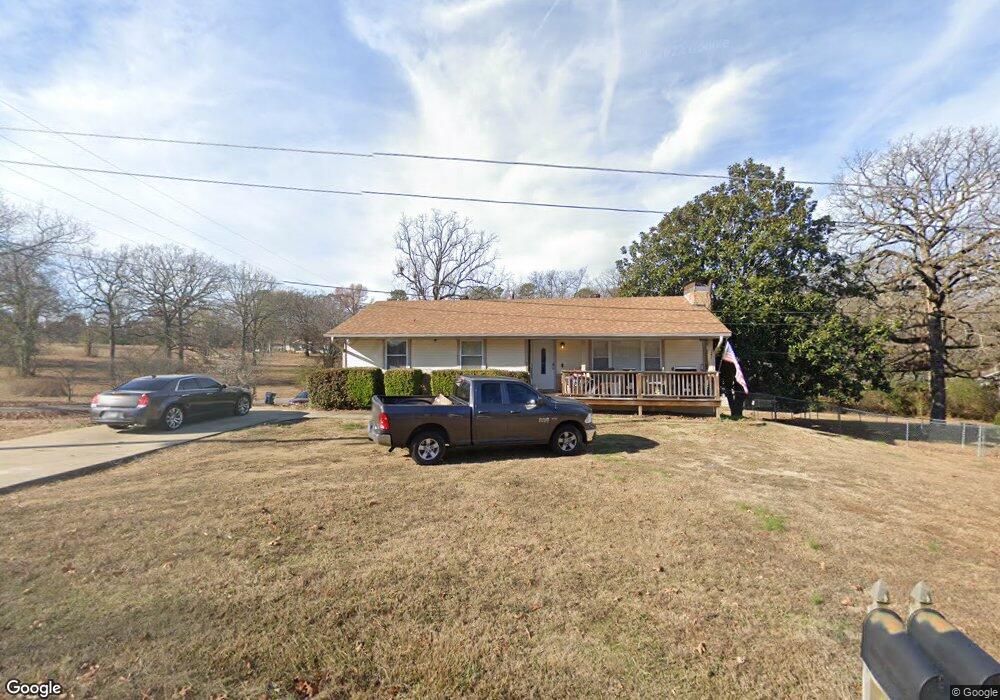
7217 Ross Ln Benton, AR 72019
Salem NeighborhoodEstimated Value: $226,000 - $326,000
3
Beds
2
Baths
2,400
Sq Ft
$114/Sq Ft
Est. Value
About This Home
This home is located at 7217 Ross Ln, Benton, AR 72019 and is currently estimated at $274,266, approximately $114 per square foot. 7217 Ross Ln is a home located in Saline County with nearby schools including Salem Elementary School, Bethel Middle School, and Bryant Middle School.
Ownership History
Date
Name
Owned For
Owner Type
Purchase Details
Closed on
Jan 7, 2021
Sold by
Earls Brian
Bought by
Earls Honna
Current Estimated Value
Purchase Details
Closed on
May 28, 2010
Sold by
Henson Robert G and Henson Karen S
Bought by
Earls Brian and Earls Honna
Home Financials for this Owner
Home Financials are based on the most recent Mortgage that was taken out on this home.
Original Mortgage
$128,000
Outstanding Balance
$85,583
Interest Rate
5%
Mortgage Type
New Conventional
Estimated Equity
$188,683
Create a Home Valuation Report for This Property
The Home Valuation Report is an in-depth analysis detailing your home's value as well as a comparison with similar homes in the area
Home Values in the Area
Average Home Value in this Area
Purchase History
| Date | Buyer | Sale Price | Title Company |
|---|---|---|---|
| Earls Honna | -- | None Available | |
| Earls Brian | $160,000 | -- |
Source: Public Records
Mortgage History
| Date | Status | Borrower | Loan Amount |
|---|---|---|---|
| Open | Earls Brian | $128,000 |
Source: Public Records
Tax History Compared to Growth
Tax History
| Year | Tax Paid | Tax Assessment Tax Assessment Total Assessment is a certain percentage of the fair market value that is determined by local assessors to be the total taxable value of land and additions on the property. | Land | Improvement |
|---|---|---|---|---|
| 2025 | $2,033 | $41,667 | $6,240 | $35,427 |
| 2024 | $1,896 | $41,667 | $6,240 | $35,427 |
| 2023 | $1,623 | $41,667 | $6,240 | $35,427 |
| 2022 | $1,587 | $41,667 | $6,240 | $35,427 |
| 2021 | $1,443 | $34,020 | $5,200 | $28,820 |
| 2020 | $1,320 | $34,020 | $5,200 | $28,820 |
| 2019 | $1,320 | $34,020 | $5,200 | $28,820 |
| 2018 | $1,274 | $34,020 | $5,200 | $28,820 |
| 2017 | $1,202 | $34,020 | $5,200 | $28,820 |
| 2016 | $1,328 | $28,320 | $4,600 | $23,720 |
| 2015 | $1,315 | $28,320 | $4,600 | $23,720 |
| 2014 | $1,015 | $26,820 | $4,600 | $22,220 |
Source: Public Records
Map
Nearby Homes
- 1121 Essex Dr
- 1109 Essex Dr
- 2025 Seven Gables
- 1112 Lawrence Ln
- 7613 Carrie Dr
- 696 Mulberry Salem Rd
- 7890 Carrie Dr
- 8616 Old Congo Rd
- 7925 Cindy Dr
- 854 Salem Heights Dr
- 5701 Red Leaf Dr
- 1725 White Oak Ln
- 1810 White Oak Cir
- 1528 Brookshire Dr
- 1600 Canyon Maple
- 1641 White Oak Cir
- 5947 Beth Ln
- 1465 Woolridge
- 8237 & 8235 Zuber Rd
- 1756 White Oak Ln
- 7241 Ross Ln
- 7224 Davidwood Dr
- 7218 Ross Ln
- 1199 Kimwood Dr
- 7270 Davidwood Dr
- 7266 Ross Ln
- 0 Ross Ln
- 7297 Ross Ln
- 7310 Davidwood Dr
- 7300 Ross Ln
- 7227 Amelia Rd
- 7225 Davidwood Dr
- 7329 Ross Ln
- 7267 Davidwood Dr
- 7189 Davidwood Dr
- 7338 Davidwood Dr
- 7342 Ross Ln
- 7309 Davidwood Dr
- 7153 Davidwood Dr
- 7271 Amelia Rd