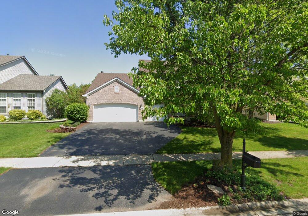
722 Manhattan Cir Unit 2 Oswego, IL 60543
Northwest Oswego NeighborhoodEstimated Value: $452,000 - $469,459
4
Beds
3
Baths
2,740
Sq Ft
$168/Sq Ft
Est. Value
About This Home
This home is located at 722 Manhattan Cir Unit 2, Oswego, IL 60543 and is currently estimated at $459,615, approximately $167 per square foot. 722 Manhattan Cir Unit 2 is a home located in Kendall County with nearby schools including Fox Chase Elementary School, Traughber Junior High School, and Oswego High School.
Ownership History
Date
Name
Owned For
Owner Type
Purchase Details
Closed on
Aug 18, 2003
Sold by
Richard Smykal Inc
Bought by
Petrauskas Michael P and Petrauskas Lisa A
Current Estimated Value
Home Financials for this Owner
Home Financials are based on the most recent Mortgage that was taken out on this home.
Original Mortgage
$237,350
Outstanding Balance
$107,177
Interest Rate
5.97%
Mortgage Type
Purchase Money Mortgage
Estimated Equity
$352,438
Create a Home Valuation Report for This Property
The Home Valuation Report is an in-depth analysis detailing your home's value as well as a comparison with similar homes in the area
Home Values in the Area
Average Home Value in this Area
Purchase History
| Date | Buyer | Sale Price | Title Company |
|---|---|---|---|
| Petrauskas Michael P | $295,000 | Chicago Title Insurance Co |
Source: Public Records
Mortgage History
| Date | Status | Borrower | Loan Amount |
|---|---|---|---|
| Open | Petrauskas Michael P | $237,350 |
Source: Public Records
Tax History Compared to Growth
Tax History
| Year | Tax Paid | Tax Assessment Tax Assessment Total Assessment is a certain percentage of the fair market value that is determined by local assessors to be the total taxable value of land and additions on the property. | Land | Improvement |
|---|---|---|---|---|
| 2024 | $10,399 | $135,220 | $25,312 | $109,908 |
| 2023 | $9,372 | $119,664 | $22,400 | $97,264 |
| 2022 | $9,372 | $109,783 | $20,550 | $89,233 |
| 2021 | $9,316 | $105,561 | $19,760 | $85,801 |
| 2020 | $9,024 | $101,501 | $19,000 | $82,501 |
| 2019 | $8,863 | $98,328 | $19,000 | $79,328 |
| 2018 | $8,669 | $95,633 | $25,664 | $69,969 |
| 2017 | $8,379 | $87,737 | $23,545 | $64,192 |
| 2016 | $8,236 | $85,181 | $22,859 | $62,322 |
| 2015 | $8,112 | $80,359 | $21,565 | $58,794 |
| 2014 | -- | $75,810 | $20,344 | $55,466 |
| 2013 | -- | $76,575 | $20,549 | $56,026 |
Source: Public Records
Map
Nearby Homes
- 173 Dolores St
- 409 Fawn Dr
- 102 Mary St
- 435 Fawn Dr
- 2100 Light Rd Unit 109
- 602 Clearwater Ct Unit 2
- 1721 State Route 31
- 608 Clearwater Ct
- 338 Millstream Ln Unit 1
- 403 Lake Ct
- 7.43 Acres Vacant La State Route 31
- 505 Parkland Ct
- 133 River Mist Dr Unit 3
- 11-13 W Anchor Rd
- 238 Willowwood Dr
- 411 Bayberry Dr
- 156 River Mist Dr
- 2110 State Route 31
- 5.43 B-3 Commercial State Route 31
- 125 Presidential Blvd Unit 3248
- 724 Manhattan Cir Unit 2
- 720 Manhattan Cir Unit 2
- 352 Century Dr Unit 2
- 726 Manhattan Cir
- 354 Century Dr
- 350 Century Dr
- 718 Manhattan Cir
- 721 Manhattan Cir Unit 2
- 348 Century Dr Unit 2
- 356 Century Dr Unit 2
- 723 Manhattan Cir Unit 2
- 728 Manhattan Cir
- 715 Manhattan Cir Unit 2
- 725 Manhattan Cir Unit 2
- 346 Century Dr Unit 2
- 358 Century Dr
- 716 Manhattan Cir Unit 2
- 730 Manhattan Cir Unit 2
- 714 Manhattan Cir
- 727 Manhattan Cir Unit 2