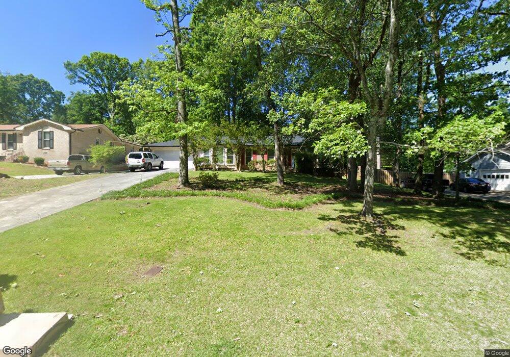
722 Mountainbrooke Cir Stone Mountain, GA 30087
Estimated Value: $314,000 - $396,000
3
Beds
2
Baths
1,767
Sq Ft
$196/Sq Ft
Est. Value
About This Home
This home is located at 722 Mountainbrooke Cir, Stone Mountain, GA 30087 and is currently estimated at $346,765, approximately $196 per square foot. 722 Mountainbrooke Cir is a home located in Gwinnett County with nearby schools including Camp Creek Elementary School, Trickum Middle School, and Parkview High School.
Ownership History
Date
Name
Owned For
Owner Type
Purchase Details
Closed on
Jun 26, 2008
Sold by
Lasalle Bk Series 2007-Cb4
Bought by
Ovesen Roy
Current Estimated Value
Home Financials for this Owner
Home Financials are based on the most recent Mortgage that was taken out on this home.
Original Mortgage
$115,200
Outstanding Balance
$73,260
Interest Rate
5.96%
Mortgage Type
New Conventional
Estimated Equity
$273,505
Purchase Details
Closed on
Apr 1, 2008
Sold by
Hill Sarah L
Bought by
C-Bass Mtg Ln Asset 2007-Cb4
Purchase Details
Closed on
Jan 27, 2006
Sold by
Sinnott Margaret F
Bought by
Hill Sarah L
Home Financials for this Owner
Home Financials are based on the most recent Mortgage that was taken out on this home.
Original Mortgage
$174,650
Interest Rate
6.14%
Mortgage Type
Trade
Create a Home Valuation Report for This Property
The Home Valuation Report is an in-depth analysis detailing your home's value as well as a comparison with similar homes in the area
Home Values in the Area
Average Home Value in this Area
Purchase History
| Date | Buyer | Sale Price | Title Company |
|---|---|---|---|
| Ovesen Roy | $128,000 | -- | |
| C-Bass Mtg Ln Asset 2007-Cb4 | $149,850 | -- | |
| Hill Sarah L | $183,000 | -- |
Source: Public Records
Mortgage History
| Date | Status | Borrower | Loan Amount |
|---|---|---|---|
| Open | Ovesen Roy | $115,200 | |
| Previous Owner | Hill Sarah L | $174,650 |
Source: Public Records
Tax History Compared to Growth
Tax History
| Year | Tax Paid | Tax Assessment Tax Assessment Total Assessment is a certain percentage of the fair market value that is determined by local assessors to be the total taxable value of land and additions on the property. | Land | Improvement |
|---|---|---|---|---|
| 2025 | $4,784 | $124,000 | $22,200 | $101,800 |
| 2024 | $3,940 | $128,040 | $22,200 | $105,840 |
| 2023 | $3,940 | $98,720 | $22,400 | $76,320 |
| 2022 | $3,880 | $98,720 | $22,400 | $76,320 |
| 2021 | $3,406 | $84,280 | $19,600 | $64,680 |
| 2020 | $3,148 | $76,680 | $15,200 | $61,480 |
| 2019 | $2,757 | $68,720 | $15,200 | $53,520 |
| 2018 | $2,756 | $68,720 | $15,200 | $53,520 |
| 2016 | $2,053 | $48,160 | $8,000 | $40,160 |
| 2015 | $2,072 | $48,160 | $8,000 | $40,160 |
| 2014 | -- | $36,120 | $8,000 | $28,120 |
Source: Public Records
Map
Nearby Homes
- 771 Mountainbrooke Cir SW
- 851 Rockbridge Rd SW
- 717 Oxford Ct SW
- 746 Oxford Ct SW
- 881 Rockbridge Rd SW
- 923 Tall Pine Ct SW
- 5774 Vantage Ct
- 1019 Crestwood Ln
- 5632 Stillwater Ct
- 5798 Musket Ln
- 5936 Millstone Ln
- 483 Rollingwood Dr
- 507 Castlearie Dr
- 507 Castleaire Dr Unit 1
- 574 Horseshoe Cir SW
- 5104 Onawa Ct SW
- 358 W Wind Dr SW
- 5521 E Wind Dr SW
- 5633 Breezy Ct SW
- 712 Mountainbrooke Cir
- 732 Mountainbrooke Cir
- 844 Rocky Ridge Ct
- 702 Mountainbrooke Cir
- 711 Mountainbrooke Cir Unit 4
- 717 Mountainbrooke Cir
- 717 Mountainbrooke Cir
- 752 Mountainbrooke Cir
- 701 Mountainbrooke Cir
- 840 Rocky Ridge Ct
- 692 Mountainbrooke Cir
- 691 Mountainbrooke Cir
- 762 Mountainbrooke Cir
- 835 Rocky Ridge Ct
- 681 Mountainbrooke Cir
- 682 Mountainbrooke Cir
- 766 Mountainbrooke Cir Unit 4
- 731 Mountainbrooke Cir
- 5607 Mountainbrooke Ct
- 854 Rocky Ridge Ct