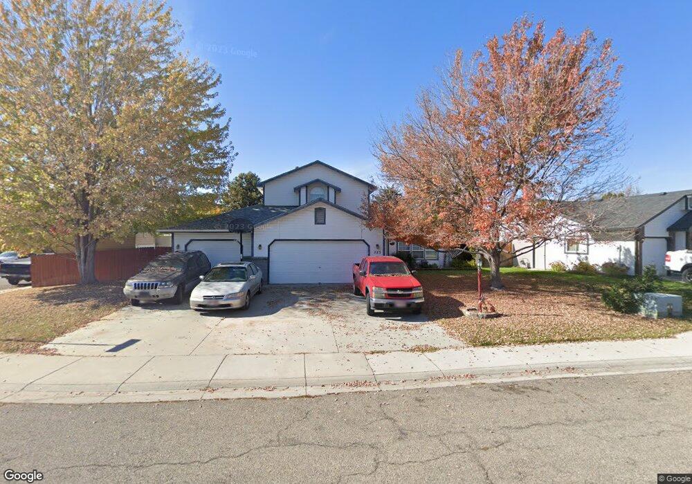
723 S Browning Ave Boise, ID 83709
West Boise NeighborhoodEstimated Value: $480,000 - $495,000
4
Beds
3
Baths
2,083
Sq Ft
$235/Sq Ft
Est. Value
About This Home
This home is located at 723 S Browning Ave, Boise, ID 83709 and is currently estimated at $489,861, approximately $235 per square foot. 723 S Browning Ave is a home located in Ada County with nearby schools including Ustick Elementary School, Lewis & Clark Middle School, and Centennial High School.
Ownership History
Date
Name
Owned For
Owner Type
Purchase Details
Closed on
Jun 5, 2013
Sold by
Phelps Terry and Phels Terry R
Bought by
Phelps Terry
Current Estimated Value
Home Financials for this Owner
Home Financials are based on the most recent Mortgage that was taken out on this home.
Original Mortgage
$216,000
Outstanding Balance
$152,481
Interest Rate
3.32%
Mortgage Type
New Conventional
Estimated Equity
$337,380
Purchase Details
Closed on
Feb 26, 2007
Sold by
Phelps Coleen B
Bought by
Phelps Terry R
Home Financials for this Owner
Home Financials are based on the most recent Mortgage that was taken out on this home.
Original Mortgage
$225,000
Interest Rate
6.21%
Mortgage Type
Purchase Money Mortgage
Create a Home Valuation Report for This Property
The Home Valuation Report is an in-depth analysis detailing your home's value as well as a comparison with similar homes in the area
Home Values in the Area
Average Home Value in this Area
Purchase History
| Date | Buyer | Sale Price | Title Company |
|---|---|---|---|
| Phelps Terry | -- | Title Source Inc | |
| Phelps Terry R | -- | Transnation Title |
Source: Public Records
Mortgage History
| Date | Status | Borrower | Loan Amount |
|---|---|---|---|
| Open | Phelps Terry | $216,000 | |
| Closed | Phelps Terry R | $225,000 |
Source: Public Records
Tax History Compared to Growth
Tax History
| Year | Tax Paid | Tax Assessment Tax Assessment Total Assessment is a certain percentage of the fair market value that is determined by local assessors to be the total taxable value of land and additions on the property. | Land | Improvement |
|---|---|---|---|---|
| 2025 | $1,993 | $444,200 | -- | -- |
| 2024 | $1,775 | $426,600 | -- | -- |
| 2023 | $1,775 | $380,000 | $0 | $0 |
| 2022 | $2,615 | $512,500 | $0 | $0 |
| 2021 | $2,133 | $368,400 | $0 | $0 |
| 2020 | $2,037 | $304,500 | $0 | $0 |
| 2019 | $2,522 | $297,000 | $0 | $0 |
| 2018 | $2,127 | $249,800 | $0 | $0 |
| 2017 | $1,857 | $222,400 | $0 | $0 |
| 2016 | $1,718 | $205,200 | $0 | $0 |
| 2015 | $1,705 | $195,600 | $0 | $0 |
| 2012 | -- | $141,700 | $0 | $0 |
Source: Public Records
Map
Nearby Homes
- 11683 W Aldershot St
- 11829 W Camas St
- 704 S Kiser Ave
- 12152 W Lewisburg Ct
- 12410 W Lewisburg Dr
- 11225 W Camas St
- 713 S Winthrop Way
- 11085 W Bridgetower Dr
- 11147 W Highmont Dr
- 11058 W Edgehill Dr
- 10866 W Sandhurst Dr
- 937 S Nautilus Ave
- 973 S Nautilus Ave
- 11899 W Blueberry Ct
- 960 S Nautilus Ave
- 941 S Wavetrain Ave
- 10776 W Smoke Ranch Dr
- 4345 E Vacheron St
- 1961 S Peppercorn Place
- 4195 E Woodmurra St
- 699 S Browning Ave
- 11884 W Dickens Dr
- 11889 W Bronte Dr
- 11906 W Dickens Dr
- 11889 W Bronte Way
- 728 S Browning Ave
- 675 S Browning Ave
- 704 S Browning Ave
- 11855 W Dickens Dr
- 11835 W Dickens Dr
- 752 S Browning Ave
- 680 S Browning Ave
- 11909 W Bronte Dr
- 11815 W Dickens Dr
- 11909 W Bronte Way
- 11928 W Dickens Dr
- 11895 W Dickens Dr
- 660 S Browning Ave
- 721 S Hemingway Ave
- 11789 W Bronte Way