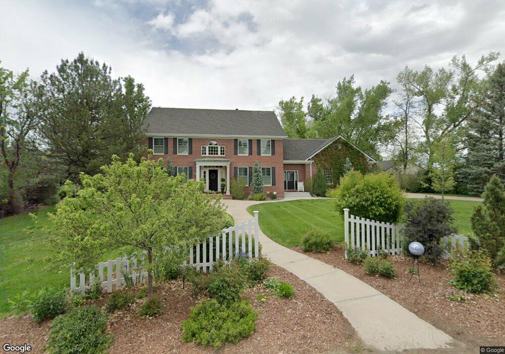
725 Front Range Rd Littleton, CO 80120
Heritage NeighborhoodEstimated Value: $1,868,000 - $2,779,000
4
Beds
7
Baths
3,816
Sq Ft
$619/Sq Ft
Est. Value
About This Home
This home is located at 725 Front Range Rd, Littleton, CO 80120 and is currently estimated at $2,362,952, approximately $619 per square foot. 725 Front Range Rd is a home located in Arapahoe County with nearby schools including Runyon Elementary School, Euclid Middle School, and Heritage High School.
Ownership History
Date
Name
Owned For
Owner Type
Purchase Details
Closed on
Nov 5, 2019
Sold by
Maloy Shawn and Maloy Julie A
Bought by
Maloy Shawn and Maloy Julie
Current Estimated Value
Purchase Details
Closed on
Oct 14, 2014
Sold by
Maloy Shawn and Maloy Julie A
Bought by
Maloy Shawn P and Maloy Julie A
Home Financials for this Owner
Home Financials are based on the most recent Mortgage that was taken out on this home.
Original Mortgage
$956,250
Interest Rate
4.12%
Mortgage Type
Credit Line Revolving
Purchase Details
Closed on
Dec 1, 2003
Sold by
Rhodes Rockne and Rhodes Dawn
Bought by
Maloy Shawn and Maloy Julie A
Home Financials for this Owner
Home Financials are based on the most recent Mortgage that was taken out on this home.
Original Mortgage
$820,000
Interest Rate
6.01%
Mortgage Type
Purchase Money Mortgage
Purchase Details
Closed on
May 10, 1999
Sold by
Palfreyman Teena and Palfreyman Richard B
Bought by
Rhodes Rockne and Rhodes Dawn
Home Financials for this Owner
Home Financials are based on the most recent Mortgage that was taken out on this home.
Original Mortgage
$508,000
Interest Rate
7.04%
Purchase Details
Closed on
Mar 3, 1998
Sold by
Palfreyman Richard B and Palfreyman Teena
Bought by
Palfreyman Teena
Home Financials for this Owner
Home Financials are based on the most recent Mortgage that was taken out on this home.
Original Mortgage
$476,000
Interest Rate
6.98%
Purchase Details
Closed on
Jan 29, 1998
Sold by
Palfreyman Teena
Bought by
Palfreyman Richard B and Palfreman Teena
Home Financials for this Owner
Home Financials are based on the most recent Mortgage that was taken out on this home.
Original Mortgage
$476,000
Interest Rate
6.98%
Purchase Details
Closed on
Nov 17, 1997
Sold by
Palfreyman Richard B and Palfreyman Teena
Bought by
Palfreyman Teena
Create a Home Valuation Report for This Property
The Home Valuation Report is an in-depth analysis detailing your home's value as well as a comparison with similar homes in the area
Home Values in the Area
Average Home Value in this Area
Purchase History
| Date | Buyer | Sale Price | Title Company |
|---|---|---|---|
| Maloy Shawn | -- | None Available | |
| Maloy Shawn P | -- | North American Title | |
| Maloy Shawn P | -- | North American Title | |
| Maloy Shawn | $1,025,000 | -- | |
| Rhodes Rockne | $635,000 | Land Title | |
| Palfreyman Teena | -- | -- | |
| Palfreyman Richard B | -- | Land Title | |
| Palfreyman Teena | -- | -- |
Source: Public Records
Mortgage History
| Date | Status | Borrower | Loan Amount |
|---|---|---|---|
| Previous Owner | Maloy Shawn P | $956,250 | |
| Previous Owner | Maloy Shawn | $820,000 | |
| Previous Owner | Rhodes Rockne | $508,000 | |
| Previous Owner | Palfreyman Richard B | $476,000 | |
| Closed | Rhodes Rockne | $95,250 |
Source: Public Records
Tax History Compared to Growth
Tax History
| Year | Tax Paid | Tax Assessment Tax Assessment Total Assessment is a certain percentage of the fair market value that is determined by local assessors to be the total taxable value of land and additions on the property. | Land | Improvement |
|---|---|---|---|---|
| 2024 | $15,331 | $160,331 | -- | -- |
| 2023 | $15,331 | $160,331 | $0 | $0 |
| 2022 | $11,002 | $108,365 | $0 | $0 |
| 2021 | $10,971 | $108,365 | $0 | $0 |
| 2020 | $11,918 | $121,128 | $0 | $0 |
| 2019 | $11,212 | $121,128 | $0 | $0 |
| 2018 | $8,669 | $99,540 | $0 | $0 |
| 2017 | $8,033 | $99,540 | $0 | $0 |
| 2016 | $9,042 | $107,651 | $0 | $0 |
| 2015 | $9,065 | $107,651 | $0 | $0 |
| 2014 | -- | $81,630 | $0 | $0 |
| 2013 | -- | $87,060 | $0 | $0 |
Source: Public Records
Map
Nearby Homes
- 7019 S Windermere St
- 1540 W Briarwood Ave
- 7391 S Costilla St
- 1705 W Hinsdale Place
- 6664 S Datura St
- 2443 W Sunset Dr
- 7652 S Gallup Ct
- 2812 W Davies Dr
- 7070 S Lakeview St
- 2418 W Euclid Ave
- 7132 S Bryant St Unit 232
- 7420 S Houstoun Waring Cir
- 6921 S Bryant St
- 6511 S Cedar St
- 2979 W Rowland Place
- 7006 S Elati St
- 707 W Easter Ave
- 7120 S Clay St
- 2957 W Rowland Ave
- 6483 S Sycamore St
- 730 Front Range Rd
- 721 Front Range Rd
- 1946 W Davies Ave
- 1906 W Davies Ave
- 1976 W Davies Ave
- 1896 W Davies Ave
- 2006 W Davies Ave
- 745 Front Range Rd
- 1886 W Davies Ave
- 2046 W Davies Ave
- 803 Front Range Rd
- 715 Front Range Rd
- 6993 S Prescott St
- 1965 W Davies Ave
- 2005 W Davies Ave
- 6994 S Prescott St
- 2086 W Davies Ave
- 739 Front Range Rd
- 2045 W Davies Ave
- 805 Front Range Rd