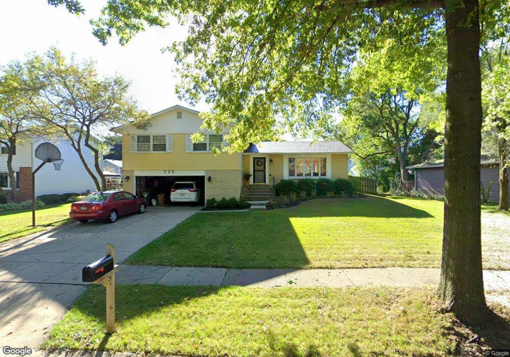
725 Mulberry Ct Algonquin, IL 60102
High Hill Farms NeighborhoodEstimated Value: $364,162 - $410,000
4
Beds
3
Baths
1,573
Sq Ft
$250/Sq Ft
Est. Value
About This Home
This home is located at 725 Mulberry Ct, Algonquin, IL 60102 and is currently estimated at $392,791, approximately $249 per square foot. 725 Mulberry Ct is a home located in McHenry County with nearby schools including Westfield Community School, Kenneth E Neubert Elementary School, and United Junior High School.
Ownership History
Date
Name
Owned For
Owner Type
Purchase Details
Closed on
May 31, 1996
Sold by
Molony James T and Molony Mary Lou
Bought by
Parker Chris and Parker Karen
Current Estimated Value
Home Financials for this Owner
Home Financials are based on the most recent Mortgage that was taken out on this home.
Original Mortgage
$153,000
Interest Rate
8.31%
Mortgage Type
Balloon
Create a Home Valuation Report for This Property
The Home Valuation Report is an in-depth analysis detailing your home's value as well as a comparison with similar homes in the area
Home Values in the Area
Average Home Value in this Area
Purchase History
| Date | Buyer | Sale Price | Title Company |
|---|---|---|---|
| Parker Chris | $171,500 | Land Title Group Inc |
Source: Public Records
Mortgage History
| Date | Status | Borrower | Loan Amount |
|---|---|---|---|
| Previous Owner | Parker Chris | $153,000 |
Source: Public Records
Tax History Compared to Growth
Tax History
| Year | Tax Paid | Tax Assessment Tax Assessment Total Assessment is a certain percentage of the fair market value that is determined by local assessors to be the total taxable value of land and additions on the property. | Land | Improvement |
|---|---|---|---|---|
| 2024 | $7,443 | $111,142 | $23,472 | $87,670 |
| 2023 | $7,651 | $99,403 | $20,993 | $78,410 |
| 2022 | $6,871 | $86,120 | $21,044 | $65,076 |
| 2021 | $6,587 | $80,231 | $19,605 | $60,626 |
| 2020 | $6,410 | $77,391 | $18,911 | $58,480 |
| 2019 | $6,251 | $74,072 | $18,100 | $55,972 |
| 2018 | $5,950 | $68,427 | $16,721 | $51,706 |
| 2017 | $5,822 | $64,462 | $15,752 | $48,710 |
| 2016 | $5,727 | $60,460 | $14,774 | $45,686 |
| 2013 | -- | $62,996 | $13,783 | $49,213 |
Source: Public Records
Map
Nearby Homes
- 721 Brentwood Ct
- 102 Center St
- 314 Washington St
- 1235 Fairmont Ct
- 1 N Hubbard St
- SWC Talaga and Algonquin Rd
- 266 Grandview Ct
- 0 River Dr N Unit MRD12473279
- 16 Brian Ct
- 909 Roger St
- 700 Fairfield Ln
- 420 N Harrison St
- 710 Sprucetree Ln
- 1210 Brandywine Cir
- 809 Menominee Dr
- 807 Menominee Dr
- 600 E Algonquin Rd
- 1820 Crofton Dr
- 1245 Winaki Trail
- 541 Blackhawk Dr
- 715 Mulberry Ct
- 735 Mulberry Ct
- 722 Evergreen Ct
- 712 Evergreen Ct
- 732 Evergreen Ct
- 720 Mulberry Ct
- 745 Mulberry Ct
- 705 Mulberry Ct
- 730 Mulberry Ct
- 702 Evergreen Ct
- 710 Mulberry Ct
- 740 Mulberry Ct
- 742 Evergreen Ct
- 700 Mulberry Ct Unit 1
- 750 Mulberry Ct
- 731 Orchard Ct
- 560 Forest Cir
- 721 Orchard Ct
- 711 Evergreen Ct
- 721 Evergreen Ct