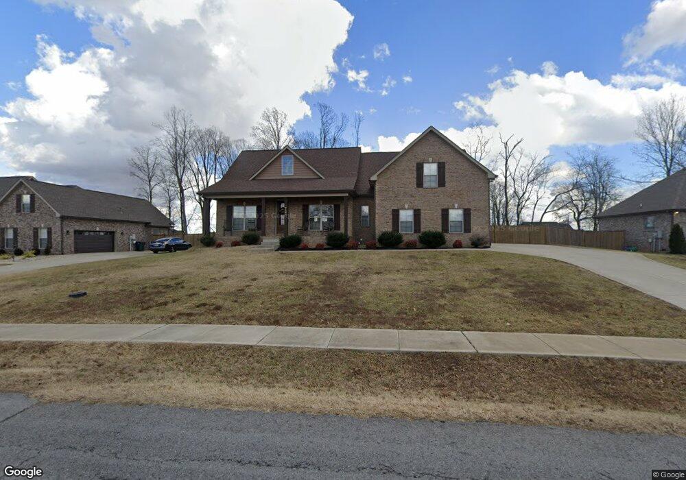
725 N Russell St Portland, TN 37148
Estimated Value: $622,214 - $751,000
3
Beds
3
Baths
3,253
Sq Ft
$216/Sq Ft
Est. Value
About This Home
This home is located at 725 N Russell St, Portland, TN 37148 and is currently estimated at $702,304, approximately $215 per square foot. 725 N Russell St is a home located in Sumner County with nearby schools including Watt Hardison Elementary School, Portland West Middle School, and Portland High School.
Ownership History
Date
Name
Owned For
Owner Type
Purchase Details
Closed on
Aug 31, 2018
Sold by
Stratton Taylor Builders Llc
Bought by
Bohling Martin R and Bohling Laura W
Current Estimated Value
Home Financials for this Owner
Home Financials are based on the most recent Mortgage that was taken out on this home.
Original Mortgage
$332,910
Outstanding Balance
$288,556
Interest Rate
4.6%
Mortgage Type
New Conventional
Estimated Equity
$413,748
Purchase Details
Closed on
Feb 28, 2017
Sold by
Mcglothlin James Hughes
Bought by
Stratton Taylor Builders Llc
Home Financials for this Owner
Home Financials are based on the most recent Mortgage that was taken out on this home.
Original Mortgage
$228,000
Interest Rate
4.09%
Mortgage Type
Construction
Create a Home Valuation Report for This Property
The Home Valuation Report is an in-depth analysis detailing your home's value as well as a comparison with similar homes in the area
Home Values in the Area
Average Home Value in this Area
Purchase History
| Date | Buyer | Sale Price | Title Company |
|---|---|---|---|
| Bohling Martin R | $369,900 | Cbc Title & Escrow | |
| Stratton Taylor Builders Llc | $26,000 | Fayette County Title |
Source: Public Records
Mortgage History
| Date | Status | Borrower | Loan Amount |
|---|---|---|---|
| Open | Bohling Martin R | $332,910 | |
| Previous Owner | Stratton Taylor Builders Llc | $228,000 |
Source: Public Records
Tax History Compared to Growth
Tax History
| Year | Tax Paid | Tax Assessment Tax Assessment Total Assessment is a certain percentage of the fair market value that is determined by local assessors to be the total taxable value of land and additions on the property. | Land | Improvement |
|---|---|---|---|---|
| 2025 | $2,361 | $166,175 | $0 | $0 |
| 2024 | $2,361 | $166,175 | $15,000 | $151,175 |
| 2023 | $3,156 | $92,475 | $8,750 | $83,725 |
| 2022 | $3,072 | $92,475 | $8,750 | $83,725 |
| 2021 | $3,072 | $92,475 | $8,750 | $83,725 |
| 2020 | $3,072 | $92,475 | $8,750 | $83,725 |
| 2019 | $4,184 | $0 | $0 | $0 |
| 2018 | $196 | $0 | $0 | $0 |
| 2017 | $186 | $0 | $0 | $0 |
Source: Public Records
Map
Nearby Homes
- 725B N Russell St
- 727A N Russell St
- 135 Irish Oaks Dr
- 730 N Russell St
- 104 Mesa Dr
- 136A Wind Wood Dr
- 128 Emma Dr
- 746 N Russell St
- 229 Westland St
- 207 Meadow Ln
- 115 Sunset Place
- 116 Chad St E
- 1001 Chad St W
- 510 N Russell St
- 137 Bryan James Ln
- 101 Jasmine Way
- 419 N Russell St
- 1027 Founders Ln
- 201 Moore Ave
- 103 Teton Ct
- 725 N Russell St Unit B
- 725 N Russell St
- 725 N Russell St Unit A
- 725 N Russell St Unit B
- 725A N Russell St
- 725 N Russell St
- 727 N Russell St
- 727 N Russell St
- 727 N Russell St Unit A
- 727A N Russell St
- 723A N Russell St
- 723b N Russell St
- 143 Irish Oaks Dr
- 143 Irish Oaks Dr
- 729B N Russell St Unit B
- 729B N Russell St
- 729 B N Russell St
- 729A N Russell St
- 726 N Russell St
- 117 Elise Ln