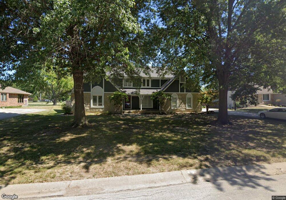
725 NW Silver Ridge Lees Summit, MO 64081
Estimated Value: $501,000 - $565,000
4
Beds
4
Baths
3,124
Sq Ft
$173/Sq Ft
Est. Value
About This Home
This home is located at 725 NW Silver Ridge, Lees Summit, MO 64081 and is currently estimated at $539,110, approximately $172 per square foot. 725 NW Silver Ridge is a home located in Jackson County with nearby schools including Cedar Creek Elementary School, Bernard C. Campbell Middle School, and Lee's Summit North High School.
Ownership History
Date
Name
Owned For
Owner Type
Purchase Details
Closed on
Apr 26, 2011
Sold by
Waldo Erma L
Bought by
Hawk Andrew C and Hawk Mary E
Current Estimated Value
Home Financials for this Owner
Home Financials are based on the most recent Mortgage that was taken out on this home.
Original Mortgage
$241,713
Outstanding Balance
$166,916
Interest Rate
4.82%
Mortgage Type
FHA
Estimated Equity
$372,194
Purchase Details
Closed on
Sep 6, 2001
Sold by
Waldo Ray G and Waldo Erma L
Bought by
Waldo Daniel E
Create a Home Valuation Report for This Property
The Home Valuation Report is an in-depth analysis detailing your home's value as well as a comparison with similar homes in the area
Home Values in the Area
Average Home Value in this Area
Purchase History
| Date | Buyer | Sale Price | Title Company |
|---|---|---|---|
| Hawk Andrew C | -- | Kansas City Title Inc | |
| Waldo Daniel E | -- | -- |
Source: Public Records
Mortgage History
| Date | Status | Borrower | Loan Amount |
|---|---|---|---|
| Open | Hawk Andrew C | $241,713 |
Source: Public Records
Tax History Compared to Growth
Tax History
| Year | Tax Paid | Tax Assessment Tax Assessment Total Assessment is a certain percentage of the fair market value that is determined by local assessors to be the total taxable value of land and additions on the property. | Land | Improvement |
|---|---|---|---|---|
| 2025 | $6,628 | $94,227 | $16,422 | $77,805 |
| 2024 | $6,580 | $91,793 | $14,018 | $77,775 |
| 2023 | $6,580 | $91,793 | $14,018 | $77,775 |
| 2022 | $5,752 | $71,250 | $7,071 | $64,179 |
| 2021 | $5,871 | $71,250 | $7,071 | $64,179 |
| 2020 | $5,638 | $67,761 | $7,071 | $60,690 |
| 2019 | $5,484 | $67,761 | $7,071 | $60,690 |
| 2018 | $5,143 | $58,973 | $6,154 | $52,819 |
| 2017 | $5,143 | $58,973 | $6,154 | $52,819 |
| 2016 | $4,518 | $51,281 | $6,688 | $44,593 |
| 2014 | $4,091 | $45,512 | $7,085 | $38,427 |
Source: Public Records
Map
Nearby Homes
- 2257 NW Summerfield Dr
- 813 NW High Point Dr
- 130 NW Ambersham Dr
- 2209 NW Wellington Ct
- 505 NW Ambersham Dr
- 2007 NW Chipman Rd
- 2436 NW Valley View Dr
- 2122 NW Ashurst Dr
- 2501 NW Shady Bend Ln
- 2110 NW Ashurst Dr
- 2503 NW Windwood Dr
- 2090 NW O'Brien Rd
- 2086 NW O'Brien Rd
- 361 NW Patch Ct
- 2536 NW Bent Tree Cir
- Monterey Plan at Reserve at Woodside Ridge
- Oakleigh Plan at Reserve at Woodside Ridge
- Ashland Plan at Reserve at Woodside Ridge
- Bentley Plan at Reserve at Woodside Ridge
- Mariah Plan at Reserve at Woodside Ridge
- 721 NW Silver Ridge
- 729 NW Silver Ridge
- 712 NW Silver Ridge
- 724 NW Silver Ridge
- 728 NW Silver Ridge
- 709 NW Black Twig Ln
- 733 NW Silver Ridge
- 713 NW Silver Ridge
- 703 NW Black Twig Ln
- 732 NW Silver Ridge
- 708 NW Silver Ridge
- 737 NW Silver Ridge
- 709 NW Silver Ridge
- 711 NW Black Twig Ln
- 2217 NW Summerfield Dr
- 2213 NW Summerfield Dr
- 704 NW Silver Ridge
- 736 NW Silver Ridge
- 2110 NW Chipman Rd
- 741 NW Silver Ridge