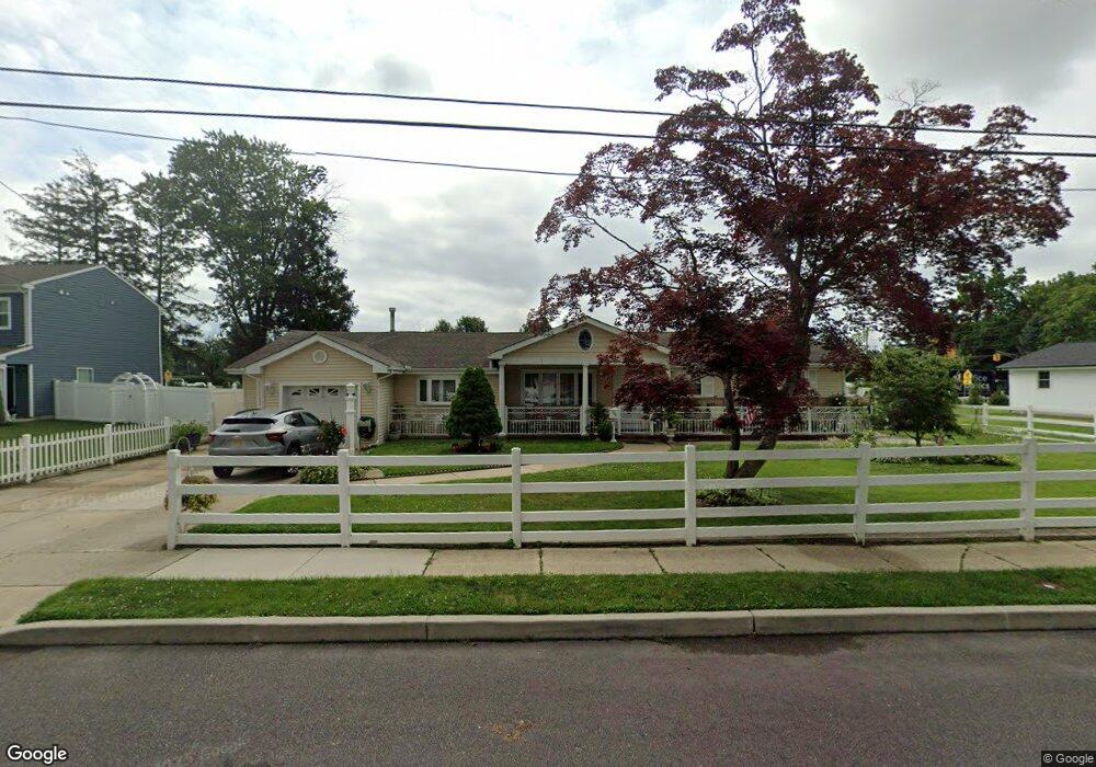
726 Brighton Dr Linwood, NJ 08221
Estimated Value: $468,842 - $591,000
--
Bed
--
Bath
2,149
Sq Ft
$251/Sq Ft
Est. Value
About This Home
This home is located at 726 Brighton Dr, Linwood, NJ 08221 and is currently estimated at $539,961, approximately $251 per square foot. 726 Brighton Dr is a home located in Atlantic County with nearby schools including Seaview Elementary School, Belhaven Middle School, and Mainland Regional High School.
Ownership History
Date
Name
Owned For
Owner Type
Purchase Details
Closed on
Nov 29, 2011
Sold by
Zambetoglu Stavros and Zambetoglu Kathy
Bought by
Zambetoglou Stavros and Zambetoglou Kathy
Current Estimated Value
Home Financials for this Owner
Home Financials are based on the most recent Mortgage that was taken out on this home.
Original Mortgage
$171,700
Outstanding Balance
$17,800
Interest Rate
3.33%
Mortgage Type
FHA
Estimated Equity
$522,161
Purchase Details
Closed on
Jan 12, 1989
Sold by
Floriani Mario F Sheriff
Bought by
Plamantouras Jim and Plamantouras John
Create a Home Valuation Report for This Property
The Home Valuation Report is an in-depth analysis detailing your home's value as well as a comparison with similar homes in the area
Home Values in the Area
Average Home Value in this Area
Purchase History
| Date | Buyer | Sale Price | Title Company |
|---|---|---|---|
| Zambetoglou Stavros | -- | None Available | |
| Plamantouras Jim | $84,600 | -- |
Source: Public Records
Mortgage History
| Date | Status | Borrower | Loan Amount |
|---|---|---|---|
| Open | Zambetoglou Stavros | $171,700 |
Source: Public Records
Tax History Compared to Growth
Tax History
| Year | Tax Paid | Tax Assessment Tax Assessment Total Assessment is a certain percentage of the fair market value that is determined by local assessors to be the total taxable value of land and additions on the property. | Land | Improvement |
|---|---|---|---|---|
| 2025 | $9,534 | $249,900 | $112,000 | $137,900 |
| 2024 | $9,534 | $249,900 | $112,000 | $137,900 |
| 2023 | $9,091 | $249,900 | $112,000 | $137,900 |
| 2022 | $9,091 | $249,900 | $112,000 | $137,900 |
| 2021 | $9,011 | $249,900 | $112,000 | $137,900 |
| 2020 | $8,886 | $249,900 | $112,000 | $137,900 |
| 2019 | $8,697 | $249,900 | $112,000 | $137,900 |
| 2018 | $8,502 | $249,900 | $112,000 | $137,900 |
| 2017 | $8,332 | $249,900 | $112,000 | $137,900 |
| 2016 | $8,052 | $249,900 | $112,000 | $137,900 |
| 2015 | $8,059 | $249,900 | $112,000 | $137,900 |
| 2014 | $7,747 | $249,900 | $112,000 | $137,900 |
Source: Public Records
Map
Nearby Homes
- 901 Oak Ave
- 1026 Bartlett Dr
- 1026 Bartlett Ave
- 407 Jefferson Ave
- 2 Sandy Ct
- 921 Oak Grove Ave
- 309 Haines Ave
- 933 Oak Grove Ave
- 210 Haines Ave
- 404 Cedarbrook Ln
- 34 Crossing Dr
- 622 Central Ave
- 28 Crossing Dr
- 130 Wilson Ave
- 550 Central Ave Unit N-12
- 550 Central Ave Unit E-14
- 550 Central Ave Unit G-16 Constitution Ct
- 550 Central Ave Unit B1
- 550 Central Ave Unit G-14 Constitution Ct
- 550 Central Ave Unit 4
- 724 Brighton Dr
- 500 W Poplar Ave
- 501 Sterling Ave
- 502 W Poplar Ave
- 722 Brighton Dr
- 502 Sterling Ave
- 503 Sterling Ave
- 503 W Poplar Ave
- 504 W Poplar Ave
- 501 Wilson Ave
- 720 Brighton Dr
- 504 Sterling Ave
- 507 W Poplar Ave
- 413 W Poplar Ave
- 503 Wilson Ave
- 509 W Poplar Ave
- 505 Sterling Ave
- 409 W Poplar Ave
- 506 W Poplar Ave
- 506 Sterling Ave