Estimated Value: $606,000 - $787,890
4
Beds
3
Baths
2,947
Sq Ft
$243/Sq Ft
Est. Value
About This Home
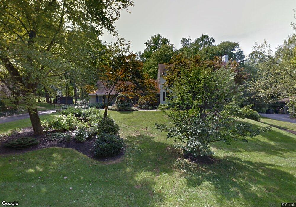
This home is located at 726 Brooke Rd, Exton, PA 19341 and is currently estimated at $715,223, approximately $242 per square foot. 726 Brooke Rd is a home located in Chester County with nearby schools including Lionville Elementary School, Lionville Middle School, and Downingtown High School East.
Ownership History
Date
Name
Owned For
Owner Type
Purchase Details
Closed on
Jul 15, 2014
Sold by
Magee Rosemary A
Bought by
Stancato Jodie L and Magee Timothy R
Current Estimated Value
Home Financials for this Owner
Home Financials are based on the most recent Mortgage that was taken out on this home.
Original Mortgage
$182,400
Outstanding Balance
$139,038
Interest Rate
4.18%
Mortgage Type
New Conventional
Estimated Equity
$576,185
Create a Home Valuation Report for This Property
The Home Valuation Report is an in-depth analysis detailing your home's value as well as a comparison with similar homes in the area
Home Values in the Area
Average Home Value in this Area
Purchase History
| Date | Buyer | Sale Price | Title Company |
|---|---|---|---|
| Stancato Jodie L | $228,000 | First American Title Ins Co |
Source: Public Records
Mortgage History
| Date | Status | Borrower | Loan Amount |
|---|---|---|---|
| Open | Stancato Jodie L | $182,400 |
Source: Public Records
Tax History
| Year | Tax Paid | Tax Assessment Tax Assessment Total Assessment is a certain percentage of the fair market value that is determined by local assessors to be the total taxable value of land and additions on the property. | Land | Improvement |
|---|---|---|---|---|
| 2025 | $7,464 | $218,070 | $48,680 | $169,390 |
| 2024 | $7,464 | $218,070 | $48,680 | $169,390 |
| 2023 | $7,246 | $218,070 | $48,680 | $169,390 |
| 2022 | $7,065 | $218,070 | $48,680 | $169,390 |
| 2021 | $6,946 | $218,070 | $48,680 | $169,390 |
| 2020 | $6,907 | $218,070 | $48,680 | $169,390 |
| 2019 | $6,907 | $218,070 | $48,680 | $169,390 |
| 2018 | $6,907 | $218,070 | $48,680 | $169,390 |
| 2017 | $6,907 | $218,070 | $48,680 | $169,390 |
| 2016 | $6,490 | $218,070 | $48,680 | $169,390 |
| 2015 | $6,490 | $218,070 | $48,680 | $169,390 |
| 2014 | $6,490 | $218,070 | $48,680 | $169,390 |
Source: Public Records
Map
Nearby Homes
- 608 Brainerd Place
- 431 Carmarthen Ct
- 432 Carmarthen Ct
- 94 Sagewood Dr Unit 189
- 88 Sagewood Dr Unit 186
- 23 Ashtree Ln Unit 140
- 208 Lucy Cir
- Santorini Plan at Worthington Farm - Luxury Single-Family Homes
- Monaco Plan at Worthington Farm - Luxury Single-Family Homes
- Lisbon Plan at Worthington Farm - Luxury Single-Family Homes
- 207 Lucy Cir
- 119 Conway Ct
- 411 Forge Ln
- 301 Worthington Dr Unit 301
- 305 Concord Ave
- 261 Watch Hill Rd
- 235 Red Leaf Ln
- 226 Red Leaf Ln
- 82 Granville Way
- 167 Brazier Ln
- 724 Brooke Rd
- 728 Brooke Rd
- 725 Brooke Rd
- 730 Brooke Rd
- 722 Brooke Rd
- 709 Brainerd Rd
- 601 Bough Rd
- 711 Brainerd Rd
- 732 Brooke Rd
- 713 Brainerd Rd
- 720 Brooke Rd
- 715 Brainerd Rd
- 707 Brainerd Rd
- 721 Brooke Rd
- 717 Brainerd Rd
- 602 Brainerd Place
- 520 Balsam Place
- 502 Balsam Place
- 721 Brainerd Rd
- 723 Brainerd Rd
Your Personal Tour Guide
Ask me questions while you tour the home.