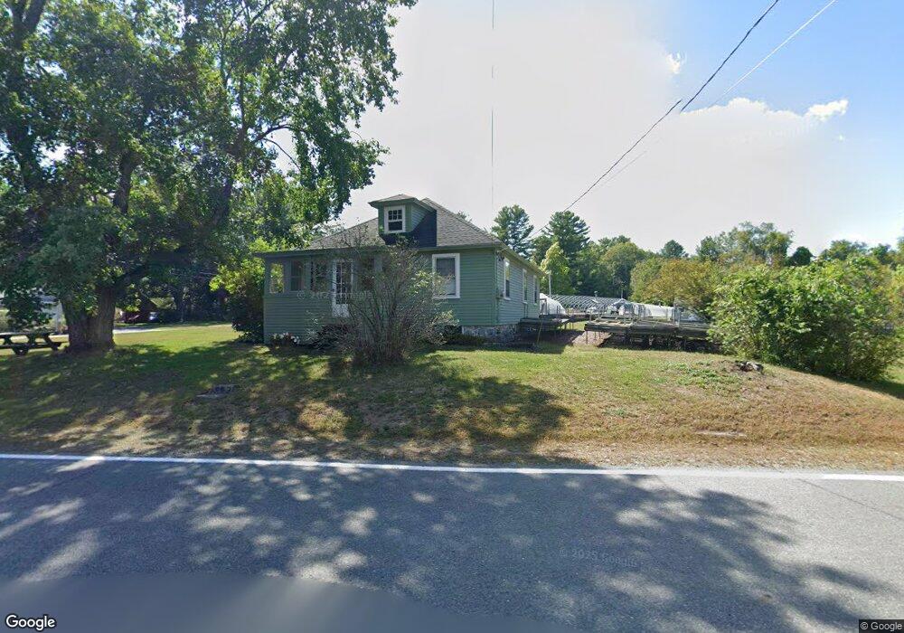
726 Main St Dunstable, MA 01827
Estimated Value: $446,043 - $521,000
2
Beds
1
Bath
884
Sq Ft
$548/Sq Ft
Est. Value
About This Home
This home is located at 726 Main St, Dunstable, MA 01827 and is currently estimated at $484,761, approximately $548 per square foot. 726 Main St is a home located in Middlesex County with nearby schools including Groton Dunstable Regional High School and 2nd Nature Academy.
Create a Home Valuation Report for This Property
The Home Valuation Report is an in-depth analysis detailing your home's value as well as a comparison with similar homes in the area
Home Values in the Area
Average Home Value in this Area
Tax History
| Year | Tax Paid | Tax Assessment Tax Assessment Total Assessment is a certain percentage of the fair market value that is determined by local assessors to be the total taxable value of land and additions on the property. | Land | Improvement |
|---|---|---|---|---|
| 2025 | $5,675 | $412,700 | $220,700 | $192,000 |
| 2024 | $5,422 | $388,400 | $202,500 | $185,900 |
| 2023 | $5,639 | $376,700 | $202,500 | $174,200 |
| 2022 | $5,549 | $363,900 | $202,500 | $161,400 |
| 2021 | $4,920 | $299,800 | $185,200 | $114,600 |
| 2020 | $4,981 | $295,800 | $185,200 | $110,600 |
| 2019 | $5,045 | $295,700 | $185,200 | $110,500 |
| 2018 | $6,318 | $285,200 | $184,300 | $100,900 |
| 2017 | $4,808 | $282,500 | $184,300 | $98,200 |
| 2016 | $4,533 | $273,900 | $176,100 | $97,800 |
| 2015 | $4,141 | $247,500 | $148,400 | $99,100 |
| 2014 | $3,900 | $247,300 | $148,400 | $98,900 |
Source: Public Records
Map
Nearby Homes
- 153 Off Pond St
- 57 French Ct
- 0 Lowell St
- 1 Doucet Ave
- 11 Lojko Dr
- 77 Wilderness Dr
- 141 Ridge Rd
- 58 Wilderness Dr
- 2 Wilderness Dr
- 1 Wilderness Dr
- 7 Wilderness Dr
- 79 Wilderness Dr
- 4 Wilderness Dr
- 3 Wilderness Dr
- 6 Green Heron Ln Unit U22
- 6 Wilderness Dr
- 57 Wilderness Dr
- 59 Wilderness Dr
- 61 Wilderness Dr
- 4 Hikers Ln
Your Personal Tour Guide
Ask me questions while you tour the home.