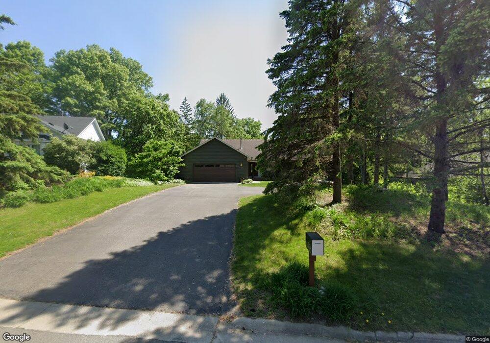
726 Marie Ave W Saint Paul, MN 55118
Estimated Value: $615,000 - $900,469
3
Beds
3
Baths
4,060
Sq Ft
$188/Sq Ft
Est. Value
About This Home
This home is located at 726 Marie Ave W, Saint Paul, MN 55118 and is currently estimated at $762,867, approximately $187 per square foot. 726 Marie Ave W is a home located in Dakota County with nearby schools including Somerset Elementary School, Heritage E-STEM Magnet School, and Two Rivers High School.
Ownership History
Date
Name
Owned For
Owner Type
Purchase Details
Closed on
Sep 1, 2021
Sold by
Ellis Betty J and Ellis Ronald W
Bought by
Heuermann Troy W and Heuermann Kristin G
Current Estimated Value
Home Financials for this Owner
Home Financials are based on the most recent Mortgage that was taken out on this home.
Original Mortgage
$495,200
Outstanding Balance
$450,595
Interest Rate
2.8%
Mortgage Type
New Conventional
Estimated Equity
$312,272
Create a Home Valuation Report for This Property
The Home Valuation Report is an in-depth analysis detailing your home's value as well as a comparison with similar homes in the area
Home Values in the Area
Average Home Value in this Area
Purchase History
| Date | Buyer | Sale Price | Title Company |
|---|---|---|---|
| Heuermann Troy W | $619,000 | Watermark Title Agency | |
| Heuermann Troy Troy | $619,000 | -- |
Source: Public Records
Mortgage History
| Date | Status | Borrower | Loan Amount |
|---|---|---|---|
| Open | Heuermann Troy W | $495,200 | |
| Closed | Heuermann Troy Troy | $495,200 |
Source: Public Records
Tax History Compared to Growth
Tax History
| Year | Tax Paid | Tax Assessment Tax Assessment Total Assessment is a certain percentage of the fair market value that is determined by local assessors to be the total taxable value of land and additions on the property. | Land | Improvement |
|---|---|---|---|---|
| 2024 | $8,446 | $796,600 | $187,700 | $608,900 |
| 2023 | $8,446 | $839,100 | $183,500 | $655,600 |
| 2022 | $6,440 | $579,200 | $183,100 | $396,100 |
| 2021 | $6,742 | $619,000 | $159,200 | $459,800 |
| 2020 | $6,408 | $636,400 | $151,600 | $484,800 |
| 2019 | $6,551 | $590,400 | $144,400 | $446,000 |
| 2018 | $6,128 | $575,600 | $134,900 | $440,700 |
| 2017 | $6,105 | $561,300 | $128,500 | $432,800 |
| 2016 | $6,065 | $543,400 | $122,400 | $421,000 |
| 2015 | $5,418 | $544,500 | $122,400 | $422,100 |
| 2014 | -- | $476,600 | $115,500 | $361,100 |
| 2013 | -- | $413,039 | $112,083 | $300,956 |
Source: Public Records
Map
Nearby Homes
- 1774 Dodd Rd
- 679 Marie Ave W
- 792 Hilltop Rd
- 1941 Dodd Rd
- 685 Hidden Creek Trail
- 1912 South Ln
- 884 Marie Ave W
- 614 Hidden Creek Trail
- XXX Barbara Ct
- 1860 Eagle Ridge Dr Unit W303
- 600 Wentworth Ave
- 912 Crown Ct
- 1626 Diane Rd
- 795 Creek Ave
- 485 Preserve Path
- 1810 Delaware Ave
- 1759 Lilac Ln
- 1925 Walsh Ln
- 1320 Riverside Ln Unit 303
- 1320 Riverside Ln Unit 112
- 720 Marie Ave W
- 730 Marie Ave W
- 727 Spring Creek Cir
- 719 Spring Creek Cir
- 725 Marie Ave W
- 721 721 Marie Ave W
- 721 721 Marie-Avenue-w
- 721 Marie Ave W
- 729 Marie Ave W
- 765 Willow Ln
- 724 Spring Creek Cir
- 717 717 Marie Ave
- 717 Marie Ave W
- 1792 Sutton Ln
- 720 Spring Creek Cir
- 716 Spring Creek Cir
- 720 Round Hill Rd
- 722 Round Hill Rd
- 724 Round Hill Rd
- 1786 Sutton Ln