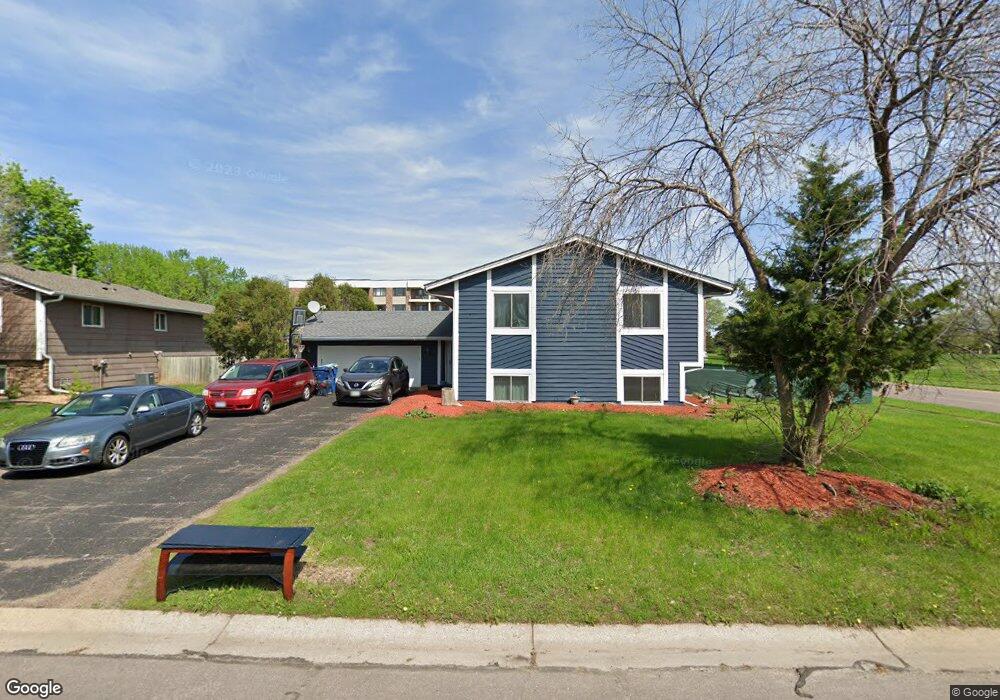
7265 146th Way W Saint Paul, MN 55124
Downtown Apple Valley NeighborhoodEstimated Value: $379,000 - $404,733
3
Beds
2
Baths
1,276
Sq Ft
$308/Sq Ft
Est. Value
About This Home
This home is located at 7265 146th Way W, Saint Paul, MN 55124 and is currently estimated at $392,933, approximately $307 per square foot. 7265 146th Way W is a home located in Dakota County with nearby schools including Greenleaf Elementary School, Falcon Ridge Middle School, and Apple Valley Senior High School.
Ownership History
Date
Name
Owned For
Owner Type
Purchase Details
Closed on
Oct 26, 2006
Sold by
Soshski Amy L and Soshski Nathan
Bought by
Siaka Lare Kenlsa Alvine
Current Estimated Value
Purchase Details
Closed on
Sep 12, 2001
Sold by
Mayer Mark C and Mayer Donna Sue
Bought by
Pugliese Amy L
Create a Home Valuation Report for This Property
The Home Valuation Report is an in-depth analysis detailing your home's value as well as a comparison with similar homes in the area
Home Values in the Area
Average Home Value in this Area
Purchase History
| Date | Buyer | Sale Price | Title Company |
|---|---|---|---|
| Siaka Lare Kenlsa Alvine | $242,900 | -- | |
| Pugliese Amy L | $186,000 | -- |
Source: Public Records
Tax History Compared to Growth
Tax History
| Year | Tax Paid | Tax Assessment Tax Assessment Total Assessment is a certain percentage of the fair market value that is determined by local assessors to be the total taxable value of land and additions on the property. | Land | Improvement |
|---|---|---|---|---|
| 2024 | $4,120 | $354,900 | $88,800 | $266,100 |
| 2023 | $4,120 | $366,200 | $89,000 | $277,200 |
| 2022 | $3,430 | $363,900 | $88,700 | $275,200 |
| 2021 | $3,284 | $301,800 | $68,300 | $233,500 |
| 2020 | $3,284 | $284,100 | $65,000 | $219,100 |
| 2019 | $2,967 | $276,100 | $61,900 | $214,200 |
| 2018 | $2,769 | $262,400 | $59,000 | $203,400 |
| 2017 | $2,704 | $236,900 | $56,200 | $180,700 |
| 2016 | $2,589 | $221,300 | $53,500 | $167,800 |
| 2015 | $2,472 | $192,641 | $47,863 | $144,778 |
| 2014 | -- | $185,120 | $45,826 | $139,294 |
| 2013 | -- | $167,462 | $41,643 | $125,819 |
Source: Public Records
Map
Nearby Homes
- 14620 Garrett Ave Unit 310
- 14461 Freesia Way
- 14242 Glencove Trail
- 7662 142nd St W
- 7342 Upper 139th St W
- 14217 Footbridge Way
- 7070 153rd St W Unit 211
- 14440 Flax Way
- 14786 Hallmark Dr
- 834 Fireside Dr
- 14080 Guthrie Ave
- 13868 Glendale Ct
- 13720 Georgia Dr
- 15323 Foliage Ave
- 15503 Gateway Path Unit 128
- 7291 Upper 136th St W
- 15511 Gateway Path Unit 132
- 14057 Flintwood Ct
- 7577 138th St W
- 14825 Haven Dr
- 7269 146th Way W
- 7271 146th Way W
- 7299 Upper 146th St W
- 7294 146th Way W
- 7281 146th Way W
- 14620 Garrett Ave Unit 106
- 14620 Garrett Ave Unit 112
- 14620 Garrett Ave Unit 303
- 14620 Garrett Ave Unit 205
- 14620 Garrett Ave Unit 206
- 14620 Garrett Ave Unit 314
- 14620 Garrett Ave Unit 110
- 14620 Garrett Ave Unit 214
- 14620 Garrett Ave Unit 103
- 14620 Garrett Ave Unit 314
- 14620 Garrett Ave Unit 313
- 14620 Garrett Ave Unit 312
- 14620 Garrett Ave Unit 311
- 14620 Garrett Ave Unit 309
- 14620 Garrett Ave Unit 308