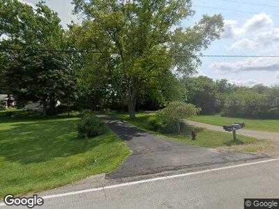
7270 Enterprise Rd West Alexandria, OH 45381
Estimated Value: $175,000 - $228,000
3
Beds
2
Baths
1,413
Sq Ft
$150/Sq Ft
Est. Value
About This Home
This home is located at 7270 Enterprise Rd, West Alexandria, OH 45381 and is currently estimated at $211,842, approximately $149 per square foot. 7270 Enterprise Rd is a home located in Preble County with nearby schools including Preble Shawnee Elementary School, West Elkton Intermediate School, and Preble Shawnee Junior/Senior High School.
Ownership History
Date
Name
Owned For
Owner Type
Purchase Details
Closed on
Jun 6, 2024
Sold by
Mumy Vincent Wayne and Mumy Nancy Ann
Bought by
Mumy Alex
Current Estimated Value
Purchase Details
Closed on
Jun 25, 2021
Sold by
Hale Orville W
Bought by
Mumy Vincent Wayne and Mumy Nancy Ann
Purchase Details
Closed on
Sep 9, 2019
Sold by
Hale Barbara Ann
Bought by
Hale Orville and Hale Orville W
Create a Home Valuation Report for This Property
The Home Valuation Report is an in-depth analysis detailing your home's value as well as a comparison with similar homes in the area
Home Values in the Area
Average Home Value in this Area
Purchase History
| Date | Buyer | Sale Price | Title Company |
|---|---|---|---|
| Mumy Vincent Wayne | $125,100 | Jill Title |
Source: Public Records
Mortgage History
| Date | Status | Borrower | Loan Amount |
|---|---|---|---|
| Previous Owner | Mumy Vincent Wayne | $25,000 | |
| Previous Owner | Hall Orville W | $33,265 |
Source: Public Records
Tax History Compared to Growth
Tax History
| Year | Tax Paid | Tax Assessment Tax Assessment Total Assessment is a certain percentage of the fair market value that is determined by local assessors to be the total taxable value of land and additions on the property. | Land | Improvement |
|---|---|---|---|---|
| 2024 | $1,804 | $47,080 | $14,950 | $32,130 |
| 2023 | $1,804 | $47,080 | $14,950 | $32,130 |
| 2022 | $1,610 | $43,790 | $13,020 | $30,770 |
| 2021 | $1,342 | $43,790 | $13,020 | $30,770 |
| 2020 | $1,283 | $43,790 | $13,020 | $30,770 |
| 2019 | $1,084 | $38,650 | $11,730 | $26,920 |
| 2018 | $1,125 | $38,650 | $11,730 | $26,920 |
| 2017 | $1,026 | $38,650 | $11,730 | $26,920 |
| 2016 | $974 | $36,620 | $11,380 | $25,240 |
| 2014 | $520 | $36,620 | $11,380 | $25,240 |
| 2013 | $520 | $36,610 | $11,375 | $25,235 |
Source: Public Records
Map
Nearby Homes
- 305 S Ada Doty St
- 14541 Lower Gratis Rd
- 8763 Greenbush Rd
- 10187 Quaker Trace Rd
- 10370 Gratis Jacksonburg Rd
- 3993 Farmersville W Alex Rd
- 132 Maple Ave
- 132 W Maple St
- 134 Beechwood Ave
- 15600 Dechant Rd
- 7080 Stock Rd
- 120 E Center St
- 5239 W Elkton Gifford Rd
- 1568 Wolf Rd
- 58 Hemple Rd
- 688 State Route 503 S
- 10872 Hetzler Rd
- 11012 Greenwood Rd
- 4760 Farmersville Pike
- 3784 Winston Ln
- 7270 Enterprise Rd
- 7272 Enterprise Rd
- 7276 Enterprise Rd
- 7350 Enterprise Rd
- 6038 Gratis Enterprise Rd
- 6078 Gratis Enterprise Rd
- 300 Gratis Enterprise Rd
- 302 Woods Circle Dr
- 302 Woods Cir
- 6166 Gratis Enterprise Rd
- 301 Woods Dr
- 304 Wood Cir
- 7929 Fudge Rd
- 7655 Enterprise Rd
- 404 S East St
- 303 Wood Dr
- 304 E North St
- 318 E North St
- 308 E North St
- 306 Wood Dr
