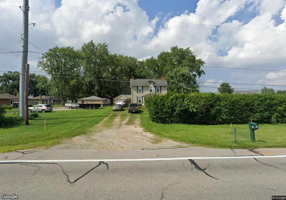
7280 Feder Rd Galloway, OH 43119
Brown NeighborhoodEstimated Value: $317,756 - $402,000
3
Beds
2
Baths
1,747
Sq Ft
$206/Sq Ft
Est. Value
About This Home
This home is located at 7280 Feder Rd, Galloway, OH 43119 and is currently estimated at $359,189, approximately $205 per square foot. 7280 Feder Rd is a home located in Franklin County with nearby schools including Brown Elementary School, Hilliard Station Sixth Grade Elementary School, and Hilliard Memorial Middle School.
Ownership History
Date
Name
Owned For
Owner Type
Purchase Details
Closed on
May 6, 2015
Sold by
Given John D and Given Elaine L
Bought by
Given Seth T
Current Estimated Value
Home Financials for this Owner
Home Financials are based on the most recent Mortgage that was taken out on this home.
Original Mortgage
$140,000
Outstanding Balance
$93,928
Interest Rate
0.78%
Mortgage Type
New Conventional
Estimated Equity
$265,261
Purchase Details
Closed on
May 4, 1987
Bought by
Given John D and Given Elaine L
Create a Home Valuation Report for This Property
The Home Valuation Report is an in-depth analysis detailing your home's value as well as a comparison with similar homes in the area
Home Values in the Area
Average Home Value in this Area
Purchase History
| Date | Buyer | Sale Price | Title Company |
|---|---|---|---|
| Given Seth T | $175,000 | Attorney | |
| Given John D | $50,000 | -- |
Source: Public Records
Mortgage History
| Date | Status | Borrower | Loan Amount |
|---|---|---|---|
| Open | Given Seth T | $140,000 |
Source: Public Records
Tax History
| Year | Tax Paid | Tax Assessment Tax Assessment Total Assessment is a certain percentage of the fair market value that is determined by local assessors to be the total taxable value of land and additions on the property. | Land | Improvement |
|---|---|---|---|---|
| 2025 | $4,449 | $73,150 | $23,100 | $50,050 |
| 2024 | $4,449 | $73,150 | $23,100 | $50,050 |
| 2023 | $3,907 | $73,150 | $23,100 | $50,050 |
| 2022 | $4,548 | $67,660 | $18,590 | $49,070 |
| 2021 | $4,550 | $67,660 | $18,590 | $49,070 |
| 2020 | $4,554 | $67,660 | $18,590 | $49,070 |
| 2019 | $4,638 | $58,940 | $16,170 | $42,770 |
| 2018 | $3,954 | $58,940 | $16,170 | $42,770 |
| 2017 | $4,047 | $58,940 | $16,170 | $42,770 |
| 2016 | $3,469 | $40,850 | $12,810 | $28,040 |
| 2015 | $3,282 | $40,850 | $12,810 | $28,040 |
| 2014 | $3,292 | $40,850 | $12,810 | $28,040 |
| 2013 | $1,510 | $38,920 | $12,215 | $26,705 |
Source: Public Records
Map
Nearby Homes
- 1569 Crosley Ln
- 6352 Ripken St
- 6360 Rickwood Trail
- 1482 Cardinez Way
- 6350 Ripken St
- 1493 Jarry Ave
- 6328 Ripken St
- 6312 Marinelli Dr N
- 6310 Marinelli Dr N
- 1541 Forbes Ave
- 1518 Forbes Ave
- 1496 Raley Way
- 2003 Broccoli Dr
- 1516 Raley Way
- 1854 Pomodoro Dr Unit Lot 140
- 1501 Boes Ct
- 6198 Renner Park Dr
- 112 Alton Darby Creek Rd
- 0 Dellinger Rd Unit 9 2030113
- 1276 Four Star Dr E
Your Personal Tour Guide
Ask me questions while you tour the home.