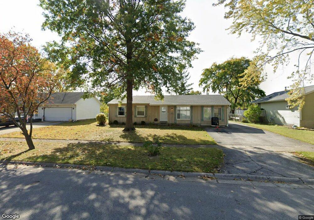
729 Apache Ln Lowell, IN 46356
West Creek NeighborhoodEstimated Value: $237,692 - $264,000
3
Beds
2
Baths
1,248
Sq Ft
$202/Sq Ft
Est. Value
About This Home
This home is located at 729 Apache Ln, Lowell, IN 46356 and is currently estimated at $252,173, approximately $202 per square foot. 729 Apache Ln is a home located in Lake County with nearby schools including Lowell Middle School and Lowell Senior High School.
Ownership History
Date
Name
Owned For
Owner Type
Purchase Details
Closed on
Jun 11, 2018
Sold by
Lohse Debbie L and The Ropbert D Sharkey Land Tru
Bought by
Sharkey Lisa
Current Estimated Value
Purchase Details
Closed on
Jun 20, 2006
Sold by
Sharkey Robert
Bought by
Sharkey Robert D and Robert D Sharkey Land Trust
Purchase Details
Closed on
Jun 30, 2005
Sold by
Deruntz David and Deruntz Denise
Bought by
Sharkey Robert
Home Financials for this Owner
Home Financials are based on the most recent Mortgage that was taken out on this home.
Original Mortgage
$131,900
Interest Rate
5.75%
Mortgage Type
Fannie Mae Freddie Mac
Create a Home Valuation Report for This Property
The Home Valuation Report is an in-depth analysis detailing your home's value as well as a comparison with similar homes in the area
Home Values in the Area
Average Home Value in this Area
Purchase History
| Date | Buyer | Sale Price | Title Company |
|---|---|---|---|
| Sharkey Lisa | -- | None Available | |
| Sharkey Robert D | -- | None Available | |
| Sharkey Robert | -- | Northwest Indiana Title Serv |
Source: Public Records
Mortgage History
| Date | Status | Borrower | Loan Amount |
|---|---|---|---|
| Previous Owner | Sharkey Robert | $131,900 |
Source: Public Records
Tax History
| Year | Tax Paid | Tax Assessment Tax Assessment Total Assessment is a certain percentage of the fair market value that is determined by local assessors to be the total taxable value of land and additions on the property. | Land | Improvement |
|---|---|---|---|---|
| 2025 | $1,849 | $202,900 | $33,500 | $169,400 |
| 2024 | $4,762 | $189,000 | $33,500 | $155,500 |
| 2023 | $1,712 | $181,000 | $33,500 | $147,500 |
| 2022 | $1,712 | $173,300 | $33,500 | $139,800 |
| 2021 | $1,417 | $147,800 | $29,100 | $118,700 |
| 2020 | $1,249 | $138,200 | $29,100 | $109,100 |
| 2019 | $1,306 | $132,000 | $29,100 | $102,900 |
| 2018 | $1,248 | $127,700 | $29,100 | $98,600 |
| 2017 | $1,420 | $133,000 | $29,100 | $103,900 |
| 2016 | $1,299 | $133,700 | $29,100 | $104,600 |
| 2014 | $1,273 | $131,800 | $29,100 | $102,700 |
| 2013 | $1,208 | $123,900 | $29,100 | $94,800 |
Source: Public Records
Map
Nearby Homes
- 715 Cheyenne Dr
- 654 Cheyenne Dr
- 822 Seminole Dr
- 872 Valley View Dr
- 617 Fawn Cir
- 615 Debra Kay Dr
- 631 Debra Kay Dr
- 115 N Nichols St
- 524 Timberwood Ln
- The Sierra IIs Plan at Freedom Springs
- The Reynolds Plan at Freedom Springs
- The Phillips IV Plan at Freedom Springs
- The Ocean Springs Plan at Freedom Springs
- The Glendale Plan at Freedom Springs
- The Phillips II Plan at Freedom Springs
- The Cheyenne Plan at Freedom Springs
- The Parkwood Plan at Freedom Springs
- The Ashford P Plan at Freedom Springs
- The Amhurst III Plan at Freedom Springs
- The Westwood II Plan at Freedom Springs
- 733 Apache Ln
- 725 Apache Ln Unit 10
- 738 Cheyenne Dr Unit 10
- 737 Apache Ln
- 721 Apache Ln
- 742 Cheyenne Dr Unit 10
- 734 Cheyenne Dr
- 726 Apache Ln Unit 10
- 728 Cheyenne Dr Unit 10
- 722 Apache Ln
- 741 Apache Ln
- 717 Apache Ln
- 718 Apache Ln
- 734 Apache Ln
- 752 Cheyenne Dr
- 746 Cheyenne Dr Unit 10
- 722 Cheyenne Dr Unit 10
- 745 Apache Ln
- 714 Apache Ln
- 713 Apache Ln Unit 10
Your Personal Tour Guide
Ask me questions while you tour the home.