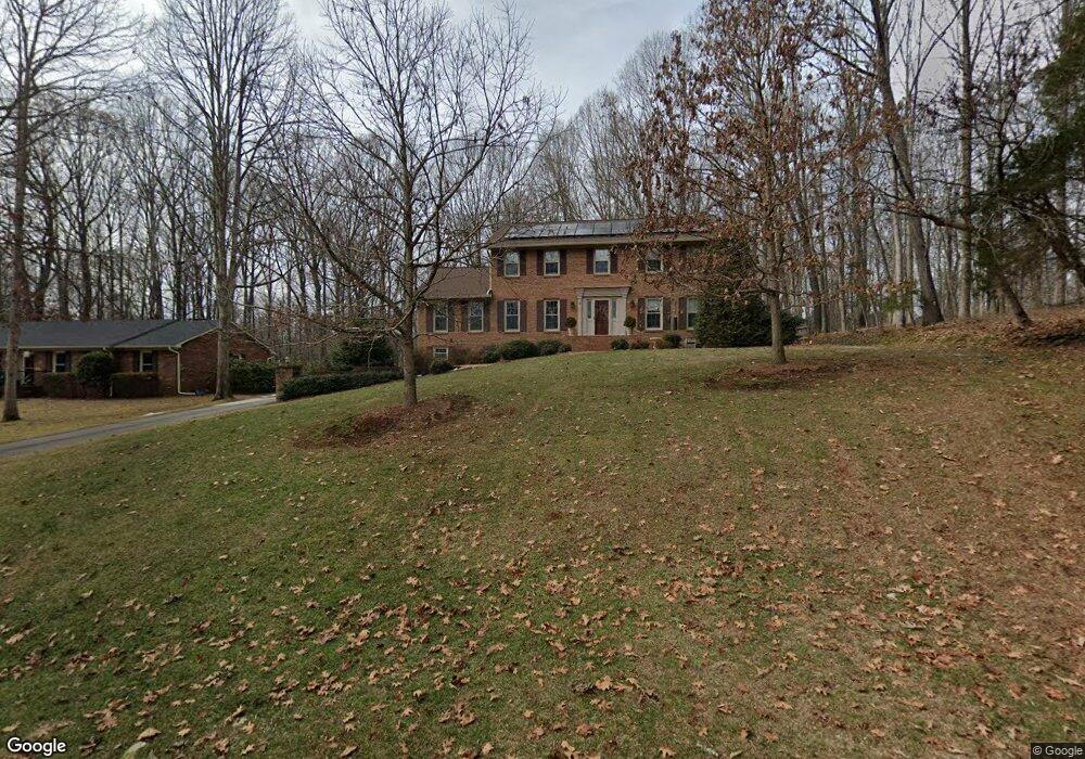
729 La Vale Dr Clemmons, NC 27012
Estimated Value: $515,375 - $559,000
4
Beds
3
Baths
3,072
Sq Ft
$177/Sq Ft
Est. Value
About This Home
This home is located at 729 La Vale Dr, Clemmons, NC 27012 and is currently estimated at $543,844, approximately $177 per square foot. 729 La Vale Dr is a home located in Forsyth County with nearby schools including Clemmons Elementary School, Clemmons Middle School, and West Forsyth High.
Ownership History
Date
Name
Owned For
Owner Type
Purchase Details
Closed on
Feb 5, 2008
Sold by
Howell David C and Howell Joan K
Bought by
Severs Robert and Severs Eileen
Current Estimated Value
Home Financials for this Owner
Home Financials are based on the most recent Mortgage that was taken out on this home.
Original Mortgage
$300,000
Outstanding Balance
$184,275
Interest Rate
5.65%
Mortgage Type
VA
Estimated Equity
$359,569
Create a Home Valuation Report for This Property
The Home Valuation Report is an in-depth analysis detailing your home's value as well as a comparison with similar homes in the area
Home Values in the Area
Average Home Value in this Area
Purchase History
| Date | Buyer | Sale Price | Title Company |
|---|---|---|---|
| Severs Robert | $300,000 | None Available |
Source: Public Records
Mortgage History
| Date | Status | Borrower | Loan Amount |
|---|---|---|---|
| Open | Severs Robert | $300,000 |
Source: Public Records
Tax History
| Year | Tax Paid | Tax Assessment Tax Assessment Total Assessment is a certain percentage of the fair market value that is determined by local assessors to be the total taxable value of land and additions on the property. | Land | Improvement |
|---|---|---|---|---|
| 2025 | $3,112 | $529,600 | $70,000 | $459,600 |
| 2024 | $3,046 | $326,500 | $53,500 | $273,000 |
| 2023 | $3,046 | $326,500 | $53,500 | $273,000 |
| 2022 | $3,046 | $326,500 | $53,500 | $273,000 |
| 2021 | $3,046 | $326,500 | $53,500 | $273,000 |
| 2020 | $2,612 | $275,600 | $47,000 | $228,600 |
| 2019 | $2,639 | $275,600 | $47,000 | $228,600 |
| 2018 | $2,546 | $275,600 | $47,000 | $228,600 |
| 2016 | $2,326 | $250,101 | $43,000 | $207,101 |
Source: Public Records
Map
Nearby Homes
- 125 Asbury Place Ct
- 4845 Hearthstone Rd
- 4016 Clinard Rd
- 3578 Tanglebrook Trail
- 100 McKnights Trace
- 3606 Squirewood Dr
- 3908 Westridge Meadow Cir
- 4320 Woodbourne Dr
- 4255 Briar Creek Rd
- 7328 Riverview Knoll Ct Unit 76
- 3799 Peony Way
- 3805 Littlebrook Dr
- 6732 Rollingwood Dr
- 510 Merrybrook Ct
- 7010 Stancliff Ct
- 6905 Crandall Ct
- 7955 Valley View Dr
- 3973 Valley View Cir
- 3508 Donegal Dr
- 6231 Finch Meadow Ct
- 725 La Vale Dr
- 4343 La Vale Ct
- 721 La Vale Dr
- 4337 La Vale Ct
- 736 La Vale Dr
- 732 La Vale Dr
- 717 La Vale Dr
- 728 La Vale Dr
- 4349 La Vale Ct
- 4331 La Vale Ct
- 724 La Vale Dr
- 724 Lavale Dr
- 713 La Vale Dr
- 4325 La Vale Ct
- 4354 La Vale Ct
- 720 La Vale Dr
- 4319 La Vale Ct
- 709 La Vale Dr
- 4348 La Vale Ct
- 716 La Vale Dr
Your Personal Tour Guide
Ask me questions while you tour the home.