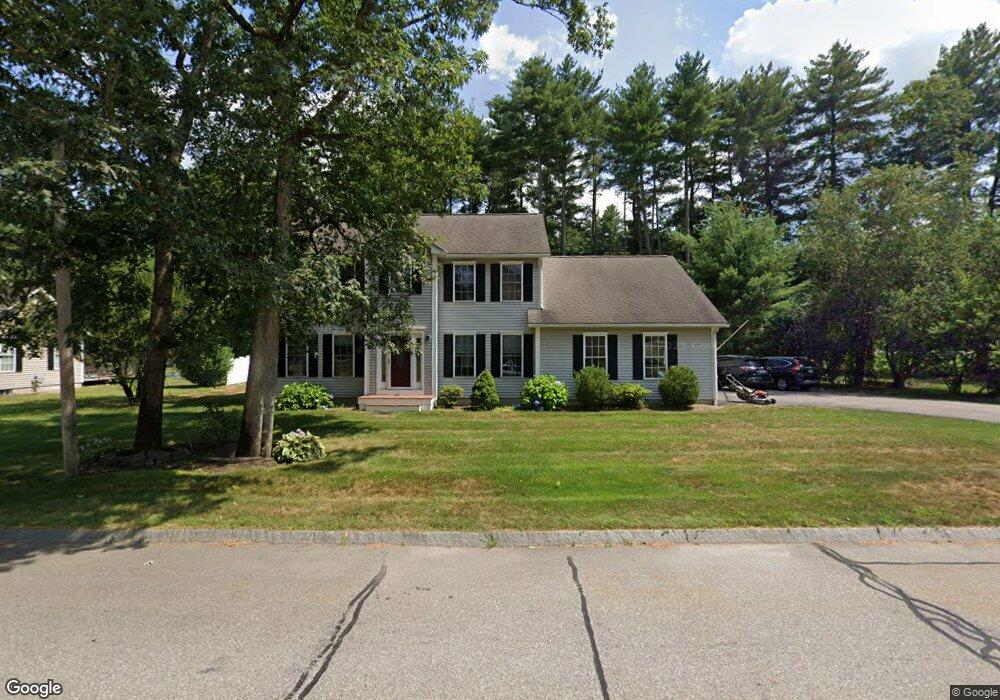
73 Ferry Rd Nashua, NH 03064
Northeast Nashua NeighborhoodEstimated Value: $671,000 - $779,000
4
Beds
3
Baths
2,200
Sq Ft
$325/Sq Ft
Est. Value
About This Home
This home is located at 73 Ferry Rd, Nashua, NH 03064 and is currently estimated at $714,833, approximately $324 per square foot. 73 Ferry Rd is a home located in Hillsborough County with nearby schools including Charlotte Ave Elementary School, Pennichuck Middle School, and Nashua High School North.
Ownership History
Date
Name
Owned For
Owner Type
Purchase Details
Closed on
Dec 30, 2024
Sold by
Morris Heidi A
Bought by
Heidi Morris Ret and Morris
Current Estimated Value
Purchase Details
Closed on
Aug 20, 2004
Sold by
Farrar David A and Farrar Jannine M
Bought by
Morris Heidi A
Purchase Details
Closed on
Nov 21, 2000
Sold by
Etchstone Props Inc
Bought by
Farrar David A and Farrar Jannine M
Create a Home Valuation Report for This Property
The Home Valuation Report is an in-depth analysis detailing your home's value as well as a comparison with similar homes in the area
Home Values in the Area
Average Home Value in this Area
Purchase History
| Date | Buyer | Sale Price | Title Company |
|---|---|---|---|
| Heidi Morris Ret | -- | None Available | |
| Heidi Morris Ret | -- | None Available | |
| Morris Heidi A | $405,000 | -- | |
| Farrar David A | $274,900 | -- | |
| Morris Heidi A | $405,000 | -- | |
| Farrar David A | $274,900 | -- |
Source: Public Records
Mortgage History
| Date | Status | Borrower | Loan Amount |
|---|---|---|---|
| Previous Owner | Farrar David A | $314,000 | |
| Previous Owner | Farrar David A | $316,000 |
Source: Public Records
Tax History Compared to Growth
Tax History
| Year | Tax Paid | Tax Assessment Tax Assessment Total Assessment is a certain percentage of the fair market value that is determined by local assessors to be the total taxable value of land and additions on the property. | Land | Improvement |
|---|---|---|---|---|
| 2024 | $10,647 | $669,600 | $172,800 | $496,800 |
| 2023 | $10,194 | $559,200 | $138,200 | $421,000 |
| 2022 | $10,105 | $559,200 | $138,200 | $421,000 |
| 2021 | $9,455 | $407,200 | $101,300 | $305,900 |
| 2020 | $9,207 | $407,200 | $101,300 | $305,900 |
| 2019 | $8,861 | $407,200 | $101,300 | $305,900 |
| 2018 | $8,637 | $407,200 | $101,300 | $305,900 |
| 2017 | $8,547 | $331,400 | $92,100 | $239,300 |
| 2016 | $8,065 | $321,700 | $92,100 | $229,600 |
| 2015 | $7,891 | $321,700 | $92,100 | $229,600 |
| 2014 | $7,737 | $321,700 | $92,100 | $229,600 |
Source: Public Records
Map
Nearby Homes
- 33 Ferry Rd
- 30 Burgess St
- 17 Danbury Rd
- 9 Elystan Cir
- 12 Juliana Ave Unit 14
- 3 Opal Way Unit 3
- 1 Opal Way Unit 1
- 2 Opal Way Unit 2
- 11 Juliana Ave Unit 52
- 31 Juliana Ave
- 31 Juliana Ave Unit 4
- 31 Ashland St
- 19 Bartlett Ave
- 113 Concord St
- 12 Bell St Unit 100103
- 74 Profile Cir
- 3 Wright Rd
- 123 Cannongate III
- 4 Reservoir St
- 11 Amherst Terrace
- 75 Ferry Rd
- 71 Ferry Rd
- 4 Dunlap Dr
- 77 Ferry Rd
- 76 Ferry Rd
- 66 Ferry Rd
- 47 Drury Ln Unit U15
- 45 Drury Ln Unit U16
- 43 Drury Ln Unit G1
- 43 Drury Ln Unit U17
- 41 Drury Ln Unit U18
- 6 Dunlap Dr
- 79 Ferry Rd
- 39 Drury Ln Unit U19
- 37 Drury Ln Unit U20
- 35 Drury Ln Unit U21
- 28 Drury Ln Unit U14
- 5 Dunlap Dr
- 8 Dunlap Dr
- 33 Drury Ln Unit U22