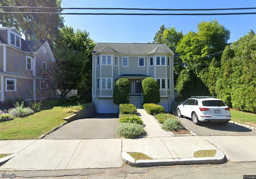
73 Oak Ave Unit 75 West Newton, MA 02465
West Newton NeighborhoodEstimated Value: $1,088,000 - $1,397,000
3
Beds
2
Baths
1,267
Sq Ft
$992/Sq Ft
Est. Value
About This Home
This home is located at 73 Oak Ave Unit 75, West Newton, MA 02465 and is currently estimated at $1,257,312, approximately $992 per square foot. 73 Oak Ave Unit 75 is a home located in Middlesex County with nearby schools including C.C. Burr, F.A. Day Middle School, and Newton North High School.
Ownership History
Date
Name
Owned For
Owner Type
Purchase Details
Closed on
Nov 28, 2023
Sold by
Ellen F Hall Ret and Hall
Bought by
Rosa Juan M and Peralta Ana G
Current Estimated Value
Home Financials for this Owner
Home Financials are based on the most recent Mortgage that was taken out on this home.
Original Mortgage
$968,000
Outstanding Balance
$950,525
Interest Rate
7.57%
Mortgage Type
Purchase Money Mortgage
Estimated Equity
$306,787
Purchase Details
Closed on
Jun 6, 2017
Sold by
Hall Ellen F
Bought by
Ellen F Hall Ret and Hall
Purchase Details
Closed on
Oct 6, 2015
Sold by
Singh Kanwar I and Brar Maneet K
Bought by
Hall Ellen F
Home Financials for this Owner
Home Financials are based on the most recent Mortgage that was taken out on this home.
Original Mortgage
$619,500
Interest Rate
4%
Mortgage Type
Purchase Money Mortgage
Purchase Details
Closed on
Aug 16, 2013
Sold by
Bedford Kristen and Partello Wayne
Bought by
Singh Kanwar I and Brar Maneet K
Home Financials for this Owner
Home Financials are based on the most recent Mortgage that was taken out on this home.
Original Mortgage
$574,500
Interest Rate
4%
Mortgage Type
Adjustable Rate Mortgage/ARM
Purchase Details
Closed on
Nov 1, 2005
Sold by
Grenville Andrew and Grenville Jennifer
Bought by
Bedford Kristen
Purchase Details
Closed on
Sep 5, 1997
Sold by
Lechiaro Rose M Est and Lechiaro
Bought by
Creative Dev Assocs Lp
Home Financials for this Owner
Home Financials are based on the most recent Mortgage that was taken out on this home.
Original Mortgage
$360,000
Interest Rate
7.36%
Mortgage Type
Purchase Money Mortgage
Create a Home Valuation Report for This Property
The Home Valuation Report is an in-depth analysis detailing your home's value as well as a comparison with similar homes in the area
Home Values in the Area
Average Home Value in this Area
Purchase History
| Date | Buyer | Sale Price | Title Company |
|---|---|---|---|
| Rosa Juan M | $1,210,000 | None Available | |
| Ellen F Hall Ret | -- | -- | |
| Hall Ellen F | $885,000 | -- | |
| Singh Kanwar I | $766,000 | -- | |
| Bedford Kristen | $642,000 | -- | |
| Bedford Kristen | $642,000 | -- | |
| Creative Dev Assocs Lp | $215,000 | -- | |
| Creative Dev Assocs Lp | $215,000 | -- |
Source: Public Records
Mortgage History
| Date | Status | Borrower | Loan Amount |
|---|---|---|---|
| Open | Rosa Juan M | $968,000 | |
| Previous Owner | Hall Ellen F | $619,500 | |
| Previous Owner | Creative Dev Assocs Lp | $574,500 | |
| Previous Owner | Creative Dev Assocs Lp | $360,000 |
Source: Public Records
Tax History Compared to Growth
Tax History
| Year | Tax Paid | Tax Assessment Tax Assessment Total Assessment is a certain percentage of the fair market value that is determined by local assessors to be the total taxable value of land and additions on the property. | Land | Improvement |
|---|---|---|---|---|
| 2025 | $10,606 | $1,082,200 | $0 | $1,082,200 |
| 2024 | $10,255 | $1,050,700 | $0 | $1,050,700 |
| 2023 | $10,220 | $1,003,900 | $0 | $1,003,900 |
| 2022 | $10,058 | $956,100 | $0 | $956,100 |
| 2021 | $9,706 | $902,000 | $0 | $902,000 |
| 2020 | $9,417 | $902,000 | $0 | $902,000 |
| 2019 | $9,151 | $875,700 | $0 | $875,700 |
| 2018 | $9,143 | $845,000 | $0 | $845,000 |
| 2017 | $8,865 | $797,200 | $0 | $797,200 |
| 2016 | $8,478 | $745,000 | $0 | $745,000 |
| 2015 | $8,237 | $709,500 | $0 | $709,500 |
Source: Public Records
Map
Nearby Homes
- 371 Cherry St
- 2 Elm St Unit 6
- 2 Elm St Unit 8
- 106 River St Unit 18
- 106 River St Unit 2
- 106 River St Unit 14
- 14 Cottage Place Unit 14
- 10 Crescent St Unit 1
- 10 Crescent St Unit 2
- 90 Auburndale Ave
- 17 Crescent St
- 0 Duncan Rd Unit 72925240
- 287 Cherry St Unit 2
- 44 Westland Ave
- 41 Kilburn Rd
- 51 Bourne St
- 56 Dearborn St
- 17 Gilbert St
- 13 Weir St
- 62-64 Rowe St Unit B
- 73 Oak Ave Unit 1
- 73 Oak Ave Unit 75
- 73 Oak Ave
- 73 Oak Ave Unit 73
- 73 Oak Ave Unit 2
- 73 Oak Ave
- 75 Oak Ave Unit 2
- 79 Oak Ave
- 69 Oak Ave
- 67 Oak Ave
- 22 Webster Place
- 22 Webster Place Unit 2
- 20 Webster Place Unit 1
- 20 Webster Place Unit 22
- 83 Oak Ave Unit 1
- 83 Oak Ave
- 65 Oak Ave
- 65 Oak Ave Unit 65
- 16 Webster Place
- 61 Oak Ave