Estimated Value: $438,000 - $662,000
3
Beds
2
Baths
2,332
Sq Ft
$227/Sq Ft
Est. Value
About This Home
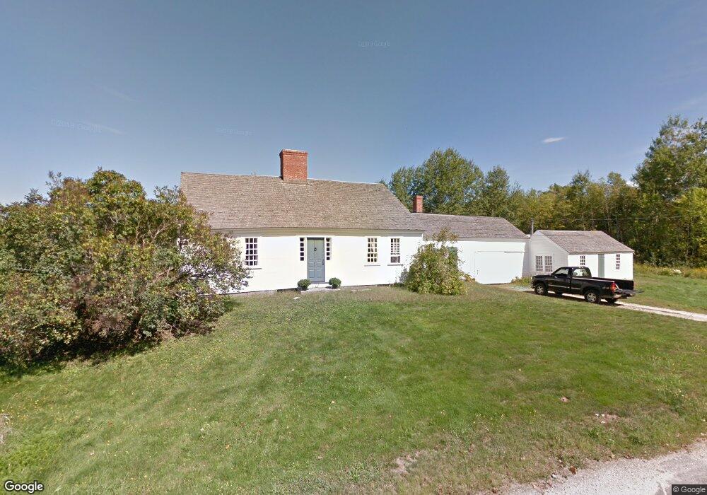
This home is located at 73 Wing Rd, Epsom, NH 03234 and is currently estimated at $528,796, approximately $226 per square foot. 73 Wing Rd is a home located in Merrimack County with nearby schools including Epsom Central School, Epsom Better Buddies, and Cornerstone Christian Academy.
Create a Home Valuation Report for This Property
The Home Valuation Report is an in-depth analysis detailing your home's value as well as a comparison with similar homes in the area
Home Values in the Area
Average Home Value in this Area
Tax History
| Year | Tax Paid | Tax Assessment Tax Assessment Total Assessment is a certain percentage of the fair market value that is determined by local assessors to be the total taxable value of land and additions on the property. | Land | Improvement |
|---|---|---|---|---|
| 2025 | $8,509 | $485,143 | $170,843 | $314,300 |
| 2024 | $7,004 | $262,931 | $92,931 | $170,000 |
| 2023 | $6,476 | $262,931 | $92,931 | $170,000 |
| 2022 | $6,297 | $264,115 | $94,115 | $170,000 |
| 2021 | $6,244 | $264,115 | $94,115 | $170,000 |
| 2020 | $5,769 | $264,263 | $94,263 | $170,000 |
| 2019 | $6,224 | $229,769 | $84,269 | $145,500 |
Source: Public Records
Map
Nearby Homes
- 357 New Rye Rd
- 7 Pinecrest Cir
- 9 Princess Ln
- 6 Lincoln St
- 2 Archer Cir
- 8 Bush Ave
- 0 Poor Town Rd Unit 4
- 1 Jefferson Ave
- 5 Catamount Hill Dr
- 88 Old Town Road Extension
- 0 Dover Unit 33 & 35
- 5 Old Turnpike Rd
- 431 Dawn Ct Unit 17
- 426 Dawn Ct Unit 22
- 427 Grady Ln Unit 29
- 821 Cross Country Rd
- 441 Blane Cir Unit 12
- 474 Blane Cir Unit 40
- 157 Old Turnpike Rd
- 260 Church Rd
Your Personal Tour Guide
Ask me questions while you tour the home.