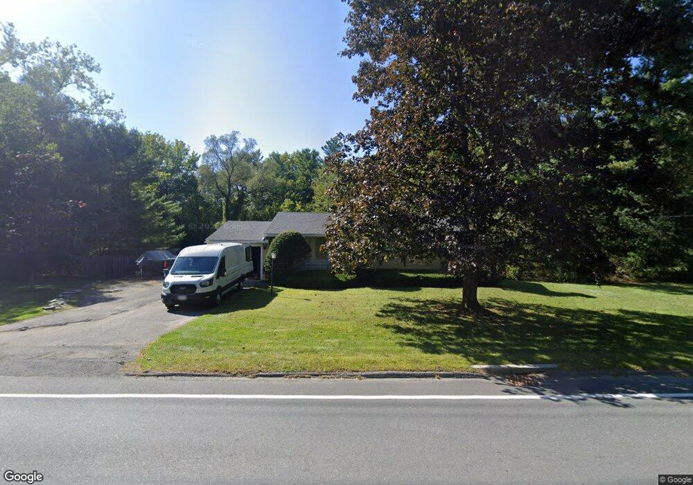
730 Dalton Division Rd Pittsfield, MA 01201
Estimated Value: $279,000 - $350,000
3
Beds
1
Bath
1,075
Sq Ft
$289/Sq Ft
Est. Value
About This Home
This home is located at 730 Dalton Division Rd, Pittsfield, MA 01201 and is currently estimated at $311,027, approximately $289 per square foot. 730 Dalton Division Rd is a home located in Berkshire County with nearby schools including Williams Elementary School, Theodore Herberg Middle School, and Sinai Academy of the Berkshires.
Ownership History
Date
Name
Owned For
Owner Type
Purchase Details
Closed on
Jan 6, 2012
Sold by
Storie Michael P and Storie Lynne M
Bought by
Storie Lynne M and Storie Lynne M
Current Estimated Value
Purchase Details
Closed on
Oct 5, 1992
Sold by
Ploss Richard F and Ploss Jacqueline A
Bought by
Storie Michael P and Storie Lynne M
Home Financials for this Owner
Home Financials are based on the most recent Mortgage that was taken out on this home.
Original Mortgage
$72,000
Interest Rate
7.83%
Mortgage Type
Purchase Money Mortgage
Create a Home Valuation Report for This Property
The Home Valuation Report is an in-depth analysis detailing your home's value as well as a comparison with similar homes in the area
Home Values in the Area
Average Home Value in this Area
Purchase History
| Date | Buyer | Sale Price | Title Company |
|---|---|---|---|
| Storie Lynne M | -- | -- | |
| Storie Michael P | -- | -- | |
| Storie Lynne M | -- | -- | |
| Storie Michael P | -- | -- | |
| Storie Michael P | $90,000 | -- | |
| Storie Michael P | $90,000 | -- |
Source: Public Records
Mortgage History
| Date | Status | Borrower | Loan Amount |
|---|---|---|---|
| Previous Owner | Storie Michael P | $108,000 | |
| Previous Owner | Storie Michael P | $72,000 |
Source: Public Records
Tax History Compared to Growth
Tax History
| Year | Tax Paid | Tax Assessment Tax Assessment Total Assessment is a certain percentage of the fair market value that is determined by local assessors to be the total taxable value of land and additions on the property. | Land | Improvement |
|---|---|---|---|---|
| 2025 | $4,636 | $258,400 | $71,200 | $187,200 |
| 2024 | $4,434 | $240,300 | $71,200 | $169,100 |
| 2023 | $4,188 | $228,600 | $71,200 | $157,400 |
| 2022 | $3,846 | $207,200 | $71,200 | $136,000 |
| 2021 | $3,675 | $190,900 | $71,200 | $119,700 |
| 2020 | $3,721 | $188,800 | $71,200 | $117,600 |
| 2019 | $3,678 | $189,400 | $76,200 | $113,200 |
| 2018 | $3,642 | $182,000 | $71,200 | $110,800 |
| 2017 | $3,335 | $169,900 | $62,700 | $107,200 |
| 2016 | $3,232 | $172,300 | $62,700 | $109,600 |
| 2015 | $3,112 | $172,300 | $62,700 | $109,600 |
Source: Public Records
Map
Nearby Homes
- 26 Leona Dr
- 104 Washington Mountain Rd
- 932 Williams St
- 171 Pine Grove Dr
- 171 Harryel St
- 0 Dalton Division Rd
- 240 Kirchner Rd
- 4 Filomena Dr
- 59 Joan Dr
- 100 Elaine Dr
- 189 Doreen St
- 28 Jayne Ave
- 787 Williams St
- 68 Brookside Dr
- 304 Dalton Division Rd
- 490 Kirchner Rd
- 565 Williams St
- 80 Mcintosh Dr
- 13 Pleasantview Dr
- 1106 South St
- 720 Dalton Division Rd
- 760 Dalton Division Rd
- 718 Dalton Division Rd
- 622 Dalton Division Rd
- 716 Dalton Division Rd
- 1085 Williams St
- 1087 Williams St
- 1083 Williams St
- 757 Dalton Division Rd
- 813 Dalton Division Rd
- 757 Dalton Divisio
- 813 Dalton Division Rd
- 708 Dalton Division Rd
- 777 Dalton Division Rd
- 704 Dalton Division Rd
- 2 Washington Ave
- 700 Dalton Division Rd
- 1053 Williams St
- 2 Washington Mountain Rd
- 1 Mountain Dr