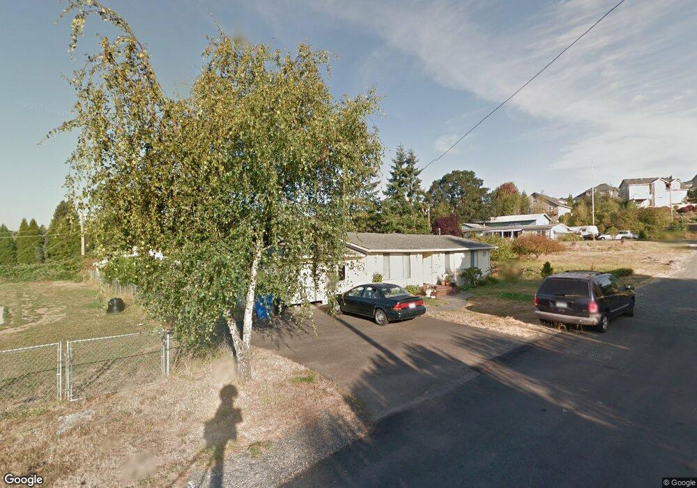
730 E Elm Ave La Center, WA 98629
Estimated Value: $486,990 - $559,000
4
Beds
2
Baths
1,948
Sq Ft
$266/Sq Ft
Est. Value
About This Home
This home is located at 730 E Elm Ave, La Center, WA 98629 and is currently estimated at $517,998, approximately $265 per square foot. 730 E Elm Ave is a home located in Clark County with nearby schools including La Center Elementary School, La Center Middle School, and La Center High School.
Ownership History
Date
Name
Owned For
Owner Type
Purchase Details
Closed on
Nov 19, 2001
Sold by
Countrywide Home Loans Inc
Bought by
Ward Clifford R and Ward Janice R
Current Estimated Value
Home Financials for this Owner
Home Financials are based on the most recent Mortgage that was taken out on this home.
Original Mortgage
$116,300
Outstanding Balance
$41,361
Interest Rate
5.5%
Estimated Equity
$476,637
Purchase Details
Closed on
Mar 28, 2001
Sold by
Karabaic Lane M
Bought by
Countrywide Home Loans Inc
Purchase Details
Closed on
Mar 2, 2000
Sold by
Dunn Craig A and Dunn Kristy J
Bought by
Karabaic Lane M
Home Financials for this Owner
Home Financials are based on the most recent Mortgage that was taken out on this home.
Original Mortgage
$156,750
Interest Rate
8.26%
Create a Home Valuation Report for This Property
The Home Valuation Report is an in-depth analysis detailing your home's value as well as a comparison with similar homes in the area
Home Values in the Area
Average Home Value in this Area
Purchase History
| Date | Buyer | Sale Price | Title Company |
|---|---|---|---|
| Ward Clifford R | $119,900 | First American Title Ins Co | |
| Countrywide Home Loans Inc | $135,656 | Chicago Title Insurance | |
| Karabaic Lane M | $165,000 | Chicago Title Insurance Co |
Source: Public Records
Mortgage History
| Date | Status | Borrower | Loan Amount |
|---|---|---|---|
| Open | Ward Clifford R | $116,300 | |
| Previous Owner | Karabaic Lane M | $156,750 |
Source: Public Records
Tax History Compared to Growth
Tax History
| Year | Tax Paid | Tax Assessment Tax Assessment Total Assessment is a certain percentage of the fair market value that is determined by local assessors to be the total taxable value of land and additions on the property. | Land | Improvement |
|---|---|---|---|---|
| 2025 | $3,950 | $447,518 | $157,075 | $290,443 |
| 2024 | $3,790 | $427,885 | $157,075 | $270,810 |
| 2023 | $400 | $428,960 | $152,500 | $276,460 |
| 2022 | $411 | $402,105 | $131,399 | $270,706 |
| 2021 | $437 | $341,141 | $105,119 | $236,022 |
| 2020 | $439 | $309,914 | $97,611 | $212,303 |
| 2019 | $710 | $292,111 | $87,849 | $204,262 |
| 2018 | $754 | $122,916 | $0 | $0 |
| 2017 | $776 | $122,916 | $0 | $0 |
| 2016 | $1,330 | $122,916 | $0 | $0 |
| 2015 | $1,330 | $122,916 | $0 | $0 |
| 2014 | -- | $189,102 | $0 | $0 |
| 2013 | -- | $165,356 | $0 | $0 |
Source: Public Records
Map
Nearby Homes
- 325 E 7th St
- 642 E Pioneer Loop
- 135 E Airedale Ave
- 2401 SE Foxtrot St
- 2405 E Foxtrot St
- 545 E Stonecreek Dr
- 771 E Heritage Loop
- 124 W 12th Way
- 790 E 15th Cir
- 1267 E Spencer Ct
- 126 W 15th St
- 564 E 15th Cir
- 1224 E Pioneer Loop
- 1506 E Heritage Loop
- 1350 E 14th Cir
- 1503 W Alder Place
- 1509 W Alder Place
- 1025 NW Pacific Hwy
- 503 E 18th St
- Silverton Plan at Stephens Hillside Farm