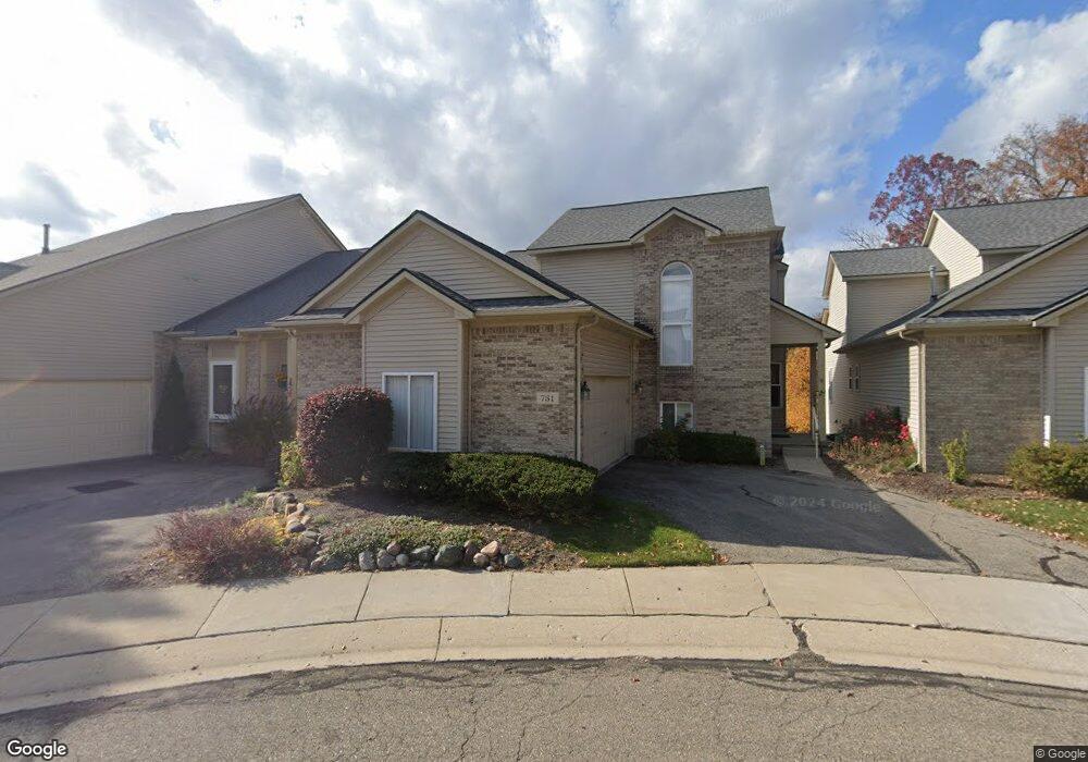
731 Mill Pointe Dr Unit 17 Milford, MI 48381
Estimated Value: $462,108 - $601,000
3
Beds
4
Baths
1,815
Sq Ft
$287/Sq Ft
Est. Value
About This Home
This home is located at 731 Mill Pointe Dr Unit 17, Milford, MI 48381 and is currently estimated at $521,277, approximately $287 per square foot. 731 Mill Pointe Dr Unit 17 is a home located in Oakland County with nearby schools including Muir Middle School, Kurtz Elementary School, and Christ Lutheran Christian Day School.
Ownership History
Date
Name
Owned For
Owner Type
Purchase Details
Closed on
Jul 19, 2011
Sold by
Mikula James R and Hattori Ruth Ann
Bought by
Bruzek Dorothea J
Current Estimated Value
Purchase Details
Closed on
Jul 23, 2010
Sold by
Renn Timothy S and Mellish Delphine M
Bought by
Mikula James R and Hatton Ruth Ann
Home Financials for this Owner
Home Financials are based on the most recent Mortgage that was taken out on this home.
Original Mortgage
$130,000
Interest Rate
4.25%
Mortgage Type
New Conventional
Purchase Details
Closed on
Jan 14, 2008
Sold by
Renn Stephen J
Bought by
Renn Stephen J and Stephen J Renn Living Trust
Purchase Details
Closed on
Jun 4, 2002
Sold by
Renn Elaine D
Bought by
Renn Stephen J
Create a Home Valuation Report for This Property
The Home Valuation Report is an in-depth analysis detailing your home's value as well as a comparison with similar homes in the area
Home Values in the Area
Average Home Value in this Area
Purchase History
| Date | Buyer | Sale Price | Title Company |
|---|---|---|---|
| Bruzek Dorothea J | $220,000 | Hometown One Title Agency L | |
| Mikula James R | $222,500 | None Available | |
| Renn Stephen J | -- | None Available | |
| Renn Stephen J | -- | -- |
Source: Public Records
Mortgage History
| Date | Status | Borrower | Loan Amount |
|---|---|---|---|
| Previous Owner | Mikula James R | $130,000 |
Source: Public Records
Tax History Compared to Growth
Tax History
| Year | Tax Paid | Tax Assessment Tax Assessment Total Assessment is a certain percentage of the fair market value that is determined by local assessors to be the total taxable value of land and additions on the property. | Land | Improvement |
|---|---|---|---|---|
| 2024 | $3,418 | $226,800 | $0 | $0 |
| 2023 | $3,272 | $222,280 | $0 | $0 |
| 2022 | $4,327 | $205,900 | $0 | $0 |
| 2021 | $2,426 | $194,200 | $0 | $0 |
| 2020 | $3,025 | $188,160 | $0 | $0 |
| 2019 | $3,059 | $170,530 | $0 | $0 |
| 2018 | $3,019 | $164,990 | $0 | $0 |
| 2017 | $1,610 | $164,990 | $0 | $0 |
| 2016 | $3,762 | $153,610 | $0 | $0 |
| 2015 | -- | $131,880 | $0 | $0 |
| 2014 | -- | $112,080 | $0 | $0 |
| 2011 | -- | $80,340 | $0 | $0 |
Source: Public Records
Map
Nearby Homes
- 303 Cabinet St
- 165 Cottage Ln
- 778 Knolls Landing Dr
- 609 Telya Ridge Unit 21
- 764 S Milford Rd Unit 35
- 710 Bellevue
- 312 Dorchester Way
- 192 Turnberry Ct Unit 13
- Unit 306 Plan at 120 E. Liberty
- Unit 305 Plan at 120 E. Liberty
- Unit 304 Plan at 120 E. Liberty
- Unit 303 Plan at 120 E. Liberty
- Unit 302 Plan at 120 E. Liberty
- Unit 301 Plan at 120 E. Liberty
- Unit 206 Plan at 120 E. Liberty
- Unit 205 Plan at 120 E. Liberty
- Unit 204 Plan at 120 E. Liberty
- Unit 203 Plan at 120 E. Liberty
- Unit 201 Plan at 120 E. Liberty
- 120 E Liberty St Unit 203
- 735 Mill Pointe Dr Unit 18
- 727 Mill Pointe Dr Unit 16
- 715 Pointe Ct Unit 15
- 711 Pointe Ct
- 711 Pointe Ct Unit 14
- 732 Mill Pointe Dr
- 728 Mill Pointe Dr Unit 21
- 707 Pointe Ct
- 736 Mill Pointe Dr
- 736 Mill Pointe Dr Unit 19
- 683 Pointe Ct Unit 9
- 687 Pointe Ct Unit 10
- 695 Pointe Ct
- 691 Pointe Ct
- 648 Mill Pointe Dr
- 659 Mill Pointe Dr
- 659 Mill Pointe Dr Unit 5
- 640 Mill Pointe Dr
- 671 Mill Pointe Dr
- 667 Mill Pointe Dr