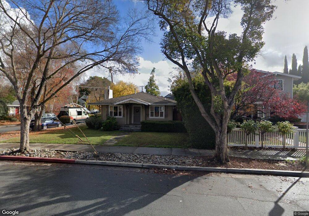
732 Lytton Ave Palo Alto, CA 94301
Crescent Park NeighborhoodEstimated Value: $2,728,000 - $3,022,000
3
Beds
2
Baths
989
Sq Ft
$2,896/Sq Ft
Est. Value
About This Home
This home is located at 732 Lytton Ave, Palo Alto, CA 94301 and is currently estimated at $2,864,484, approximately $2,896 per square foot. 732 Lytton Ave is a home located in Santa Clara County with nearby schools including Addison Elementary School, Frank S. Greene Jr. Middle, and Palo Alto High School.
Ownership History
Date
Name
Owned For
Owner Type
Purchase Details
Closed on
Jan 7, 2002
Sold by
Royse Roger and Royse Daphne
Bought by
Jaw Ching W and Lee Connie S
Current Estimated Value
Home Financials for this Owner
Home Financials are based on the most recent Mortgage that was taken out on this home.
Original Mortgage
$650,000
Outstanding Balance
$248,179
Interest Rate
6.12%
Estimated Equity
$2,616,305
Purchase Details
Closed on
Nov 2, 2000
Sold by
Shepard Grace A Trustee and Sherrill Valerie P Trustee
Bought by
Royse Roger and Royse Daphne
Home Financials for this Owner
Home Financials are based on the most recent Mortgage that was taken out on this home.
Original Mortgage
$576,000
Interest Rate
8.53%
Purchase Details
Closed on
Nov 5, 1993
Sold by
Shepard Grace Aurelia and Shepard Grace A
Bought by
Shepard Grace Aurelia and Sherrill Valerie Powell
Create a Home Valuation Report for This Property
The Home Valuation Report is an in-depth analysis detailing your home's value as well as a comparison with similar homes in the area
Home Values in the Area
Average Home Value in this Area
Purchase History
| Date | Buyer | Sale Price | Title Company |
|---|---|---|---|
| Jaw Ching W | $950,000 | First American Title Co | |
| Royse Roger | $720,000 | First American Title Co | |
| Shepard Grace Aurelia | -- | -- |
Source: Public Records
Mortgage History
| Date | Status | Borrower | Loan Amount |
|---|---|---|---|
| Open | Jaw Ching W | $650,000 | |
| Previous Owner | Royse Roger | $576,000 | |
| Closed | Jaw Ching W | $50,000 |
Source: Public Records
Tax History Compared to Growth
Tax History
| Year | Tax Paid | Tax Assessment Tax Assessment Total Assessment is a certain percentage of the fair market value that is determined by local assessors to be the total taxable value of land and additions on the property. | Land | Improvement |
|---|---|---|---|---|
| 2025 | $12,842 | $1,034,094 | $738,643 | $295,451 |
| 2024 | $12,842 | $1,013,818 | $724,160 | $289,658 |
| 2023 | $12,649 | $993,940 | $709,961 | $283,979 |
| 2022 | $12,495 | $974,452 | $696,041 | $278,411 |
| 2021 | $12,247 | $955,346 | $682,394 | $272,952 |
| 2020 | $12,004 | $945,551 | $675,397 | $270,154 |
| 2019 | $11,867 | $927,011 | $662,154 | $264,857 |
| 2018 | $11,553 | $908,835 | $649,171 | $259,664 |
| 2017 | $11,348 | $891,016 | $636,443 | $254,573 |
| 2016 | $11,046 | $873,546 | $623,964 | $249,582 |
| 2015 | $10,932 | $860,426 | $614,592 | $245,834 |
| 2014 | $10,650 | $843,572 | $602,553 | $241,019 |
Source: Public Records
Map
Nearby Homes
- 251 Middlefield Rd
- 555 Byron St Unit 104
- 678 Hawthorne Ave
- 660 Palo Alto Ave
- 707 Webster St
- 755 Homer Ave
- 1101 Hamilton Ave
- 759 Cowper St
- 637 Channing Ave
- 167 Mckendry Dr
- 447 Homer Ave
- 115 Waverley St
- 160 Waverley St
- 1049 Woodland Ave
- 162 Waverley St
- 756 Waverley St
- 1908 Menalto Ave
- 212 Gilbert Ave
- 315 Homer Ave Unit 105
- 560 Addison Ave
- 724 Lytton Ave
- 416 Fulton St
- 422 Fulton St
- 401 Fulton St
- 360 Fulton St
- 409 Fulton St
- 405 Middlefield Rd
- 428 Fulton St
- 415 Middlefield Rd
- 417 Fulton St
- 720 Lytton Ave
- 434 Fulton St
- 352 Fulton St Unit 9
- 425 Middlefield Rd
- 357 Fulton St
- 425 Fulton St
- 760 Lytton Ave
- 355 Fulton St
- 443 Fulton St
- 435 Middlefield Rd