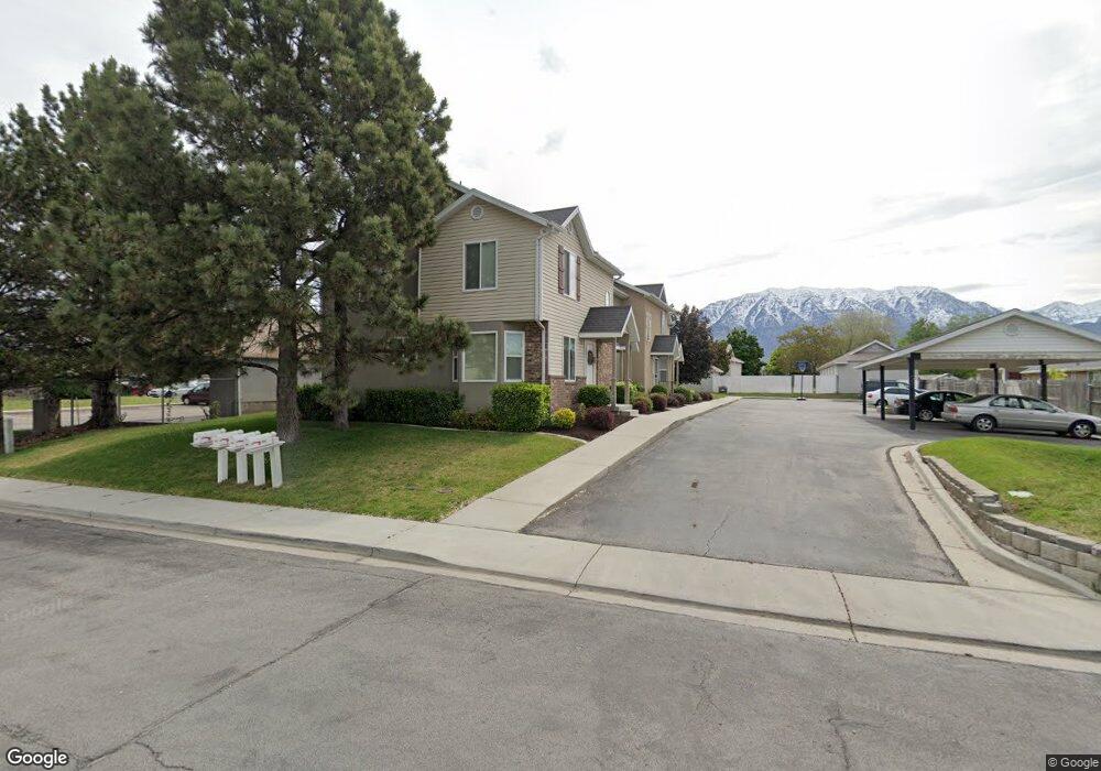
732 N 1060 W Unit 1 Orem, UT 84057
Geneva NeighborhoodEstimated Value: $330,000 - $337,000
3
Beds
2
Baths
1,360
Sq Ft
$245/Sq Ft
Est. Value
About This Home
This home is located at 732 N 1060 W Unit 1, Orem, UT 84057 and is currently estimated at $333,554, approximately $245 per square foot. 732 N 1060 W Unit 1 is a home located in Utah County with nearby schools including Orem Junior High School, Timpanogos High School, and Franklin Discovery Academy.
Ownership History
Date
Name
Owned For
Owner Type
Purchase Details
Closed on
Dec 1, 2021
Sold by
Cameron Kelson
Bought by
Webb Andrew and Hickman Brian
Current Estimated Value
Home Financials for this Owner
Home Financials are based on the most recent Mortgage that was taken out on this home.
Original Mortgage
$311,125
Outstanding Balance
$286,077
Interest Rate
3.09%
Mortgage Type
Balloon
Estimated Equity
$47,477
Purchase Details
Closed on
Jul 3, 2019
Sold by
Crosland Nathan and Crosland Mackenzie
Bought by
Kelson Cameron
Home Financials for this Owner
Home Financials are based on the most recent Mortgage that was taken out on this home.
Original Mortgage
$225,525
Interest Rate
3.82%
Mortgage Type
New Conventional
Purchase Details
Closed on
Aug 13, 2018
Sold by
Doane Dallas M and Doane Deezbaa M
Bought by
Crosland Nathan and Crosland Mackenzie
Home Financials for this Owner
Home Financials are based on the most recent Mortgage that was taken out on this home.
Original Mortgage
$216,795
Interest Rate
4.5%
Mortgage Type
New Conventional
Purchase Details
Closed on
Dec 27, 2017
Sold by
Seal Kent M
Bought by
Doane Dallas M and Doane Deezbaa M
Home Financials for this Owner
Home Financials are based on the most recent Mortgage that was taken out on this home.
Original Mortgage
$195,700
Interest Rate
3.95%
Mortgage Type
New Conventional
Purchase Details
Closed on
Sep 30, 2016
Sold by
Schroeder Samuel Quint and Schroeder Quint D
Bought by
Seal Kent M
Purchase Details
Closed on
Jan 5, 2012
Sold by
Schroeder Samuel Quint
Bought by
Schroeder Samuel Quint and Schroeder Quint D
Purchase Details
Closed on
Nov 17, 2011
Sold by
The Secretary Of Housing & Urban Develop
Bought by
Schroeder Samuel Quint
Purchase Details
Closed on
Aug 31, 2011
Sold by
Midfirst Bank
Bought by
Secretary Of Housing & Urban Development
Purchase Details
Closed on
Aug 15, 2011
Sold by
Saracino Robynn G
Bought by
Midfirst Bank
Purchase Details
Closed on
Feb 28, 2005
Sold by
Carter Construction Co
Bought by
Saracino Robynn G
Home Financials for this Owner
Home Financials are based on the most recent Mortgage that was taken out on this home.
Original Mortgage
$132,036
Interest Rate
5.73%
Mortgage Type
FHA
Create a Home Valuation Report for This Property
The Home Valuation Report is an in-depth analysis detailing your home's value as well as a comparison with similar homes in the area
Home Values in the Area
Average Home Value in this Area
Purchase History
We collect this data history from publicly available records. To have your information removed, we recommend requesting removal directly through your county’s website.
| Date | Buyer | Sale Price | Title Company |
|---|---|---|---|
| Webb Andrew | -- | Silver Leaf Title | |
| Kelson Cameron | -- | Investors Title Ins Agcy Inc | |
| Crosland Nathan | -- | Us Title Insurance Agency | |
| Doane Dallas M | -- | Stewart Title Ins Agency | |
| Seal Kent M | -- | First American | |
| Schroeder Samuel Quint | -- | First American Union Height | |
| Schroeder Samuel Quint | -- | Monument Title Insurance Inc | |
| Secretary Of Housing & Urban Development | -- | Backman Fptp | |
| Midfirst Bank | $140,356 | Etitle Insurance Agency | |
| Saracino Robynn G | -- | Bartlett Title Insurance Ag |
Source: Public Records
Mortgage History
We collect this data history from publicly available records. To have your information removed, we recommend requesting removal directly through your county’s website.
| Date | Status | Borrower | Loan Amount |
|---|---|---|---|
| Open | Webb Andrew | $311,125 | |
| Previous Owner | Kelson Cameron | $225,525 | |
| Previous Owner | Crosland Nathan | $216,795 | |
| Previous Owner | Doane Dallas M | $195,700 | |
| Previous Owner | Saracino Robynn G | $132,036 |
Source: Public Records
Tax History
| Year | Tax Paid | Tax Assessment Tax Assessment Total Assessment is a certain percentage of the fair market value that is determined by local assessors to be the total taxable value of land and additions on the property. | Land | Improvement |
|---|---|---|---|---|
| 2025 | $1,246 | $165,110 | -- | -- |
| 2024 | $1,246 | $152,350 | $0 | $0 |
| 2023 | $1,228 | $161,425 | $0 | $0 |
| 2022 | $1,383 | $176,055 | $0 | $0 |
| 2021 | $1,302 | $251,100 | $30,100 | $221,000 |
| 2020 | $1,183 | $224,200 | $26,900 | $197,300 |
| 2019 | $1,094 | $215,600 | $28,000 | $187,600 |
| 2018 | $996 | $187,500 | $22,500 | $165,000 |
| 2017 | $851 | $85,800 | $0 | $0 |
| 2016 | $838 | $77,990 | $0 | $0 |
| 2015 | $852 | $74,965 | $0 | $0 |
| 2014 | $856 | $74,965 | $0 | $0 |
Source: Public Records
Map
Nearby Homes
- 954 W 630 N Unit 34,
- 1058 W 570 St N
- 586 N 940 W
- 1075 W 530 N
- 1140 W 950 N Unit D302
- 1140 W 950 N Unit D301
- 1140 W 950 N Unit B102
- 1140 W 950 N Unit C303
- 1140 W 950 N Unit C101
- 1140 W 950 N Unit D304
- 1004 N 1090 W Unit 203
- 1094 W 465 N
- 1015 N 995 W
- 1018 N 985 W Unit 501
- 1030 N 995 W Unit 914
- 1123 W 465 N
- 983 W 1055 N Unit 812
- 776 W 640 N
- 418 N 1080 W
- 1105 W 420 N
Your Personal Tour Guide
Ask me questions while you tour the home.