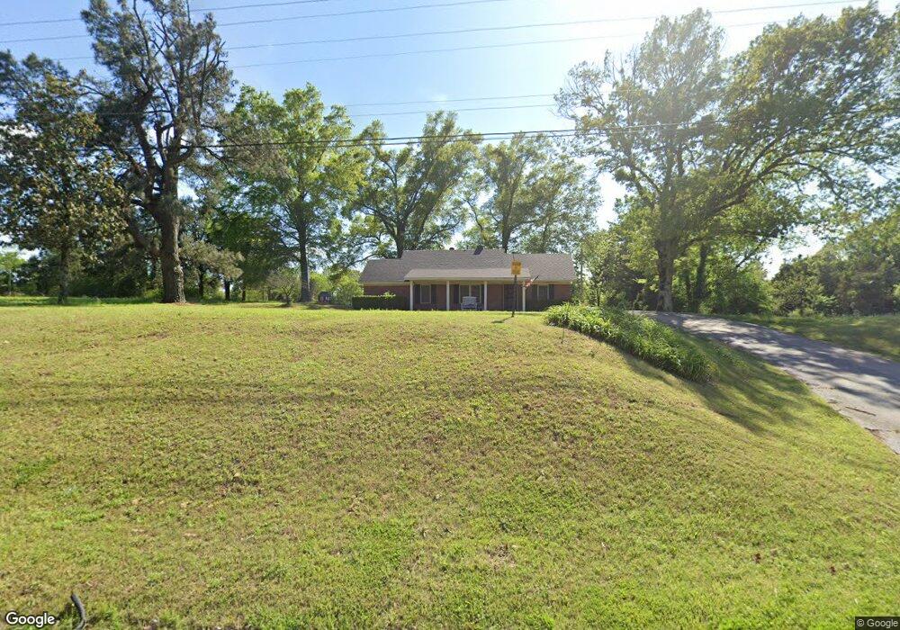
7327 Highway 178 Olive Branch, MS 38654
Estimated Value: $211,061 - $276,000
2
Beds
--
Bath
1,356
Sq Ft
$188/Sq Ft
Est. Value
About This Home
This home is located at 7327 Highway 178, Olive Branch, MS 38654 and is currently estimated at $254,515, approximately $187 per square foot. 7327 Highway 178 is a home located in DeSoto County with nearby schools including Olive Branch Elementary School, Chickasaw Elementary School, and Olive Branch Middle School.
Ownership History
Date
Name
Owned For
Owner Type
Purchase Details
Closed on
Jan 8, 2014
Sold by
Cates Carolyn
Bought by
Stewart Joel I and The Joel L Stewart Living Trust
Current Estimated Value
Create a Home Valuation Report for This Property
The Home Valuation Report is an in-depth analysis detailing your home's value as well as a comparison with similar homes in the area
Home Values in the Area
Average Home Value in this Area
Purchase History
| Date | Buyer | Sale Price | Title Company |
|---|---|---|---|
| Stewart Joel I | -- | None Available |
Source: Public Records
Tax History Compared to Growth
Tax History
| Year | Tax Paid | Tax Assessment Tax Assessment Total Assessment is a certain percentage of the fair market value that is determined by local assessors to be the total taxable value of land and additions on the property. | Land | Improvement |
|---|---|---|---|---|
| 2024 | $1,306 | $9,569 | $6,500 | $3,069 |
| 2023 | $1,306 | $9,569 | $0 | $0 |
| 2022 | $1,306 | $9,569 | $6,500 | $3,069 |
| 2021 | $1,306 | $9,569 | $6,500 | $3,069 |
| 2020 | $1,272 | $9,323 | $6,500 | $2,823 |
| 2019 | $1,266 | $9,276 | $6,500 | $2,776 |
| 2017 | $1,262 | $11,896 | $9,198 | $2,698 |
| 2016 | $1,262 | $9,198 | $6,500 | $2,698 |
| 2015 | $1,262 | $11,896 | $9,198 | $2,698 |
| 2014 | $1,262 | $9,199 | $0 | $0 |
| 2013 | $226 | $9,199 | $0 | $0 |
Source: Public Records
Map
Nearby Homes
- 8939 Youngblood Rd
- 8700 Old Craft Rd
- 7885 Hunters Bend Cove
- 8778 Mwc Rd
- 9142 Mineral Wells Rd
- 9091 Hunters Ridge Dr
- 7905 Gardendale Dr
- 1930 Plan at Allendale
- 7899 Gardendale Dr
- 7881 Gardendale Dr
- 7875 Gardendale Dr
- 7867 Gardendale Dr
- 9082 Fox Cove
- 4435 Bolivar Trail S
- 7859 Gardendale Dr
- 4406 John Wood Ln
- 4432 John Wood Ln
- 7851 Gardendale Dr
- 7839 Gardendale Dr
- 7736 Ferndale Dr
- 7350 Highway 178 Unit 178
- 7350 Highway 178
- 6825 Highway Unit 178
- 7330 Highway 178
- 7257 Highway 178
- 7290 Highway 178
- 7291 Highway 178
- 8696 Craft Rd
- 8765 Craft Rd
- 7268 Mississippi 178
- 7268 Highway 178
- 7268 Highway 178
- 7204 Highway 178
- 7417 Craft Rd
- 8 Mwc Rd
- 8328 Craft Rd
- 22 Mwc Rd
- 7190 Highway 178
- 5 Mwc Rd
- 8330 Craft Rd