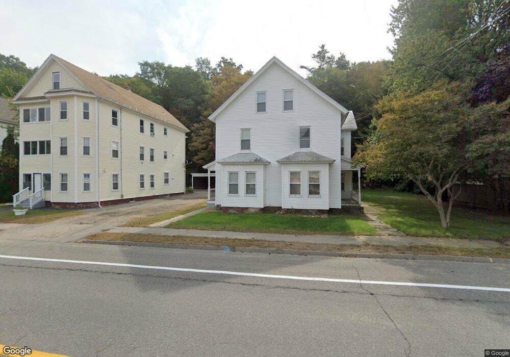
735 Main St Unit L Warren, MA 01083
Estimated Value: $288,449 - $487,000
3
Beds
2
Baths
1,388
Sq Ft
$280/Sq Ft
Est. Value
About This Home
This home is located at 735 Main St Unit L, Warren, MA 01083 and is currently estimated at $388,862, approximately $280 per square foot. 735 Main St Unit L is a home located in Worcester County with nearby schools including Quaboag Regional High School.
Ownership History
Date
Name
Owned For
Owner Type
Purchase Details
Closed on
May 1, 2018
Sold by
Leneau Edward D and Leneau Edward
Bought by
Kassis Group Llc
Current Estimated Value
Home Financials for this Owner
Home Financials are based on the most recent Mortgage that was taken out on this home.
Original Mortgage
$212,000
Outstanding Balance
$181,136
Interest Rate
4.44%
Mortgage Type
New Conventional
Estimated Equity
$207,726
Purchase Details
Closed on
Oct 4, 2017
Sold by
Leneau Sarah J
Bought by
Leneau Edward D
Purchase Details
Closed on
Mar 19, 2008
Sold by
Kamienski Boleslaw J and Sablak Sandra J
Bought by
Leneau Edward D and Leneau Sarah J
Home Financials for this Owner
Home Financials are based on the most recent Mortgage that was taken out on this home.
Original Mortgage
$244,900
Interest Rate
5.75%
Mortgage Type
Purchase Money Mortgage
Create a Home Valuation Report for This Property
The Home Valuation Report is an in-depth analysis detailing your home's value as well as a comparison with similar homes in the area
Home Values in the Area
Average Home Value in this Area
Purchase History
| Date | Buyer | Sale Price | Title Company |
|---|---|---|---|
| Kassis Group Llc | $265,000 | -- | |
| Leneau Edward D | -- | -- | |
| Leneau Edward D | $149,900 | -- |
Source: Public Records
Mortgage History
| Date | Status | Borrower | Loan Amount |
|---|---|---|---|
| Open | Kassis Group Llc | $212,000 | |
| Previous Owner | Leneau Edward D | $244,900 |
Source: Public Records
Tax History
| Year | Tax Paid | Tax Assessment Tax Assessment Total Assessment is a certain percentage of the fair market value that is determined by local assessors to be the total taxable value of land and additions on the property. | Land | Improvement |
|---|---|---|---|---|
| 2025 | $3,691 | $249,200 | $42,600 | $206,600 |
| 2024 | $3,755 | $249,200 | $42,600 | $206,600 |
| 2023 | $3,650 | $231,000 | $42,600 | $188,400 |
| 2022 | $3,219 | $206,900 | $36,700 | $170,200 |
| 2021 | $3,083 | $193,200 | $34,600 | $158,600 |
| 2020 | $3,109 | $181,200 | $34,600 | $146,600 |
| 2019 | $3,111 | $171,400 | $34,600 | $136,800 |
| 2018 | $2,866 | $165,500 | $34,600 | $130,900 |
| 2017 | $2,387 | $128,600 | $36,000 | $92,600 |
| 2016 | $2,442 | $123,100 | $34,300 | $88,800 |
| 2015 | $2,308 | $123,100 | $34,300 | $88,800 |
| 2014 | $2,351 | $123,100 | $34,300 | $88,800 |
Source: Public Records
Map
Nearby Homes
- Lot 8 Southbridge Rd
- LOT 7 Southbridge Rd
- Lot 4 Brimfield Rd
- 36 Nelson St
- 83 Comins Pond Rd
- 8 Otis St
- 17 Otis St
- 40 Hillside Ave
- 366 Southbridge Rd
- 59 High St
- Lot 5 Brimfield Rd
- Lot 3 Brimfield Rd
- Lot 4 Reed St
- Lot 7 Reed St
- 0 Town Farm Rd
- Lot 2 Brimfield Rd
- Lot 1 Brimfield Rd
- 95 Town Farm Rd
- 352 Reed St
- 3 Foster Rd
Your Personal Tour Guide
Ask me questions while you tour the home.