Estimated Value: $885,228 - $967,000
4
Beds
3
Baths
1,769
Sq Ft
$521/Sq Ft
Est. Value
About This Home
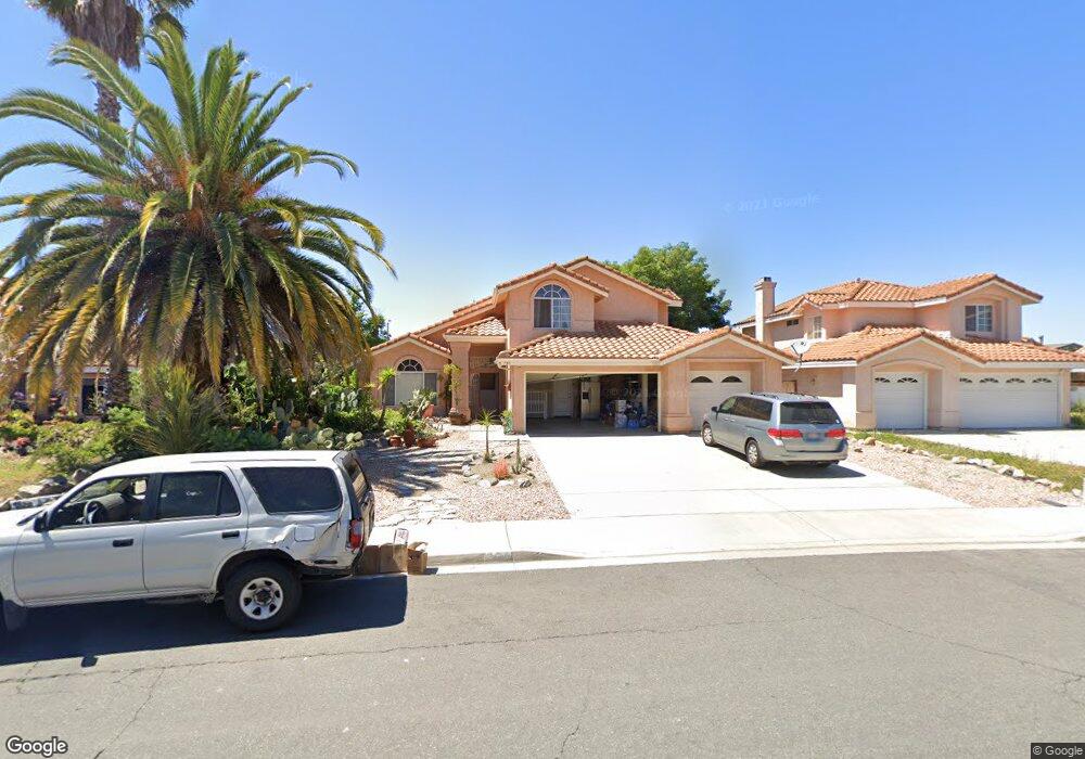
This home is located at 735 Marsopa Dr, Vista, CA 92081 and is currently estimated at $922,307, approximately $521 per square foot. 735 Marsopa Dr is a home located in San Diego County with nearby schools including Breeze Hill Elementary School, Madison Middle School, and Rancho Buena Vista High School.
Ownership History
Date
Name
Owned For
Owner Type
Purchase Details
Closed on
Aug 16, 2022
Sold by
Carole Upson
Bought by
Carole A Upson Living Trust
Current Estimated Value
Purchase Details
Closed on
Oct 3, 2001
Sold by
Ward John and Ward Katherine Rita
Bought by
Upson Carole
Home Financials for this Owner
Home Financials are based on the most recent Mortgage that was taken out on this home.
Original Mortgage
$234,000
Interest Rate
6.87%
Purchase Details
Closed on
Mar 27, 1990
Create a Home Valuation Report for This Property
The Home Valuation Report is an in-depth analysis detailing your home's value as well as a comparison with similar homes in the area
Home Values in the Area
Average Home Value in this Area
Purchase History
| Date | Buyer | Sale Price | Title Company |
|---|---|---|---|
| Carole A Upson Living Trust | -- | -- | |
| Upson Carole | $293,000 | California Title Company | |
| -- | $203,900 | -- |
Source: Public Records
Mortgage History
| Date | Status | Borrower | Loan Amount |
|---|---|---|---|
| Previous Owner | Upson Carole | $234,000 | |
| Closed | Upson Carole | $43,950 |
Source: Public Records
Tax History
| Year | Tax Paid | Tax Assessment Tax Assessment Total Assessment is a certain percentage of the fair market value that is determined by local assessors to be the total taxable value of land and additions on the property. | Land | Improvement |
|---|---|---|---|---|
| 2025 | $5,391 | $432,824 | $265,903 | $166,921 |
| 2024 | $5,391 | $424,339 | $260,690 | $163,649 |
| 2023 | $5,279 | $416,020 | $255,579 | $160,441 |
| 2022 | $5,267 | $407,864 | $250,568 | $157,296 |
| 2021 | $5,152 | $399,867 | $245,655 | $154,212 |
| 2020 | $5,123 | $395,768 | $243,137 | $152,631 |
| 2019 | $5,052 | $388,009 | $238,370 | $149,639 |
| 2018 | $4,837 | $380,402 | $233,697 | $146,705 |
| 2017 | $120 | $372,944 | $229,115 | $143,829 |
| 2016 | $4,652 | $365,632 | $224,623 | $141,009 |
| 2015 | $4,626 | $360,140 | $221,249 | $138,891 |
| 2014 | $4,517 | $353,087 | $216,916 | $136,171 |
Source: Public Records
Map
Nearby Homes
- 647 Via Costa Rica
- 629 Via Santiago
- 1164 Via Santa Paulo
- 750 Breeze Hill Rd Unit 100
- 607 Via Del Mar
- 611 Via Santa Paulo
- 1192 Via Santa Paulo
- 634 Via Santa Cruz
- 730 Breeze Hill Rd Unit 230
- 789 Michael Ct
- 793 Michael Ct
- 722 Miravar Place Lot 4 Unit Lot 4
- 601 Marazon Ln
- 801 W Vista Way
- 1522 Sunset Dr
- 1863 Sunset Dr
- 1207 Branding Iron Cir
- 1937 Sunset Dr
- 323 Hill Dr
- 1180 Academy Ln
Your Personal Tour Guide
Ask me questions while you tour the home.