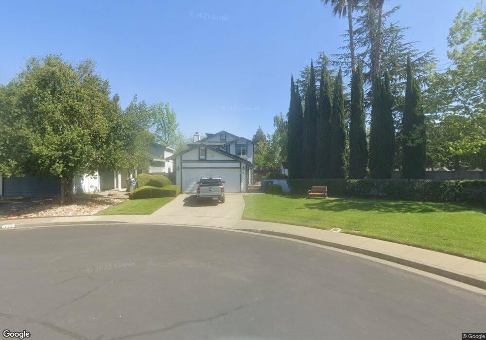
736 Danehurst Ct Vacaville, CA 95687
Estimated Value: $547,000 - $595,000
3
Beds
3
Baths
1,592
Sq Ft
$358/Sq Ft
Est. Value
About This Home
This home is located at 736 Danehurst Ct, Vacaville, CA 95687 and is currently estimated at $570,690, approximately $358 per square foot. 736 Danehurst Ct is a home located in Solano County with nearby schools including Foxboro Elementary School, Golden West Middle School, and Vanden High School.
Ownership History
Date
Name
Owned For
Owner Type
Purchase Details
Closed on
Feb 4, 2021
Sold by
Ross Mitchel L and Ross Karin
Bought by
Ross Mitchel L and Ross Karin S
Current Estimated Value
Purchase Details
Closed on
May 15, 2003
Sold by
Ross Mitchel L and Ross Karin S
Bought by
Ross Mitchell L and Ross Karin
Home Financials for this Owner
Home Financials are based on the most recent Mortgage that was taken out on this home.
Original Mortgage
$130,000
Interest Rate
5.75%
Mortgage Type
Purchase Money Mortgage
Create a Home Valuation Report for This Property
The Home Valuation Report is an in-depth analysis detailing your home's value as well as a comparison with similar homes in the area
Purchase History
| Date | Buyer | Sale Price | Title Company |
|---|---|---|---|
| Ross Mitchel L | -- | None Available | |
| Ross Mitchell L | -- | Chicago Title Co |
Source: Public Records
Mortgage History
| Date | Status | Borrower | Loan Amount |
|---|---|---|---|
| Closed | Ross Mitchell L | $130,000 |
Source: Public Records
Tax History
| Year | Tax Paid | Tax Assessment Tax Assessment Total Assessment is a certain percentage of the fair market value that is determined by local assessors to be the total taxable value of land and additions on the property. | Land | Improvement |
|---|---|---|---|---|
| 2025 | $3,083 | $258,538 | $70,009 | $188,529 |
| 2024 | $3,083 | $253,470 | $68,637 | $184,833 |
| 2023 | $3,012 | $248,501 | $67,292 | $181,209 |
| 2022 | $2,937 | $243,629 | $65,974 | $177,655 |
| 2021 | $2,886 | $238,853 | $64,681 | $174,172 |
| 2020 | $2,845 | $236,405 | $64,018 | $172,387 |
| 2019 | $2,790 | $231,770 | $62,763 | $169,007 |
| 2018 | $2,746 | $227,227 | $61,533 | $165,694 |
| 2017 | $2,649 | $222,773 | $60,327 | $162,446 |
| 2016 | $2,600 | $218,406 | $59,145 | $159,261 |
| 2015 | $2,558 | $215,126 | $58,257 | $156,869 |
| 2014 | $2,521 | $210,913 | $57,116 | $153,797 |
Source: Public Records
Map
Nearby Homes
- 821 Saddle Horn Trail
- 766 Calico Trail
- 631 Colemanite Cir
- 805 Broadfork Cir
- 231 Roundhill Ct
- 897 Sapphire Cir
- 196 Caldwell Dr
- 179 Buttercup Cir
- 967 Copper Way
- 954 Iron Dr
- 3007 Norwich Ct
- 339 Aaron Cir
- 1007 Canterbury Ct
- 116 Heritage Ln
- 165 Audrey Place
- 369 Kendrick Ln
- 448 Potters Ln
- 196 Somerville Dr
- 531 Colonial Cir
- 437 Jerrylee Rd
- 742 Danehurst Ct
- 906 Cookson St
- 700 Oakvale Way
- 712 Oakvale Way
- 779 Saddle Horn Trail
- 724 Danehurst Ct
- 773 Saddle Horn Trail
- 820 Cookson St
- 718 Danehurst Ct
- 718 Oakvale Way
- 706 Danehurst Ct
- 767 Saddle Horn Trail
- 785 Saddle Horn Trail
- 700 Danehurst Ct
- 761 Saddle Horn Trail
- 901 Cookson St
- 814 Cookson St
Your Personal Tour Guide
Ask me questions while you tour the home.