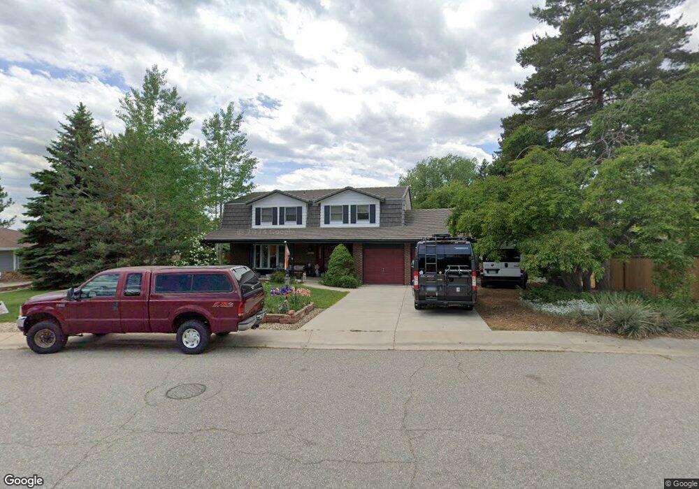
7366 Old Mill Trail Boulder, CO 80301
Gunbarrel NeighborhoodEstimated Value: $1,128,692 - $1,681,000
4
Beds
5
Baths
2,884
Sq Ft
$496/Sq Ft
Est. Value
About This Home
This home is located at 7366 Old Mill Trail, Boulder, CO 80301 and is currently estimated at $1,431,173, approximately $496 per square foot. 7366 Old Mill Trail is a home located in Boulder County with nearby schools including Heatherwood Elementary School, Nevin Platt Middle School, and Boulder High School.
Ownership History
Date
Name
Owned For
Owner Type
Purchase Details
Closed on
Nov 20, 2013
Sold by
Schwindt Mark A and Schwindt Sloan E
Bought by
Mark A Schwindt Trust #1
Current Estimated Value
Purchase Details
Closed on
Jun 24, 1997
Sold by
Pistilli Pasquale O and Pistilli Marie R
Bought by
Schwindt Mark A
Home Financials for this Owner
Home Financials are based on the most recent Mortgage that was taken out on this home.
Original Mortgage
$130,000
Outstanding Balance
$18,523
Interest Rate
7.93%
Estimated Equity
$1,412,650
Purchase Details
Closed on
Feb 26, 1994
Sold by
Pistilli Pasquale O and Pistilli Marie R
Bought by
Pistilli Pasquale O
Create a Home Valuation Report for This Property
The Home Valuation Report is an in-depth analysis detailing your home's value as well as a comparison with similar homes in the area
Home Values in the Area
Average Home Value in this Area
Purchase History
| Date | Buyer | Sale Price | Title Company |
|---|---|---|---|
| Mark A Schwindt Trust #1 | -- | None Available | |
| Schwindt Mark A | $293,000 | -- | |
| Pistilli Pasquale O | -- | -- |
Source: Public Records
Mortgage History
| Date | Status | Borrower | Loan Amount |
|---|---|---|---|
| Open | Schwindt Mark A | $130,000 |
Source: Public Records
Tax History
| Year | Tax Paid | Tax Assessment Tax Assessment Total Assessment is a certain percentage of the fair market value that is determined by local assessors to be the total taxable value of land and additions on the property. | Land | Improvement |
|---|---|---|---|---|
| 2025 | $6,747 | $78,869 | $38,763 | $40,106 |
| 2024 | $6,747 | $78,869 | $38,763 | $40,106 |
| 2023 | $6,636 | $79,697 | $43,161 | $40,220 |
| 2022 | $5,230 | $60,549 | $30,921 | $29,628 |
| 2021 | $4,987 | $62,290 | $31,810 | $30,480 |
| 2020 | $4,439 | $55,663 | $28,600 | $27,063 |
| 2019 | $5,011 | $55,663 | $28,600 | $27,063 |
| 2018 | $4,864 | $53,431 | $23,832 | $29,599 |
| 2017 | $4,719 | $59,072 | $26,348 | $32,724 |
| 2016 | $4,174 | $45,866 | $21,970 | $23,896 |
| 2015 | $3,963 | $41,361 | $21,174 | $20,187 |
| 2014 | $3,834 | $41,361 | $21,174 | $20,187 |
Source: Public Records
Map
Nearby Homes
- 7312 Island Cir
- 4500 S Meadow Dr
- 7302 Island Cir
- 7205 Rustic Trail
- 4667 Ashfield Dr
- 4422 Pali Way
- 4788 Briar Ridge Trail
- 4803 Briar Ridge Ct
- 4423 Alberta Ct
- 4953 Clubhouse Ct
- 4935 Sundance Square
- 4936 Clubhouse Cir
- 4862 Silver Sage Ct
- 7186 Petursdale Ct
- 5020 Buckingham Rd Unit B2
- 7088 Indian Peaks Trail
- 7750 Durham Way
- 4872 Country Club Way
- 5174 Buckingham Rd Unit L1
- 7134 Cedarwood Cir
- 7388 Old Mill Trail
- 7322 Yucca Ct
- 7344 Yucca Ct
- 4519 Northfield Ct
- 4537 Tanglewood Trail
- 4550 S Meadow Dr
- 7420 Old Mill Trail
- 4521 Northfield Ct
- 7340 Old Mill Trail
- 4538 S Meadow Dr
- 4524 Northfield Ct
- 7337 Yucca Ct
- 4547 Tanglewood Trail
- 4524 S Meadow Dr
- 7432 Old Mill Trail
- 4515 Northfield Ct
- 7355 Yucca Ct
- 7380 Old Mill Trail
- 7319 Yucca Ct
- 4542 Tanglewood Trail
Your Personal Tour Guide
Ask me questions while you tour the home.