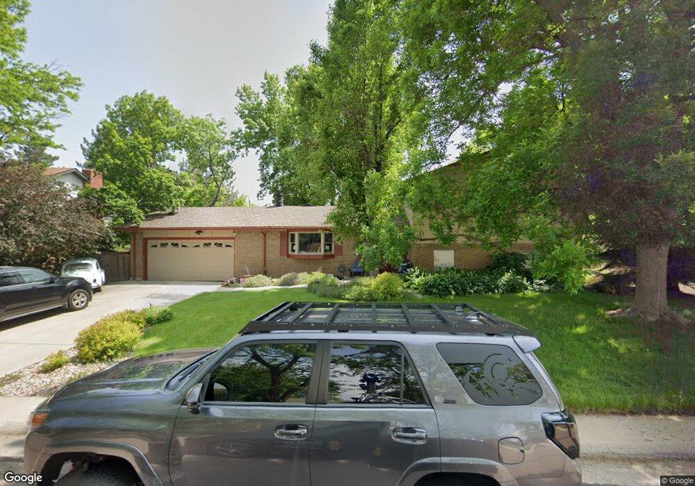
7366 S Platte Canyon Dr Littleton, CO 80128
Estimated Value: $739,511 - $887,000
3
Beds
4
Baths
1,777
Sq Ft
$452/Sq Ft
Est. Value
About This Home
This home is located at 7366 S Platte Canyon Dr, Littleton, CO 80128 and is currently estimated at $802,878, approximately $451 per square foot. 7366 S Platte Canyon Dr is a home located in Arapahoe County with nearby schools including Wilder Elementary School, Goddard Middle School, and Heritage High School.
Ownership History
Date
Name
Owned For
Owner Type
Purchase Details
Closed on
Nov 10, 2020
Sold by
Kiddy Carolyn A
Bought by
The Carolyn A Kiddy Trust
Current Estimated Value
Purchase Details
Closed on
Mar 8, 2017
Sold by
Kiddy Carolyn A and Estate Of H Donald Kiddy
Bought by
H Donald Kiddy Family Trust
Purchase Details
Closed on
Sep 21, 2000
Sold by
Ann Kiddy Hugh Donald and Ann Carolyn
Bought by
Kiddy Hugh Donald and Kiddy Carolyn Ann
Purchase Details
Closed on
Jul 4, 1776
Bought by
Conversion Arapco
Create a Home Valuation Report for This Property
The Home Valuation Report is an in-depth analysis detailing your home's value as well as a comparison with similar homes in the area
Home Values in the Area
Average Home Value in this Area
Purchase History
| Date | Buyer | Sale Price | Title Company |
|---|---|---|---|
| The Carolyn A Kiddy Trust | -- | None Available | |
| H Donald Kiddy Family Trust | -- | None Available | |
| Kiddy Hugh Donald | -- | -- | |
| Conversion Arapco | -- | -- |
Source: Public Records
Tax History Compared to Growth
Tax History
| Year | Tax Paid | Tax Assessment Tax Assessment Total Assessment is a certain percentage of the fair market value that is determined by local assessors to be the total taxable value of land and additions on the property. | Land | Improvement |
|---|---|---|---|---|
| 2024 | $4,338 | $44,294 | -- | -- |
| 2023 | $4,338 | $44,294 | $0 | $0 |
| 2022 | $3,526 | $35,661 | $0 | $0 |
| 2021 | $3,525 | $35,661 | $0 | $0 |
| 2020 | $3,359 | $35,257 | $0 | $0 |
| 2019 | $3,191 | $35,257 | $0 | $0 |
| 2018 | $2,555 | $29,642 | $0 | $0 |
| 2017 | $2,372 | $29,642 | $0 | $0 |
| 2016 | $2,259 | $28,632 | $0 | $0 |
| 2015 | $2,260 | $28,632 | $0 | $0 |
| 2014 | -- | $22,503 | $0 | $0 |
| 2013 | -- | $25,380 | $0 | $0 |
Source: Public Records
Map
Nearby Homes
- 7351 S Sheridan Ct
- 7427 S Ames Ct
- 7425 S Utica St
- 5466 W Indore Dr
- 5040 W Geddes Cir
- 7452 S Utica St
- 7175 S Polo Ridge Dr
- 7504 S Depew St
- 7120 S Sheridan Ct
- 5274 W Rowland Place
- 7604 S Platteview Dr
- 7636 S Eaton Way
- 7753 S Ames Way
- 4431 W Jamison Place
- 7079 S Polo Ridge Dr
- 7729 S Eaton Way
- 5454 W Canyon Trail Unit B
- 5344 W Canyon Trail Unit B
- 5354 W Canyon Trail Unit C
- 5474 W Canyon Trail Unit F
- 7376 S Platte Canyon Dr
- 7356 S Platte Canyon Dr
- 7367 S Platte Canyon Dr
- 7347 S Platte Canyon Dr
- 7386 S Platte Canyon Dr
- 7377 S Platte Canyon Dr
- 7387 S Platte Canyon Dr
- 7337 S Platte Canyon Dr
- 7396 S Platte Canyon Dr
- 5138 W Hinsdale Cir
- 5148 W Hinsdale Cir
- 7340 S Platte Canyon Dr
- 7397 S Platte Canyon Dr
- 5128 W Hinsdale Cir
- 7331 S Platte Canyon Dr
- 7336 S Platte Canyon Dr
- 5118 W Hinsdale Cir
- 7330 S Platte Canyon Dr
- 7420 S Sheridan Ct
- 5117 W Hinsdale Cir