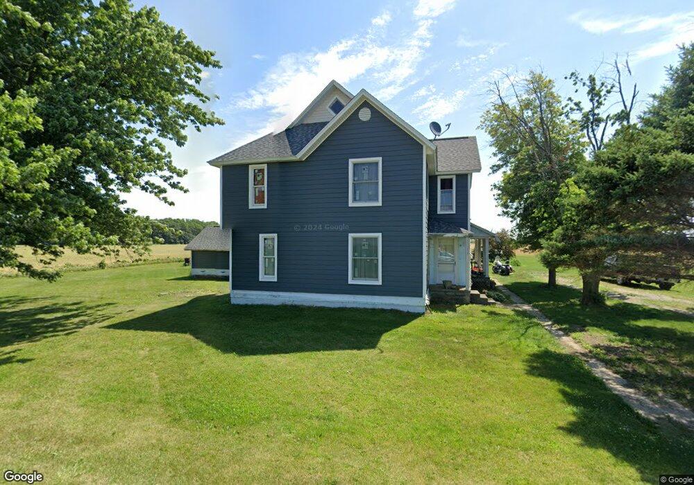
7378 Whitacre Rd Cygnet, OH 43413
Estimated Value: $178,000 - $309,000
5
Beds
1
Bath
2,872
Sq Ft
$87/Sq Ft
Est. Value
About This Home
This home is located at 7378 Whitacre Rd, Cygnet, OH 43413 and is currently estimated at $248,618, approximately $86 per square foot. 7378 Whitacre Rd is a home located in Wood County with nearby schools including Bowling Green High School.
Ownership History
Date
Name
Owned For
Owner Type
Purchase Details
Closed on
Oct 22, 2010
Sold by
Garner Michael G and Garner Susan M
Bought by
Perkins Michael R and Perkins Shanna S
Current Estimated Value
Home Financials for this Owner
Home Financials are based on the most recent Mortgage that was taken out on this home.
Original Mortgage
$90,250
Outstanding Balance
$59,404
Interest Rate
4.3%
Mortgage Type
New Conventional
Estimated Equity
$189,214
Purchase Details
Closed on
Jan 11, 1993
Bought by
Garner Michael G
Create a Home Valuation Report for This Property
The Home Valuation Report is an in-depth analysis detailing your home's value as well as a comparison with similar homes in the area
Home Values in the Area
Average Home Value in this Area
Purchase History
| Date | Buyer | Sale Price | Title Company |
|---|---|---|---|
| Perkins Michael R | $95,000 | Attorney | |
| Garner Michael G | $43,000 | -- |
Source: Public Records
Mortgage History
| Date | Status | Borrower | Loan Amount |
|---|---|---|---|
| Open | Perkins Michael R | $90,250 |
Source: Public Records
Tax History Compared to Growth
Tax History
| Year | Tax Paid | Tax Assessment Tax Assessment Total Assessment is a certain percentage of the fair market value that is determined by local assessors to be the total taxable value of land and additions on the property. | Land | Improvement |
|---|---|---|---|---|
| 2024 | $2,240 | $57,960 | $8,820 | $49,140 |
| 2023 | $2,240 | $53,310 | $8,820 | $44,490 |
| 2021 | $1,898 | $45,010 | $7,070 | $37,940 |
| 2020 | $1,915 | $45,010 | $7,070 | $37,940 |
| 2019 | $1,801 | $40,710 | $7,070 | $33,640 |
| 2018 | $1,792 | $40,710 | $7,070 | $33,640 |
| 2017 | $1,770 | $40,710 | $7,070 | $33,640 |
| 2016 | $1,459 | $33,430 | $5,320 | $28,110 |
| 2015 | $1,459 | $33,430 | $5,320 | $28,110 |
| 2014 | $1,538 | $33,430 | $5,320 | $28,110 |
| 2013 | $1,688 | $33,430 | $5,320 | $28,110 |
Source: Public Records
Map
Nearby Homes
- 13136 Jerry City Rd
- 0 S Dixie Hwy
- 351 Front St
- 165 Jackson St
- 1 Indian Creek Dr
- 9863 Mitchell Rd
- 9805 Jerry City Rd
- 8708 Huffman Rd
- 207 S Findlay Pike
- 930 E Broadway St
- 233 & 235 N Main St
- 209 Rudolph Rd
- Lot 112 Foley Run
- 12078 Eagleville Rd
- 508 W Walnut St
- 227 E Broadway St
- 0000 Eagleville Rd
- 109 Smith St
- 103 Smith St
- 128 Zihlman St
- 7611 Whitacre Rd
- 7447 Whitacre Rd
- 13384 Jerry City Rd
- 13600 Jerry City Rd
- 7776 Whitacre Rd
- 13397 Jerry City Rd
- 13228 Jerry City Rd
- 13639 Jerry City Rd
- 7491 S Dixie Hwy
- 13172 Jerry City Rd
- 13247 Jerry City Rd
- 13247 Jerry City Rd
- 13154 Jerry City Rd
- 7513 S Dixie Hwy
- 7531 S Dixie Hwy
- 7549 S Dixie Hwy
- 13303 Jerry City Rd
- 7567 S Dixie Hwy
- 7585 S Dixie Hwy
- 7593 S Dixie Hwy