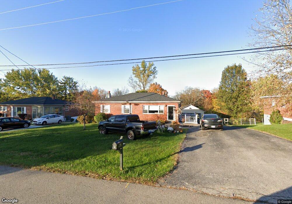
738 Jimae Ave Independence, KY 41051
Estimated Value: $199,000 - $262,000
3
Beds
2
Baths
1,006
Sq Ft
$228/Sq Ft
Est. Value
About This Home
This home is located at 738 Jimae Ave, Independence, KY 41051 and is currently estimated at $229,047, approximately $227 per square foot. 738 Jimae Ave is a home located in Kenton County with nearby schools including White's Tower Elementary School, Woodland Middle School, and Scott High School.
Ownership History
Date
Name
Owned For
Owner Type
Purchase Details
Closed on
Dec 1, 2006
Sold by
Huneycutt Nathan D and Huneycutt Heather R
Bought by
Eversole Tonya L
Current Estimated Value
Home Financials for this Owner
Home Financials are based on the most recent Mortgage that was taken out on this home.
Original Mortgage
$140,700
Outstanding Balance
$93,834
Interest Rate
6.29%
Mortgage Type
Purchase Money Mortgage
Estimated Equity
$135,213
Purchase Details
Closed on
Apr 18, 2000
Sold by
Acuff Utah
Bought by
Huneycutt Nathan D
Home Financials for this Owner
Home Financials are based on the most recent Mortgage that was taken out on this home.
Original Mortgage
$94,951
Interest Rate
8.29%
Mortgage Type
FHA
Create a Home Valuation Report for This Property
The Home Valuation Report is an in-depth analysis detailing your home's value as well as a comparison with similar homes in the area
Home Values in the Area
Average Home Value in this Area
Purchase History
| Date | Buyer | Sale Price | Title Company |
|---|---|---|---|
| Eversole Tonya L | $140,000 | Lawyers Title Of Cincinnati | |
| Huneycutt Nathan D | $95,000 | -- |
Source: Public Records
Mortgage History
| Date | Status | Borrower | Loan Amount |
|---|---|---|---|
| Open | Eversole Tonya L | $140,700 | |
| Previous Owner | Huneycutt Nathan D | $94,951 |
Source: Public Records
Tax History
| Year | Tax Paid | Tax Assessment Tax Assessment Total Assessment is a certain percentage of the fair market value that is determined by local assessors to be the total taxable value of land and additions on the property. | Land | Improvement |
|---|---|---|---|---|
| 2025 | $1,910 | $164,200 | $35,000 | $129,200 |
| 2024 | $1,776 | $145,000 | $25,000 | $120,000 |
| 2023 | $1,830 | $145,000 | $25,000 | $120,000 |
| 2022 | $1,894 | $145,000 | $25,000 | $120,000 |
| 2021 | $1,922 | $145,000 | $25,000 | $120,000 |
| 2020 | $1,896 | $140,000 | $20,000 | $120,000 |
| 2019 | $1,901 | $140,000 | $20,000 | $120,000 |
| 2018 | $1,912 | $140,000 | $20,000 | $120,000 |
| 2017 | $1,860 | $140,000 | $20,000 | $120,000 |
| 2015 | $1,803 | $140,000 | $25,000 | $115,000 |
| 2014 | $1,778 | $140,000 | $25,000 | $115,000 |
Source: Public Records
Map
Nearby Homes
- 756 Ridgepoint Dr
- Greenbriar Plan at Willow Green - Maple Street Collection
- Jensen Plan at Willow Green - Maple Street Collection
- Yosemite Plan at Willow Green - Maple Street Collection
- Beacon Plan at Willow Green - Maple Street Collection
- Wesley Plan at Willow Green - Maple Street Collection
- Fairfax Plan at Willow Green - Maple Street Collection
- Danville Plan at Willow Green - Maple Street Collection
- Cumberland Plan at Willow Green - Maple Street Collection
- Breckenridge Plan at Willow Green - Maple Street Collection
- Preston Plan at Willow Green - Maple Street Collection
- 6500 Meadow Creek Dr
- 789 Stonybrook Ct
- BRADSHAW Plan at Woods at Lakefield
- TRENT Plan at Woods at Lakefield
- CLARKSON Plan at Woods at Lakefield
- GARRETT Plan at Woods at Lakefield
- EATON Plan at Woods at Lakefield
- THORPE Plan at Woods at Lakefield
- FINNEGAN Plan at Woods at Lakefield
