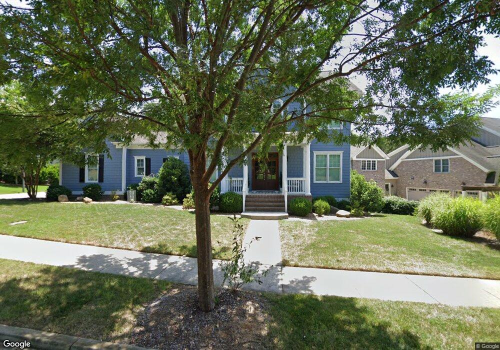
739 Harvest Pointe Dr Fort Mill, SC 29708
Baxter Village NeighborhoodEstimated Value: $1,038,000 - $1,215,993
4
Beds
4
Baths
3,547
Sq Ft
$321/Sq Ft
Est. Value
About This Home
This home is located at 739 Harvest Pointe Dr, Fort Mill, SC 29708 and is currently estimated at $1,139,664, approximately $321 per square foot. 739 Harvest Pointe Dr is a home located in York County with nearby schools including Orchard Park Elementary School, Pleasant Knoll Middle School, and Fort Mill High School.
Ownership History
Date
Name
Owned For
Owner Type
Purchase Details
Closed on
Sep 13, 2013
Sold by
Evans Coghill Homes Llc
Bought by
Kokoski Bradley R and Kokoski Haylie L
Current Estimated Value
Home Financials for this Owner
Home Financials are based on the most recent Mortgage that was taken out on this home.
Original Mortgage
$149,037
Interest Rate
4.39%
Mortgage Type
New Conventional
Purchase Details
Closed on
Nov 17, 2012
Sold by
Laciano Richard J and Laciano Paula
Bought by
Evans Coghill Homes Llc
Purchase Details
Closed on
Apr 18, 2011
Sold by
Clear Springs Baxter Llc
Bought by
Laciano Richard J and Laciano Paula
Create a Home Valuation Report for This Property
The Home Valuation Report is an in-depth analysis detailing your home's value as well as a comparison with similar homes in the area
Home Values in the Area
Average Home Value in this Area
Purchase History
| Date | Buyer | Sale Price | Title Company |
|---|---|---|---|
| Kokoski Bradley R | $630,271 | -- | |
| Evans Coghill Homes Llc | $110,000 | -- | |
| Laciano Richard J | $99,200 | -- |
Source: Public Records
Mortgage History
| Date | Status | Borrower | Loan Amount |
|---|---|---|---|
| Closed | Kokoski Bradley R | $149,037 | |
| Open | Kokoski Bradley R | $417,000 |
Source: Public Records
Tax History Compared to Growth
Tax History
| Year | Tax Paid | Tax Assessment Tax Assessment Total Assessment is a certain percentage of the fair market value that is determined by local assessors to be the total taxable value of land and additions on the property. | Land | Improvement |
|---|---|---|---|---|
| 2024 | $4,772 | $27,115 | $3,640 | $23,475 |
| 2023 | $4,576 | $26,979 | $3,628 | $23,351 |
| 2022 | $4,535 | $26,979 | $3,628 | $23,351 |
| 2021 | -- | $26,979 | $3,628 | $23,351 |
| 2020 | $4,800 | $26,979 | $0 | $0 |
| 2019 | $4,802 | $23,460 | $0 | $0 |
| 2018 | $5,096 | $23,460 | $0 | $0 |
| 2017 | $4,814 | $23,460 | $0 | $0 |
| 2016 | $4,786 | $23,460 | $0 | $0 |
| 2014 | $161 | $23,460 | $4,400 | $19,060 |
| 2013 | $161 | $28,350 | $6,600 | $21,750 |
Source: Public Records
Map
Nearby Homes
- 546 Abelia Ln
- 425 Cassia Ct
- 424 Cassia Ct
- 820 Stratford Run Dr
- 2268 New Gray Rock Rd
- 708 Drew Ave
- 0000 Alfred Ln
- 1718 Still River Way
- 2034 Suttonview Rd
- 1628 Spring Blossom Trail
- 2053 Suttonview Rd
- 2225 Masons Bend Dr
- 228 Coneflower Place
- 150 1st St N
- 5510 Morris Hunt Dr
- 5518 Morris Hunt Dr
- 1662 Sam Smith Rd
- 625 Sixth Baxter Crossing
- 3076 Amaranth Dr
- 810 Granby Dr
- 731 Harvest Pointe Dr
- 747 Harvest Pointe Dr
- 728 Harvest Pointe Dr
- 755 Harvest Pointe Dr
- 723 Harvest Pointe Dr
- 1008 Perriwinkle Ln
- 738 Harvest Pointe Dr
- 738 Harvest Pointe Dr Unit 1329
- 1008 Perriwinkle Ln
- 714 Harvest Pointe Dr
- 763 Harvest Pointe Dr
- 1016 Perriwinkle Ln
- 762 Harvest Pointe Dr
- 762 Harvest Pointe Dr Unit 1321
- 403 Sutton Rd N
- 1024 Perriwinkle Ln Unit L1326
- 771 Harvest Pointe Dr
- 1023 Perriwinkle Ln Unit 1322
- 1023 Perriwinkle Ln
- 936 Stratford Run Dr