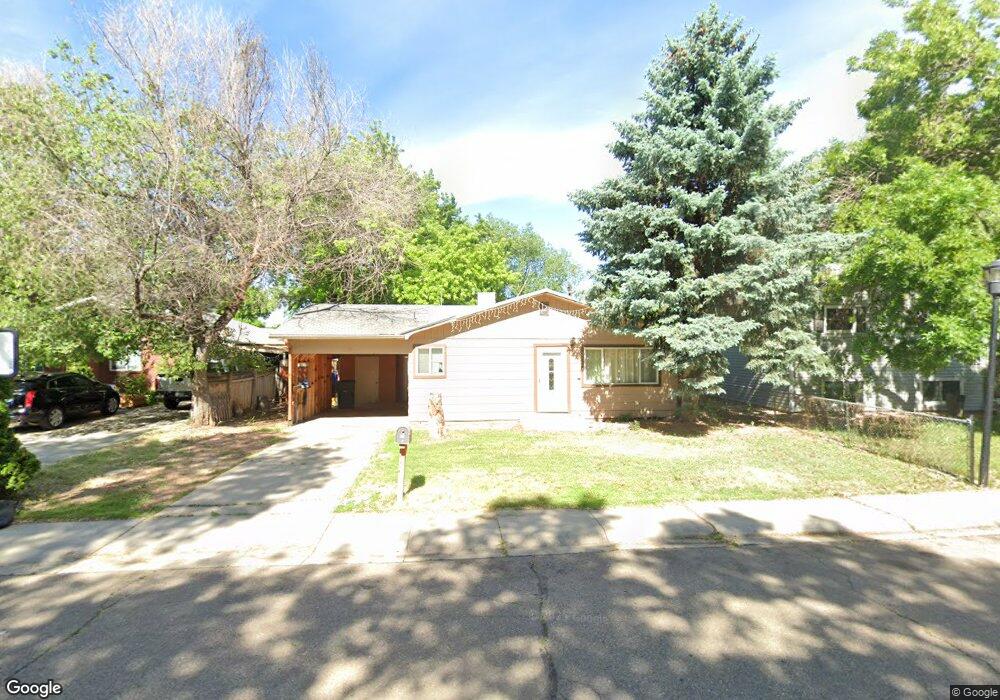
739 Rees Ct Longmont, CO 80504
Kensington NeighborhoodEstimated Value: $367,000 - $390,000
3
Beds
1
Bath
1,092
Sq Ft
$345/Sq Ft
Est. Value
About This Home
This home is located at 739 Rees Ct, Longmont, CO 80504 and is currently estimated at $376,722, approximately $344 per square foot. 739 Rees Ct is a home located in Boulder County with nearby schools including Columbine Elementary School, Trail Ridge Middle School, and Skyline High School.
Ownership History
Date
Name
Owned For
Owner Type
Purchase Details
Closed on
Jul 14, 2006
Sold by
Wells Fargo Bank Na
Bought by
Homestead Land Co Llc
Current Estimated Value
Purchase Details
Closed on
Jan 31, 2006
Sold by
Betancourt Ricardo and Betancourt Angelica
Bought by
Wells Fargo Bank Na and Certificateholders Of Asset Backed Pass
Purchase Details
Closed on
Jun 7, 2004
Sold by
Betancourt Ricardo
Bought by
Betancourt Ricardo
Home Financials for this Owner
Home Financials are based on the most recent Mortgage that was taken out on this home.
Original Mortgage
$185,250
Interest Rate
6.35%
Mortgage Type
New Conventional
Purchase Details
Closed on
Dec 31, 2001
Sold by
Tiff Jimmy W and Tiff Nancy S
Bought by
Betancourt Ricardo
Home Financials for this Owner
Home Financials are based on the most recent Mortgage that was taken out on this home.
Original Mortgage
$125,360
Interest Rate
8%
Purchase Details
Closed on
Apr 10, 1990
Bought by
Homestead Land Company Llc
Purchase Details
Closed on
Jun 24, 1983
Bought by
Homestead Land Company Llc
Purchase Details
Closed on
Sep 10, 1980
Bought by
Homestead Land Company Llc
Purchase Details
Closed on
Mar 31, 1977
Bought by
Homestead Land Company Llc
Create a Home Valuation Report for This Property
The Home Valuation Report is an in-depth analysis detailing your home's value as well as a comparison with similar homes in the area
Home Values in the Area
Average Home Value in this Area
Purchase History
| Date | Buyer | Sale Price | Title Company |
|---|---|---|---|
| Homestead Land Co Llc | $137,500 | None Available | |
| Wells Fargo Bank Na | -- | None Available | |
| Betancourt Ricardo | -- | Pacific Title & Escrow Inc | |
| Betancourt Ricardo | $156,700 | -- | |
| Homestead Land Company Llc | $46,000 | -- | |
| Homestead Land Company Llc | $58,500 | -- | |
| Homestead Land Company Llc | $50,500 | -- | |
| Homestead Land Company Llc | $25,000 | -- |
Source: Public Records
Mortgage History
| Date | Status | Borrower | Loan Amount |
|---|---|---|---|
| Previous Owner | Betancourt Ricardo | $185,250 | |
| Previous Owner | Betancourt Ricardo | $125,360 |
Source: Public Records
Tax History
| Year | Tax Paid | Tax Assessment Tax Assessment Total Assessment is a certain percentage of the fair market value that is determined by local assessors to be the total taxable value of land and additions on the property. | Land | Improvement |
|---|---|---|---|---|
| 2025 | $1,771 | $23,663 | $9,119 | $14,544 |
| 2024 | $1,771 | $23,663 | $9,119 | $14,544 |
| 2023 | $1,747 | $18,512 | $9,943 | $12,254 |
| 2022 | $1,677 | $16,951 | $7,221 | $9,730 |
| 2021 | $1,699 | $17,439 | $7,429 | $10,010 |
| 2020 | $1,616 | $16,639 | $7,222 | $9,417 |
| 2019 | $1,591 | $16,639 | $7,222 | $9,417 |
| 2018 | $1,425 | $15,005 | $6,192 | $8,813 |
| 2017 | $1,406 | $16,589 | $6,846 | $9,743 |
| 2016 | $1,196 | $12,514 | $6,448 | $6,066 |
| 2015 | $1,140 | $9,154 | $2,786 | $6,368 |
| 2014 | $855 | $9,154 | $2,786 | $6,368 |
Source: Public Records
Map
Nearby Homes
- 225 E 8th Ave Unit E20
- 225 E 8th Ave Unit F2
- 225 E 8th Ave Unit C14
- 830 Martin St
- 845 Martin St
- 10 9th Ave Unit 18
- 815 Hilltop St
- 145 Placer Ave
- 244 Sorento Place
- 29 Marshall Place
- 500 Lashley St Unit 48
- 128 E 5th Ave
- 136 E 5th Ave
- 140 E 5th Ave
- 536 Atwood St
- 262 E 5th Ave
- 36 Reed Place
- 240 Wadsworth Cir
- 422 Atwood St
- 104 Rothrock Place
Your Personal Tour Guide
Ask me questions while you tour the home.