

Highlights
- Covered Patio or Porch
- Walk-In Closet
- High Speed Internet
- Petal Primary School Rated A
- Shed
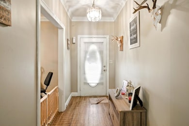
About This Home
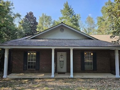
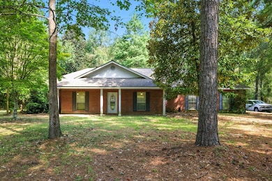
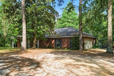
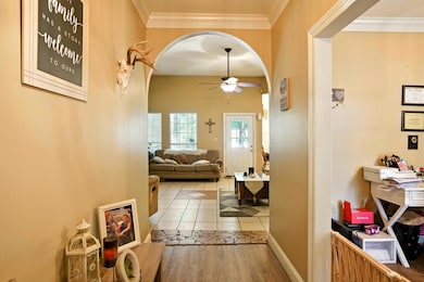
Its your LUCKy Day!!! What everyone wants!!! 4 bedrooms, 2 baths, TONS of space, on an acre in Petal Schools on GOODLUCK Rd.!!! Exterior features a wooded lot, storage building, fenced area, front and back porch and more! Schedule your showing today!!
Home Details
Home Type
- Single Family
Year Built
- Built in 1996
Parking
- Exterior Garage Door
Home Design
- Architectural Shingle Roof
Outdoor Features
- Covered Patio or Porch
- Shed
- Outbuilding
Additional Features
- Walk-In Closet
- Chain Link Fence
- High Speed Internet
Map
Tax History
| Year | Tax Paid | Tax Assessment Tax Assessment Total Assessment is a certain percentage of the fair market value that is determined by local assessors to be the total taxable value of land and additions on the property. | Land | Improvement |
|---|---|---|---|---|
| 2025 | $1,533 | $13,899 | $0 | $0 |
| 2024 | $1,533 | $12,881 | $0 | $0 |
| 2023 | $1,397 | $128,810 | $0 | $0 |
| 2022 | $1,331 | $12,881 | $0 | $0 |
| 2021 | $1,342 | $12,881 | $0 | $0 |
| 2020 | $1,303 | $12,475 | $0 | $0 |
| 2019 | $1,299 | $12,475 | $0 | $0 |
| 2018 | $1,303 | $12,475 | $0 | $0 |
| 2017 | $1,325 | $12,475 | $0 | $0 |
| 2016 | $1,274 | $12,136 | $0 | $0 |
| 2015 | $1,249 | $121,844 | $0 | $0 |
| 2014 | $1,370 | $12,184 | $0 | $0 |
Property History
| Date | Event | Price | List to Sale | Price per Sq Ft |
|---|---|---|---|---|
| 02/02/2026 02/02/26 | Price Changed | $269,000 | -3.6% | $117 / Sq Ft |
| 12/18/2025 12/18/25 | Price Changed | $279,000 | -2.8% | $121 / Sq Ft |
| 10/23/2025 10/23/25 | Price Changed | $286,900 | -1.0% | $124 / Sq Ft |
| 09/22/2025 09/22/25 | Price Changed | $289,900 | -3.3% | $126 / Sq Ft |
| 09/04/2025 09/04/25 | For Sale | $299,900 | -- | $130 / Sq Ft |
Purchase History
| Date | Type | Sale Price | Title Company |
|---|---|---|---|
| Warranty Deed | -- | -- | |
| Warranty Deed | -- | -- |
Mortgage History
| Date | Status | Loan Amount | Loan Type |
|---|---|---|---|
| Closed | $144,764 | No Value Available |
Source: Hattiesburg Area Association of REALTORS®
MLS Number: 143991
APN: 1-033I-12-003.00
Disclaimer: Certain information contained herein is derived from information provided by parties other than Homes.com. All information provided is deemed reliable, but is not guaranteed to be accurate and should be independently verified.
![]() IDX information is provided exclusively for personal, non-commercial use, and may not be used for any purpose other than to identify prospective properties consumers may be interested in purchasing. Information is deemed reliable but not guaranteed.
IDX information is provided exclusively for personal, non-commercial use, and may not be used for any purpose other than to identify prospective properties consumers may be interested in purchasing. Information is deemed reliable but not guaranteed.
- 135 Burger Rd
- 145 Green Bay Dr
- 0 Archel St
- 224 Hensarling Rd
- 105 Green Bay Dr
- 40 Brody Ln
- 64 Country Park Dr
- 48 Brady Rd
- 02 Horseshoe Ln
- 01 Horseshoe Ln
- 13 S Village Ln
- 92 High Meadows Cir
- 96 High Meadows Cir
- 19 Thomford Way
- 0 Hwy 42 Unit 141116
- 189 Sunline Dr
- 24 Rotan Ct
- 69 Sunline Dr
- 00 Ms-42
- 72 Sunline Dr
- 119 Pine St
- 112 E Front St
- 447 William Carey Pkwy
- 312 N 18th Ave
- 806 Maxwell Dr
- 78 Wisteria Dr
- 3004 Glendale Ave
- 2304 W 7th St
- 114 S 24th Ave
- 215 N 25th Ave
- 2501 W 7th St
- 2300 Lincoln Rd
- 6355 U S Highway 49
- 620 S 28th Ave
- 2808 W 7th St
- 209 S 29th Ave
- 6490 U S Hwy 49 N
- 200 Blue Gable Rd
- 3310 W 7th St
- 201 Blue Gable Rd

Ask me questions while you tour the home.