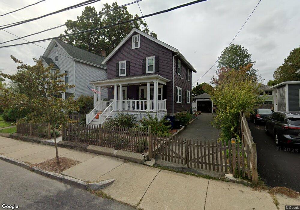
74 Knoll St Roslindale, MA 02131
Roslindale NeighborhoodEstimated Value: $839,964 - $1,004,000
4
Beds
2
Baths
1,488
Sq Ft
$611/Sq Ft
Est. Value
About This Home
This home is located at 74 Knoll St, Roslindale, MA 02131 and is currently estimated at $908,991, approximately $610 per square foot. 74 Knoll St is a home located in Suffolk County with nearby schools including Brooke Charter School Roslindale, Holy Name Parish School, and Sacred Heart STEM School.
Ownership History
Date
Name
Owned For
Owner Type
Purchase Details
Closed on
May 3, 2010
Sold by
Mccue Howard M and Murray Catherine J
Bought by
Scott Samuel K and Kajunski Christine R
Current Estimated Value
Purchase Details
Closed on
Aug 1, 2003
Sold by
Kleiner Alexander F and Smith-Kleiner Felicia A
Bought by
Mccue Howard M and Murray Catherine J
Purchase Details
Closed on
Apr 13, 1998
Sold by
Greenspan Cathy A and Lippke Judith A
Bought by
Kleiner A F and Smith-Kleiner Felicia
Purchase Details
Closed on
Oct 6, 1989
Sold by
Monaghan Russell K
Bought by
Greenspan Cathy A
Create a Home Valuation Report for This Property
The Home Valuation Report is an in-depth analysis detailing your home's value as well as a comparison with similar homes in the area
Home Values in the Area
Average Home Value in this Area
Purchase History
| Date | Buyer | Sale Price | Title Company |
|---|---|---|---|
| Scott Samuel K | $417,500 | -- | |
| Mccue Howard M | $425,000 | -- | |
| Kleiner A F | $197,500 | -- | |
| Greenspan Cathy A | $164,000 | -- |
Source: Public Records
Mortgage History
| Date | Status | Borrower | Loan Amount |
|---|---|---|---|
| Open | Greenspan Cathy A | $351,000 | |
| Closed | Greenspan Cathy A | $354,800 |
Source: Public Records
Tax History Compared to Growth
Tax History
| Year | Tax Paid | Tax Assessment Tax Assessment Total Assessment is a certain percentage of the fair market value that is determined by local assessors to be the total taxable value of land and additions on the property. | Land | Improvement |
|---|---|---|---|---|
| 2025 | $8,589 | $741,700 | $241,700 | $500,000 |
| 2024 | $7,475 | $685,800 | $215,900 | $469,900 |
| 2023 | $7,365 | $685,800 | $215,900 | $469,900 |
| 2022 | $6,663 | $612,400 | $192,800 | $419,600 |
| 2021 | $6,358 | $595,900 | $192,800 | $403,100 |
| 2020 | $5,805 | $549,700 | $177,600 | $372,100 |
| 2019 | $5,346 | $507,200 | $153,900 | $353,300 |
| 2018 | $4,924 | $469,800 | $153,900 | $315,900 |
| 2017 | $4,975 | $469,800 | $153,900 | $315,900 |
| 2016 | $5,017 | $456,100 | $153,900 | $302,200 |
| 2015 | $4,948 | $408,600 | $147,600 | $261,000 |
| 2014 | $4,673 | $371,500 | $147,600 | $223,900 |
Source: Public Records
Map
Nearby Homes
- 87 Knoll St
- 24 Hazelmere Rd
- 2 Weld Hill St Unit PH2
- 79 Robert St Unit 3
- 26 Bradfield Ave Unit 3
- 43 Ainsworth St Unit 2
- 15 S Fairview St Unit 3
- 103 Belgrade Ave Unit 2
- 17 Metcalf St
- 15 Newburg St Unit 1
- 65 Birch St Unit 3
- 214 Allandale Rd Unit B
- 257 Belgrade Ave
- 242 Belgrade Ave
- 80 Roslindale Ave Unit 3
- 620 South St
- 10 Hackensack Terrace
- 228 Allandale Rd Unit 1B
- 112 Roslindale Ave Unit 2
- 206 Allandale Rd Unit 3C
- 78 Knoll St
- 68 Knoll St
- 82 Knoll St
- 73 Ardale St
- 77 Ardale St
- 77 Ardale St Unit 1
- 69 Ardale St
- 69 Ardale St Unit 1
- 83 Ardale St
- 65 Ardale St
- 61 Knoll St
- 61 Knoll St Unit 2
- 69 Knoll St
- 69 Knoll St Unit 1
- 86 Knoll St Unit 88
- 88 Knoll St Unit B
- 88 Knoll St Unit A
- 88 Knoll St Unit 2
- 71 Knoll St
- 87 Ardale St