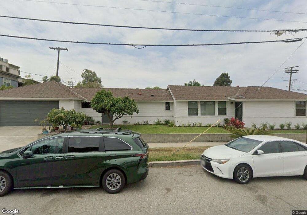
7400 Flight Ave Los Angeles, CA 90045
Westchester NeighborhoodEstimated Value: $1,548,000 - $1,745,658
3
Beds
2
Baths
2,140
Sq Ft
$766/Sq Ft
Est. Value
About This Home
This home is located at 7400 Flight Ave, Los Angeles, CA 90045 and is currently estimated at $1,640,165, approximately $766 per square foot. 7400 Flight Ave is a home located in Los Angeles County with nearby schools including Westport Heights Elementary, Wright Middle School STEAM Magnet, and Westchester Enriched Sciences Magnets.
Ownership History
Date
Name
Owned For
Owner Type
Purchase Details
Closed on
Jun 10, 1999
Sold by
Herath Sonali
Bought by
Tolentino Quirino M and Tolentino Suryanie A
Current Estimated Value
Purchase Details
Closed on
Nov 19, 1998
Sold by
Herath Sonali
Bought by
Herath Sonali and Herath Chandrika Noeline
Purchase Details
Closed on
Mar 16, 1998
Sold by
Holland Dennis
Bought by
Herath Sonali
Home Financials for this Owner
Home Financials are based on the most recent Mortgage that was taken out on this home.
Original Mortgage
$220,000
Interest Rate
7.07%
Mortgage Type
Stand Alone First
Create a Home Valuation Report for This Property
The Home Valuation Report is an in-depth analysis detailing your home's value as well as a comparison with similar homes in the area
Home Values in the Area
Average Home Value in this Area
Purchase History
| Date | Buyer | Sale Price | Title Company |
|---|---|---|---|
| Tolentino Quirino M | $327,500 | Orange Coast Title | |
| Herath Sonali | -- | -- | |
| Herath Sonali | $275,000 | Fidelity National Title Ins |
Source: Public Records
Mortgage History
| Date | Status | Borrower | Loan Amount |
|---|---|---|---|
| Previous Owner | Herath Sonali | $220,000 | |
| Closed | Herath Sonali | $27,500 |
Source: Public Records
Tax History Compared to Growth
Tax History
| Year | Tax Paid | Tax Assessment Tax Assessment Total Assessment is a certain percentage of the fair market value that is determined by local assessors to be the total taxable value of land and additions on the property. | Land | Improvement |
|---|---|---|---|---|
| 2025 | $8,191 | $663,122 | $264,930 | $398,192 |
| 2024 | $8,191 | $650,121 | $259,736 | $390,385 |
| 2023 | $8,040 | $637,375 | $254,644 | $382,731 |
| 2022 | $7,679 | $624,878 | $249,651 | $375,227 |
| 2021 | $7,576 | $612,626 | $244,756 | $367,870 |
| 2019 | $7,354 | $594,457 | $237,498 | $356,959 |
| 2018 | $7,222 | $582,802 | $232,842 | $349,960 |
| 2016 | $6,896 | $560,173 | $223,801 | $336,372 |
| 2015 | $6,797 | $551,760 | $220,440 | $331,320 |
| 2014 | $6,825 | $540,952 | $216,122 | $324,830 |
Source: Public Records
Map
Nearby Homes
- 5723 W 74th St
- 7803 Flight Ave
- 5530 Thornburn St Unit 102
- 5858 Abernathy Dr
- 5506 Thornburn St
- 5467 W 76th St
- 5503 Thornburn St
- 5600 W 78th St
- 7701 Toland Ave
- 5400 Thornburn St
- 7100 Alvern St Unit 404
- 7100 Alvern St Unit 317
- 5401 Thornburn St
- 5845 W 74th St
- 7111 La Tijera Blvd Unit C101
- 7137 Ramsgate Ave
- 7559 Midfield Ave
- 7037 La Tijera Blvd Unit C102
- 7562 Midfield Ave
- 7701 Hindry Ave
- 7404 Flight Ave
- 7414 Flight Ave
- 5651 W 74th St
- 7407 Flight Ave
- 7411 Flight Ave
- 7500 Flight Ave
- 7364 Flight Ave
- 7403 La Tijera Blvd
- 7403 La Tijera Blvd Unit 14
- 7403 La Tijera Blvd Unit 221
- 7403 La Tijera Blvd Unit 307
- 7403 La Tijera Blvd Unit 306
- 7403 La Tijera Blvd Unit 315
- 7403 La Tijera Blvd Unit 313
- 7403 La Tijera Blvd Unit 130
- 7403 La Tijera Blvd Unit 129
- 7403 La Tijera Blvd Unit 128
- 7403 La Tijera Blvd Unit 320
- 7403 La Tijera Blvd Unit 127
- 7403 La Tijera Blvd Unit 320