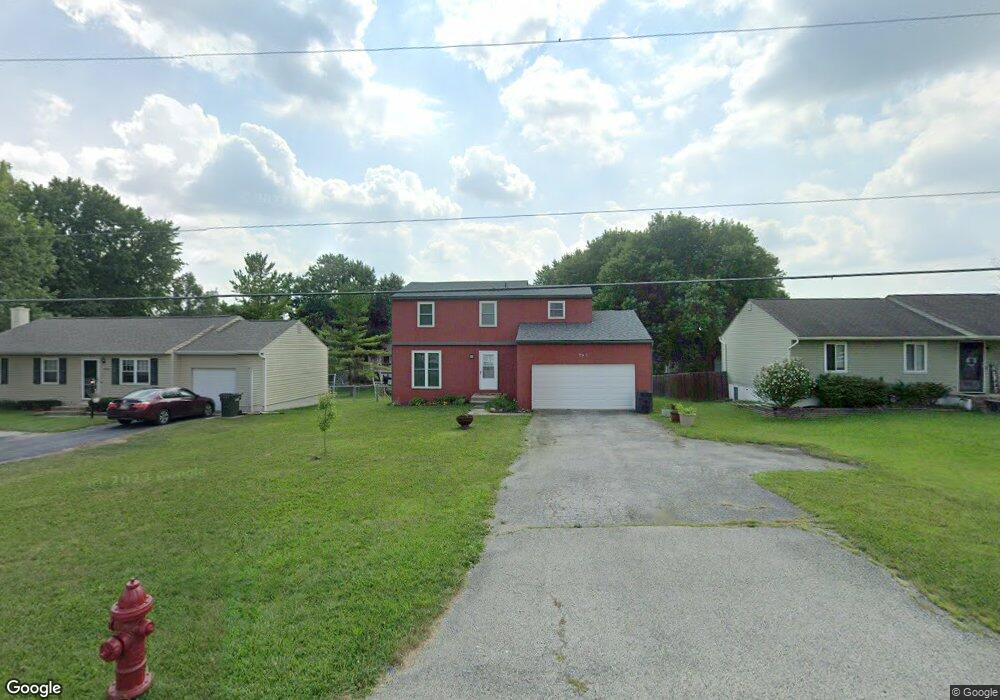
741 Hubbard Rd Galloway, OH 43119
Estimated Value: $300,000 - $321,000
4
Beds
2
Baths
1,632
Sq Ft
$188/Sq Ft
Est. Value
About This Home
This home is located at 741 Hubbard Rd, Galloway, OH 43119 and is currently estimated at $307,357, approximately $188 per square foot. 741 Hubbard Rd is a home located in Franklin County with nearby schools including Brown Elementary School, Hilliard Station Sixth Grade Elementary School, and Hilliard Memorial Middle School.
Ownership History
Date
Name
Owned For
Owner Type
Purchase Details
Closed on
Jul 25, 2008
Sold by
Bowman Sandra L
Bought by
Warren Robert A and Warren Melissa N
Current Estimated Value
Home Financials for this Owner
Home Financials are based on the most recent Mortgage that was taken out on this home.
Original Mortgage
$117,000
Outstanding Balance
$76,137
Interest Rate
6.5%
Mortgage Type
VA
Estimated Equity
$231,220
Purchase Details
Closed on
Mar 22, 1976
Bought by
Bowman Claude A
Create a Home Valuation Report for This Property
The Home Valuation Report is an in-depth analysis detailing your home's value as well as a comparison with similar homes in the area
Home Values in the Area
Average Home Value in this Area
Purchase History
| Date | Buyer | Sale Price | Title Company |
|---|---|---|---|
| Warren Robert A | $117,000 | Talon Group | |
| Bowman Claude A | -- | -- |
Source: Public Records
Mortgage History
| Date | Status | Borrower | Loan Amount |
|---|---|---|---|
| Open | Warren Robert A | $117,000 |
Source: Public Records
Tax History
| Year | Tax Paid | Tax Assessment Tax Assessment Total Assessment is a certain percentage of the fair market value that is determined by local assessors to be the total taxable value of land and additions on the property. | Land | Improvement |
|---|---|---|---|---|
| 2025 | $5,776 | $88,380 | $23,420 | $64,960 |
| 2024 | $5,776 | $88,380 | $23,420 | $64,960 |
| 2023 | $4,986 | $88,375 | $23,415 | $64,960 |
| 2022 | $3,977 | $53,730 | $16,700 | $37,030 |
| 2021 | $3,974 | $53,730 | $16,700 | $37,030 |
| 2020 | $3,978 | $53,730 | $16,700 | $37,030 |
| 2019 | $3,897 | $44,810 | $13,900 | $30,910 |
| 2018 | $3,693 | $44,810 | $13,900 | $30,910 |
| 2017 | $3,709 | $44,810 | $13,900 | $30,910 |
| 2016 | $3,697 | $40,990 | $7,910 | $33,080 |
| 2015 | $3,500 | $40,990 | $7,910 | $33,080 |
| 2014 | $3,464 | $40,990 | $7,910 | $33,080 |
| 2013 | $1,867 | $43,155 | $8,330 | $34,825 |
Source: Public Records
Map
Nearby Homes
- 716 Academy Dr
- 8652 Westpoint Dr
- 8873 Canoe Dr
- 914 Slagle Place
- 8458 Squad Dr
- 375 Darby Ct
- 0 Dellinger Rd Unit 9 2030113
- 1276 Four Star Dr E
- 116 S Frey Ave
- 145 Center Ave Unit 149
- 41 N Hampton St
- 430 Trillium Dr
- 263 Merriman Dr
- 36 Putnam Ave
- 306 Madison Dr S
- 484 London Rd
- 728 Murnan Rd
- 670 Hillsdale Dr
- 696 Kirkwood Dr Unit 698
- 704 Kirkwood Dr Unit 706
- 729 Hubbard Rd
- 749 Hubbard Rd
- 740 Gatis Place
- 0 Hubbard Rd Unit 10451
- 0 Hubbard Rd Unit 6060
- 0 Hubbard Rd Unit 9709943
- 0 Hubbard Rd Unit 223034651
- 0 Hubbard Rd Unit 223026609
- 0 Hubbard Rd Unit 223026596
- 0 Hubbard Rd
- 0000 Hubbard Rd
- 1410 Hubbard Rd
- 8798 Hubbard Rd
- 721 Hubbard Rd
- 746 Gatis Place
- 763 Hubbard Rd
- 732 Gatis Place
- 8751 Hubbard Dr S
- 8759 S Hubbard Rd
- 8759 Hubbard Dr S
Your Personal Tour Guide
Ask me questions while you tour the home.