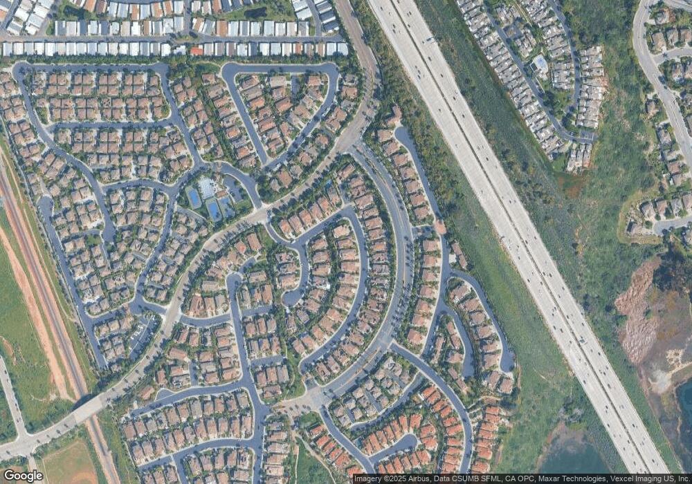
7423 Capstan Dr Carlsbad, CA 92011
South Beach NeighborhoodEstimated Value: $2,085,633 - $2,486,000
2
Beds
3
Baths
2,798
Sq Ft
$810/Sq Ft
Est. Value
About This Home
This home is located at 7423 Capstan Dr, Carlsbad, CA 92011 and is currently estimated at $2,265,408, approximately $809 per square foot. 7423 Capstan Dr is a home located in San Diego County with nearby schools including Pacific Rim Elementary, Aviara Oaks Middle, and Carlsbad High School.
Ownership History
Date
Name
Owned For
Owner Type
Purchase Details
Closed on
Jun 21, 2013
Sold by
Burke Steven C and Burke Suzanne R
Bought by
Burke Steven C and Burke Suzanne R
Current Estimated Value
Purchase Details
Closed on
Jul 24, 1998
Sold by
Greystone Homes Inc
Bought by
Burke Steven C and Burke Suzanne R
Home Financials for this Owner
Home Financials are based on the most recent Mortgage that was taken out on this home.
Original Mortgage
$227,000
Interest Rate
6.42%
Create a Home Valuation Report for This Property
The Home Valuation Report is an in-depth analysis detailing your home's value as well as a comparison with similar homes in the area
Home Values in the Area
Average Home Value in this Area
Purchase History
| Date | Buyer | Sale Price | Title Company |
|---|---|---|---|
| Burke Steven C | -- | None Available | |
| Burke Steven C | $466,000 | First American Title |
Source: Public Records
Mortgage History
| Date | Status | Borrower | Loan Amount |
|---|---|---|---|
| Previous Owner | Burke Steven C | $227,000 |
Source: Public Records
Tax History Compared to Growth
Tax History
| Year | Tax Paid | Tax Assessment Tax Assessment Total Assessment is a certain percentage of the fair market value that is determined by local assessors to be the total taxable value of land and additions on the property. | Land | Improvement |
|---|---|---|---|---|
| 2025 | $8,389 | $735,084 | $274,342 | $460,742 |
| 2024 | $8,389 | $720,671 | $268,963 | $451,708 |
| 2023 | $8,349 | $706,541 | $263,690 | $442,851 |
| 2022 | $8,230 | $692,688 | $258,520 | $434,168 |
| 2021 | $8,172 | $679,106 | $253,451 | $425,655 |
| 2020 | $8,122 | $672,144 | $250,853 | $421,291 |
| 2019 | $7,987 | $658,966 | $245,935 | $413,031 |
| 2018 | $7,680 | $646,046 | $241,113 | $404,933 |
| 2017 | $91 | $633,380 | $236,386 | $396,994 |
| 2016 | $7,288 | $620,961 | $231,751 | $389,210 |
| 2015 | $7,261 | $611,634 | $228,270 | $383,364 |
| 2014 | $7,150 | $599,654 | $223,799 | $375,855 |
Source: Public Records
Map
Nearby Homes
- 7313 San Luis St Unit 236
- 7236 San Benito St Unit 355
- 7233 San Bartolo St Unit 376
- 7305 San Bartolo St Unit 374
- 7241 San Luis St
- 7313 Santa Barbara St Unit 294
- 7317 Santa Barbara St Unit 292
- 7025 San Bartolo St Unit 42
- 7207 Santa Barbara St Unit 154
- 7008 San Bartolo St Unit 27
- 7002 San Bartolo St Unit 30
- 7205 Santa Barbara St Unit 153
- 7027 San Bartolo St Unit 43
- 7024 San Bartolo St Unit 19
- 7023 San Bartolo St Unit 41
- 7144 Santa Rosa St Unit 86
- 7004 San Bartolo St
- 7013 Lavender Way
- 7066 Leeward St Unit 95
- 2053 W Pearl St
- 7427 Capstan Dr
- 7419 Capstan Dr
- 7431 Capstan Dr
- 7426 Sundial Place
- 7430 Sundial Place
- 7424 Capstan Dr
- 7434 Sundial Place
- 7428 Capstan Dr
- 7420 Capstan Dr
- 7435 Capstan Dr
- 7432 Capstan Dr
- 7416 Capstan Dr
- 7436 Capstan Dr
- 612 Marlin Ln
- 7412 Capstan Dr
- 7438 Sundial Place
- 7439 Capstan Dr
- 608 Marlin Ln
- 620 Marlin Ln
- 7440 Capstan Dr
