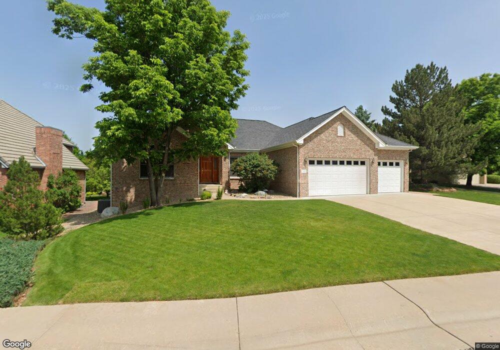
7432 S Utica St Littleton, CO 80128
Estimated Value: $1,026,291 - $1,273,000
2
Beds
6
Baths
2,602
Sq Ft
$441/Sq Ft
Est. Value
About This Home
This home is located at 7432 S Utica St, Littleton, CO 80128 and is currently estimated at $1,148,573, approximately $441 per square foot. 7432 S Utica St is a home located in Arapahoe County with nearby schools including Wilder Elementary School, Goddard Middle School, and Heritage High School.
Ownership History
Date
Name
Owned For
Owner Type
Purchase Details
Closed on
May 3, 1999
Sold by
Courtright Corp
Bought by
Schick Diane K and Schick Wesley J
Current Estimated Value
Home Financials for this Owner
Home Financials are based on the most recent Mortgage that was taken out on this home.
Original Mortgage
$228,000
Interest Rate
6.99%
Purchase Details
Closed on
Apr 13, 1998
Sold by
Meadowbrook Development Llc
Bought by
Courtright Corp
Create a Home Valuation Report for This Property
The Home Valuation Report is an in-depth analysis detailing your home's value as well as a comparison with similar homes in the area
Home Values in the Area
Average Home Value in this Area
Purchase History
| Date | Buyer | Sale Price | Title Company |
|---|---|---|---|
| Schick Diane K | $438,000 | Empire Title & Escrow | |
| Courtright Corp | $80,000 | Land Title |
Source: Public Records
Mortgage History
| Date | Status | Borrower | Loan Amount |
|---|---|---|---|
| Closed | Schick Diane K | $228,000 | |
| Closed | Schick Diane K | $166,200 |
Source: Public Records
Tax History Compared to Growth
Tax History
| Year | Tax Paid | Tax Assessment Tax Assessment Total Assessment is a certain percentage of the fair market value that is determined by local assessors to be the total taxable value of land and additions on the property. | Land | Improvement |
|---|---|---|---|---|
| 2024 | $6,772 | $77,519 | -- | -- |
| 2023 | $6,772 | $77,519 | $0 | $0 |
| 2022 | $6,038 | $66,428 | $0 | $0 |
| 2021 | $6,022 | $66,428 | $0 | $0 |
| 2020 | $6,346 | $64,494 | $0 | $0 |
| 2019 | $5,970 | $64,494 | $0 | $0 |
| 2018 | $5,117 | $58,759 | $0 | $0 |
| 2017 | $4,742 | $58,759 | $0 | $0 |
| 2016 | $4,840 | $57,622 | $0 | $0 |
| 2015 | $4,852 | $57,622 | $0 | $0 |
| 2014 | -- | $41,981 | $0 | $0 |
| 2013 | -- | $49,500 | $0 | $0 |
Source: Public Records
Map
Nearby Homes
- 7425 S Utica St
- 7452 S Utica St
- 7175 S Polo Ridge Dr
- 4431 W Jamison Place
- 7604 S Platteview Dr
- 5040 W Geddes Cir
- 7079 S Polo Ridge Dr
- 7351 S Sheridan Ct
- 7427 S Ames Ct
- 5466 W Indore Dr
- 7120 S Sheridan Ct
- 5274 W Rowland Place
- 7504 S Depew St
- 7000 S Sheridan Blvd
- 7753 S Ames Way
- 5041 W Portland Dr
- 7636 S Eaton Way
- 5344 W Canyon Trail Unit B
- 5354 W Canyon Trail Unit C
- 5454 W Canyon Trail Unit B
- 7402 S Utica St
- 4581 W Hinsdale Ave
- 4560 W Geddes Ave
- 7405 S Utica St
- 7472 S Utica St
- 7455 S Utica St
- 4561 W Hinsdale Ave
- 4580 W Hinsdale Ave
- 7475 S Utica St
- 4591 W Geddes Ave
- 4540 W Geddes Ave
- 4601 W Geddes Ave
- 4581 W Geddes Ave
- 7440 S Wolff St
- 7400 S Wolff St
- 7460 S Wolff St
- 4571 W Geddes Ave
- 4621 W Geddes Ave
- 4541 W Hinsdale Ave
- 4560 W Hinsdale Ave