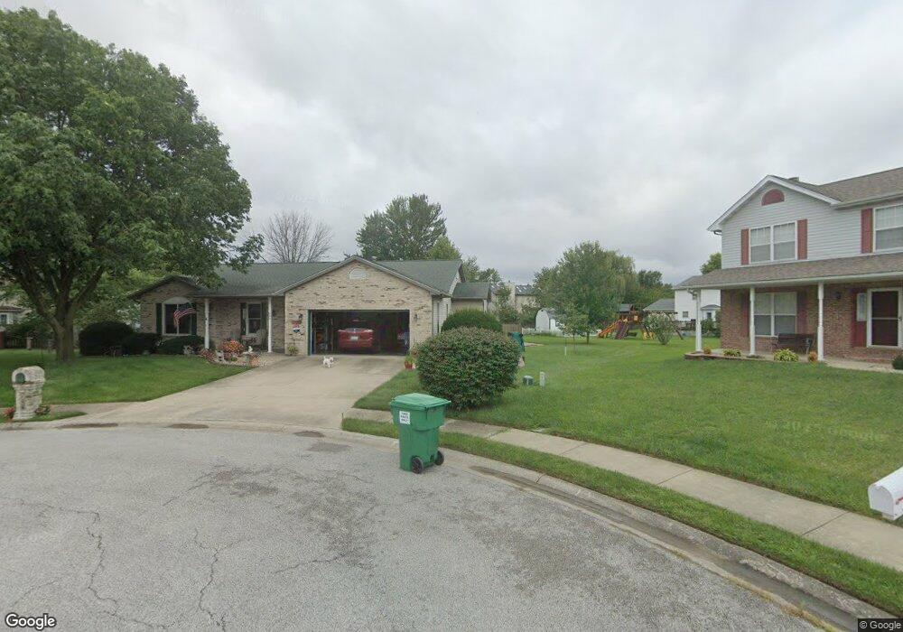
744 Carol Ann Dr O Fallon, IL 62269
Estimated Value: $302,325 - $350,000
--
Bed
--
Bath
1,953
Sq Ft
$165/Sq Ft
Est. Value
About This Home
This home is located at 744 Carol Ann Dr, O Fallon, IL 62269 and is currently estimated at $323,081, approximately $165 per square foot. 744 Carol Ann Dr is a home located in St. Clair County with nearby schools including Evans Elementary School, Carriel Junior High School, and O'Fallon Township High School.
Ownership History
Date
Name
Owned For
Owner Type
Purchase Details
Closed on
Oct 22, 2001
Sold by
Dawkins Brad and Dawkins Catherine Macgowan
Bought by
Kern Anthony P and Kern Belinda K
Current Estimated Value
Home Financials for this Owner
Home Financials are based on the most recent Mortgage that was taken out on this home.
Original Mortgage
$174,070
Outstanding Balance
$67,689
Interest Rate
6.8%
Mortgage Type
FHA
Estimated Equity
$255,392
Create a Home Valuation Report for This Property
The Home Valuation Report is an in-depth analysis detailing your home's value as well as a comparison with similar homes in the area
Home Values in the Area
Average Home Value in this Area
Purchase History
| Date | Buyer | Sale Price | Title Company |
|---|---|---|---|
| Kern Anthony P | $169,000 | Metro East Title Corp |
Source: Public Records
Mortgage History
| Date | Status | Borrower | Loan Amount |
|---|---|---|---|
| Open | Kern Anthony P | $174,070 |
Source: Public Records
Tax History Compared to Growth
Tax History
| Year | Tax Paid | Tax Assessment Tax Assessment Total Assessment is a certain percentage of the fair market value that is determined by local assessors to be the total taxable value of land and additions on the property. | Land | Improvement |
|---|---|---|---|---|
| 2024 | $5,602 | $87,686 | $17,891 | $69,795 |
| 2023 | $5,075 | $77,825 | $15,879 | $61,946 |
| 2022 | $4,731 | $71,550 | $14,599 | $56,951 |
| 2021 | $5,236 | $71,780 | $14,646 | $57,134 |
| 2020 | $5,190 | $67,947 | $13,865 | $54,082 |
| 2019 | $5,062 | $67,947 | $13,865 | $54,082 |
| 2018 | $4,918 | $65,974 | $13,462 | $52,512 |
| 2017 | $4,594 | $59,952 | $13,998 | $45,954 |
| 2016 | $4,576 | $58,552 | $13,671 | $44,881 |
| 2014 | $4,222 | $57,875 | $13,513 | $44,362 |
| 2013 | $4,787 | $58,933 | $13,510 | $45,423 |
Source: Public Records
Map
Nearby Homes
- 749 Michael St Unit 65
- 406 Colleen Dr
- 334 Aladar Dr
- 312 Nancy Dr
- 215 Eagle Ridge Unit 215
- 121 S Lawn Ave
- 121 Douglas St
- 435 Ponderosa Ave Unit 2
- 421 Eagle Terrace Dr
- 894 Misty Valley Rd
- 422 W 4th St
- 430 S Hickory St
- 104 Ruth Dr
- 702 W Washington St
- 302 W 3rd St
- 706 S Vine St
- 511 S Vine St
- 762 Kelley Dr
- 204 W State St
- 704 W Madison St
- 738 Carol Ann Dr
- 656 Shamrock Dr
- 652 Shamrock Dr
- 950 Indian Creek Dr
- 745 Carol Ann Dr
- 944 Indian Creek Dr
- 662 Shamrock Dr
- 732 Carol Ann Dr
- 739 Carol Ann Dr
- 739 Carol Ann Dr
- 938 Indian Creek Dr
- 644 Shamrock Dr
- 731 Carol Ann Dr
- 726 Carol Ann Dr
- 932 Indian Creek Dr
- 935 Brookdale Ct
- 655 Shamrock Dr
- 700 Highcliff Dr
- 651 Shamrock Dr
- 941 Brookdale Ct