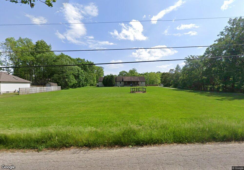
7467 Kirk Rd Canfield, OH 44406
Austintown NeighborhoodEstimated Value: $301,000 - $364,577
4
Beds
4
Baths
2,100
Sq Ft
$160/Sq Ft
Est. Value
About This Home
This home is located at 7467 Kirk Rd, Canfield, OH 44406 and is currently estimated at $336,144, approximately $160 per square foot. 7467 Kirk Rd is a home located in Mahoning County with nearby schools including Austintown Elementary School, Austintown Intermediate School, and Austintown Middle School.
Ownership History
Date
Name
Owned For
Owner Type
Purchase Details
Closed on
Aug 27, 2021
Sold by
Pontius Jaime M
Bought by
Pontius Stephen Z
Current Estimated Value
Purchase Details
Closed on
May 28, 2009
Sold by
Biggs Benjamin J and Biggs Roberta
Bought by
Wells Fargo Bank N A
Purchase Details
Closed on
Oct 31, 2003
Sold by
Biggs Benjamin J
Bought by
Biggs Benjamin J and Biggs Roberta
Home Financials for this Owner
Home Financials are based on the most recent Mortgage that was taken out on this home.
Original Mortgage
$173,000
Interest Rate
8.99%
Mortgage Type
Purchase Money Mortgage
Purchase Details
Closed on
Mar 9, 2000
Bought by
Stephen Z Pontius
Create a Home Valuation Report for This Property
The Home Valuation Report is an in-depth analysis detailing your home's value as well as a comparison with similar homes in the area
Home Values in the Area
Average Home Value in this Area
Purchase History
| Date | Buyer | Sale Price | Title Company |
|---|---|---|---|
| Pontius Stephen Z | -- | None Available | |
| Wells Fargo Bank N A | $126,000 | None Available | |
| Biggs Benjamin J | -- | -- | |
| Stephen Z Pontius | -- | -- |
Source: Public Records
Mortgage History
| Date | Status | Borrower | Loan Amount |
|---|---|---|---|
| Previous Owner | Biggs Benjamin J | $173,000 |
Source: Public Records
Tax History
| Year | Tax Paid | Tax Assessment Tax Assessment Total Assessment is a certain percentage of the fair market value that is determined by local assessors to be the total taxable value of land and additions on the property. | Land | Improvement |
|---|---|---|---|---|
| 2025 | $4,163 | $86,720 | $12,600 | $74,120 |
| 2024 | $3,974 | $86,720 | $12,600 | $74,120 |
| 2023 | $3,911 | $86,720 | $12,600 | $74,120 |
| 2022 | $2,800 | $49,720 | $11,530 | $38,190 |
| 2021 | $2,801 | $49,720 | $11,530 | $38,190 |
| 2020 | $2,813 | $49,720 | $11,530 | $38,190 |
| 2019 | $2,968 | $47,800 | $11,080 | $36,720 |
| 2018 | $2,856 | $47,800 | $11,080 | $36,720 |
| 2017 | $2,776 | $47,800 | $11,080 | $36,720 |
| 2016 | $2,700 | $44,760 | $8,310 | $36,450 |
| 2015 | $2,618 | $44,760 | $8,310 | $36,450 |
| 2014 | $2,630 | $44,760 | $8,310 | $36,450 |
| 2013 | $2,602 | $44,760 | $8,310 | $36,450 |
Source: Public Records
Map
Nearby Homes
- 3449 Meanderwood Dr
- 3121 Meanderwood Dr
- 2998 Whispering Pines Dr
- 6948 Meander Reserve Ct
- 4849 My Way
- 6581 Country Ridge Ave
- 6438 Calvary Ct
- 9112 New Rd
- 6343 Gibson Rd
- 583 Wyndclift Cir
- 21 Timber Run Ct
- 242 Wilcox Rd Unit 242
- 379 Wyndclift Place
- 68 Timber Run Dr
- 0 Maple Ave Unit 5190079
- 0 Maple Ave Unit 5190077
- 0 Maple Ave Unit 5190082
- 5552 Callaway Cir Unit 2
- 1556 Pimlico Dr Unit 15
- 1540 Pimlico Dr
- 3425 Meanderwood Dr
- 3421 Meanderwood Dr
- 7033 Kirk Rd
- 3429 Meanderwood Dr
- 7025 Kirk Rd
- 7477 Kirk Rd
- 7065 Berry Blossom Dr
- 7057 Berry Blossom Dr
- 3433 Meanderwood Dr
- 3420 Meanderwood Dr
- 7051 Berry Blossom Dr
- 7001 Kirk Rd
- 3428 Meanderwood Dr
- 7080 Kirk Rd
- 3434 Meanderwood Dr
- 3437 Meanderwood Dr
- 7050 Kirk Rd
- 7070 Berry Blossom Dr
- 7487 Kirk Rd
- 7045 Berry Blossom Dr
Your Personal Tour Guide
Ask me questions while you tour the home.