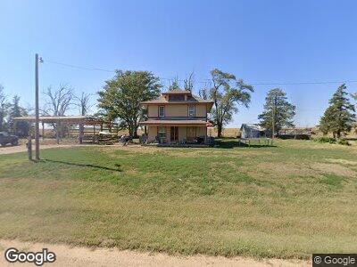
747 N 20th Rd Tescott, KS 67484
Estimated Value: $118,000 - $169,000
5
Beds
2
Baths
1,890
Sq Ft
$75/Sq Ft
Est. Value
About This Home
This home is located at 747 N 20th Rd, Tescott, KS 67484 and is currently estimated at $141,857, approximately $75 per square foot. 747 N 20th Rd is a home located in Ottawa County with nearby schools including Tescott Elementary School and Tescott Junior High/High School.
Ownership History
Date
Name
Owned For
Owner Type
Purchase Details
Closed on
Sep 13, 2011
Sold by
Wicker Lisa K and Nickel Lisa K
Bought by
Challans Daniel R and Challans Kelsey L
Current Estimated Value
Home Financials for this Owner
Home Financials are based on the most recent Mortgage that was taken out on this home.
Original Mortgage
$57,500
Interest Rate
4.08%
Create a Home Valuation Report for This Property
The Home Valuation Report is an in-depth analysis detailing your home's value as well as a comparison with similar homes in the area
Home Values in the Area
Average Home Value in this Area
Purchase History
| Date | Buyer | Sale Price | Title Company |
|---|---|---|---|
| Challans Daniel R | -- | -- |
Source: Public Records
Mortgage History
| Date | Status | Borrower | Loan Amount |
|---|---|---|---|
| Previous Owner | Challans Daniel R | $57,500 | |
| Previous Owner | Wicker Lisa K | $44,500 |
Source: Public Records
Tax History Compared to Growth
Tax History
| Year | Tax Paid | Tax Assessment Tax Assessment Total Assessment is a certain percentage of the fair market value that is determined by local assessors to be the total taxable value of land and additions on the property. | Land | Improvement |
|---|---|---|---|---|
| 2024 | $1,783 | $12,655 | $268 | $12,387 |
| 2023 | $1,643 | $11,477 | $268 | $11,209 |
| 2022 | $1,381 | $9,327 | $281 | $9,046 |
| 2021 | $1,304 | $8,740 | $281 | $8,459 |
| 2020 | $1,304 | $8,462 | $281 | $8,181 |
| 2019 | $1,332 | $8,368 | $281 | $8,087 |
| 2018 | $1,332 | $8,349 | $281 | $8,068 |
| 2017 | $1,330 | $8,317 | $281 | $8,036 |
| 2016 | $1,352 | $8,317 | $281 | $8,036 |
| 2015 | -- | $8,162 | $281 | $7,881 |
| 2014 | -- | $8,161 | $255 | $7,906 |
Source: Public Records
Map
Nearby Homes
- 000 N 280th Rd
- 00000 N 90th Rd
- 000 E Union Dr
- 0 Laramie Rd
- 13637 W Shipton Rd
- 524 N Rock St
- 246 S 1st Ave
- 302 & 304 E 8th St
- 725 Argyle Ave
- 620 E 5th St
- 0000 Aspen Rd
- 506 & 516 Clay St
- 520 & 522 Clay St
- 608 & 606 Clay St
- 00000 E Grain Dr
- 0000 W Watkins Rd
- 0000 E North St
- 123 N 1st St
- 121 N 1st St
- 103 S 1st St