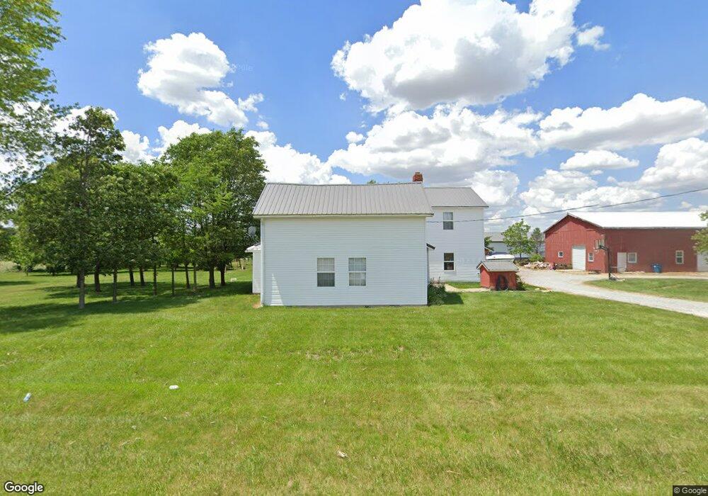
7472 S 1100 W-90 Warren, IN 46792
Estimated Value: $259,000 - $394,671
3
Beds
1
Bath
1,286
Sq Ft
$245/Sq Ft
Est. Value
About This Home
This home is located at 7472 S 1100 W-90, Warren, IN 46792 and is currently estimated at $315,168, approximately $245 per square foot. 7472 S 1100 W-90 is a home located in Wells County with nearby schools including Spalding Park Elementary School, Southern Wells Elementary School, and Southern Wells Junior/Senior High School.
Ownership History
Date
Name
Owned For
Owner Type
Purchase Details
Closed on
Jan 10, 2020
Sold by
Turney Jason D and Turney Amie B
Bought by
Roe Robert L
Current Estimated Value
Home Financials for this Owner
Home Financials are based on the most recent Mortgage that was taken out on this home.
Original Mortgage
$172,000
Interest Rate
3.73%
Mortgage Type
Construction
Purchase Details
Closed on
May 4, 2010
Sold by
Toporek Timothy T
Bought by
Turney Amie B and Turney Jason D
Purchase Details
Closed on
Oct 2, 2000
Sold by
Jame Shook
Bought by
Toporek Timothy T
Create a Home Valuation Report for This Property
The Home Valuation Report is an in-depth analysis detailing your home's value as well as a comparison with similar homes in the area
Home Values in the Area
Average Home Value in this Area
Purchase History
| Date | Buyer | Sale Price | Title Company |
|---|---|---|---|
| Roe Robert L | -- | None Available | |
| Turney Amie B | $125,000 | -- | |
| Toporek Timothy T | -- | -- |
Source: Public Records
Mortgage History
| Date | Status | Borrower | Loan Amount |
|---|---|---|---|
| Closed | Roe Robert L | $172,000 |
Source: Public Records
Tax History Compared to Growth
Tax History
| Year | Tax Paid | Tax Assessment Tax Assessment Total Assessment is a certain percentage of the fair market value that is determined by local assessors to be the total taxable value of land and additions on the property. | Land | Improvement |
|---|---|---|---|---|
| 2024 | $1,421 | $272,400 | $60,100 | $212,300 |
| 2023 | $1,061 | $229,300 | $56,400 | $172,900 |
| 2022 | $1,062 | $209,200 | $45,600 | $163,600 |
| 2021 | $943 | $186,100 | $43,600 | $142,500 |
| 2020 | $522 | $118,600 | $43,500 | $75,100 |
| 2019 | $522 | $112,100 | $32,700 | $79,400 |
| 2018 | $481 | $106,900 | $33,200 | $73,700 |
| 2017 | $411 | $102,100 | $29,300 | $72,800 |
| 2016 | $392 | $101,400 | $30,000 | $71,400 |
| 2014 | $382 | $96,500 | $30,000 | $66,500 |
| 2013 | $372 | $94,500 | $27,200 | $67,300 |
Source: Public Records
Map
Nearby Homes
- 11899 S Hartford City Rd
- 10199 S Wayne Rd
- 627 E Jefferson St
- 9964 E 400 N
- 412 N Nancy St
- 325 N Wayne St
- 511 N Nancy St
- 503 E Main St
- 907 N Main St
- 911 N Wayne St
- TBD Bennett Dr
- 201 E Vine St
- 111 W Penn St
- I 69 E 700 N
- 10793 E 200 N
- 8885 E 400 N
- 603 W Main St
- 6124 S 600 W
- 0183 W State Road 18
- 2578 W State Road 18
- 7472 S 1100 W
- 7674 S 1100 W-90 Unit 90
- 11120 W 700 S-90
- 1150 W 1150 W W
- 10976 W 800 S-90
- 11451 W 800 S
- 10601 W 800 S-90
- 11577 W 800 S-90
- 10463 W 800 S-90
- 10358 W 700 S-90
- 10369 W 800 S-90
- 11707 W 800 S-90
- 10394 W 800 S Unit 90
- 10390 W 800 S
- 6700 S 1150 W-90 Unit 90
- 6607 S 1150 W-90
- 10394 W 800 S-90
- 11774 W 800 S-90
- 10390 W 800 S-90
- 7636 S 1000 W-90 Unit 90